
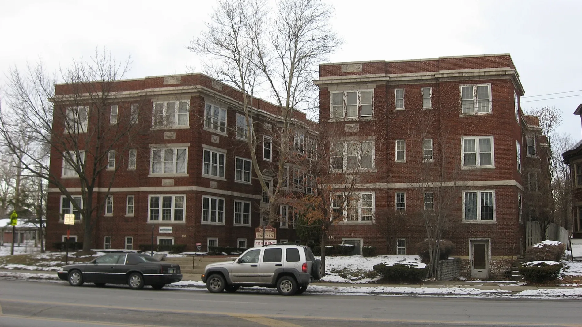
North Monroe Avenue in Columbus, Ohio
North Monroe Avenue in Columbus is a single-lane, asphalted residential street. The street has sidewalks. It runs in a north-south direction starting from East Broad Street and crosses Avon Place, East Long Street and East Spring Street and ends at Mount Vernon Avenue.
- Road Type
- residential street
- Lanes
- 1
- Speed Limit
- 25 mph
- Route
- north-south
Image
Bars
Bike rentals
Liquor stores
Bus stops
Cafes
Restaurants
Pharmacies
Beer gardens
Florists
Streets nearby
East Long StreetThe Roosevelt Coffeehouse, E Long St & Normandy Ave, Slammers, Uptown District, E Long St & N Washington Ave, E Long St & Jefferson Ave, E Long St & N 4th St, What the Waffle, Turkey Hill, E Long St & Cleveland Ave, Equitas Health Pharmacy, King-Lincoln Bronzeville
400 ft
East Gay StreetNews Fountain, Bishops Walk Fountain, Tip Top Kitchen & Cocktails, Due Amici, CoGo 3rd St and Gay St, Cafe Phenix, Subway, Capitol Square Printing, The Monk's Copy Shops, Nail Styling Salon, Rinkov Eyecare Centers, Plantain Café, Zer0z, Zurie, The Ruggery, Rio Fresh Cafe, Don Rey Cigar
500 ft
Almond Avenue0.1 mi
North Garfield Avenue0.1 mi
North 17th Street0.1 mi
Avon Place0.1 mi
North 18th Street0.1 mi
Australia Alley0.2 mi
Talmadge Street0.2 mi
Miami Avenue0.2 mi
South Garfield Avenue0.2 mi
Madison Avenue0.2 mi
Douglass Street0.3 mi
East Spring StreetE Spring St & N High St, FedEx Office, E Spring St & Neilston St, E Spring St & N Grant Ave, Warehouse District, E Spring St & Mount Vernon Ave, E Spring St & N 4th St, E Spring St & Cleveland Ave
0.3 mi
Hoffman Avenue0.3 mi
South 18th StreetThe Lifestyle Café
0.3 mi
North 20th Street0.3 mi
East Broad StreetUnited States Postal Service Mailbox, Northeast Cannon, These Are My Jewels, Lest We Forget, Northwest Cannon, E Broad St & N High St, E Broad St & S High St, Credit Union of Ohio ATM, E Broad St & S 4th St, E Broad St & N Grant Ave, E Broad St & S Grant Ave, E Broad St & N Nelson Rd, E Broad St & Monypenny Ave, E Broad St & Taylor Station Rd, E Broad St & N 3rd St, E Broad St & S 3rd St, E Broad St & S 5th St, E Broad St & N 5th St, E Broad St & N 4th St, Discovery District, Cup O Joe, Broad Street United Methodist Church, E Broad St & N Washington Ave, E Broad St & S Washington Ave, E Broad St & Jefferson Ave, E Broad St & Winner Ave, E Broad St & Wilson Ave, E Broad St & Hamilton Park, E Broad St & Parsons Ave, E Broad St & Cardinal Park Dr, E Broad St & N Ohio Ave, E Broad St & S Ohio Ave, E Broad St & N 17th St, E Broad St & S James Rd, KeyBank, E Broad St & Reynolds Crossing Dr, E Broad St & Bannockburn Blvd, Speedway, E Broad St & Waggoner Rd, E Broad St & Meijer Dr, E Broad St & Cedar Cliff, 8400 E Broad St, E Broad St & the Limited, 3675 E Broad St, Walgreens, E Broad St & S Napoleon Ave, E Broad St & N Weyant Ave, Grandma's Pizza & Pasta, Snap & Crack Locksmith, Buckeye Pets, Impress Beauty Outlet, Synergi Salon, The Vaper Shop, Z's Asian Bistro, E Broad St & N Hampton Rd, E Broad St & S Hampton Rd, E Broad St & N Ashburton Rd, E Broad St & Lowell Rd, E Broad St & Kellner Rd, E Broad St & N Harding Rd, E Broad St & S Harding Rd, E Broad St & N Broadleigh Rd, E Broad St & S Broadleigh Rd, E Broad St & Brunson Ave, E Broad St & Franklin Park Con, E Broad St & Woodland Ave, E Broad St & Parkwood Ave, E Broad St & Franklin Pk W, E Broad St & Latta Ave, E Broad St & Governor Pl, E Broad St & S Champion Ave, Near East Side, E Broad St & N 20th St, E Broad St & Hoffman Ave, E Broad St & S Douglas St, E Broad St & Mcnaughten Rd, Chick-fil-A, E Broad St & Outerbelt St, E Broad St & Brice Rd, E Broad St & N Brice Rd, E Broad St & Broad Pointe Pl, E Broad St & Eastpointe Ridge Dr, Turkey Hill, E Broad St & Blacklick Xing, E Broad St & Reynoldsburg New Albany, E Broad St & Lancaster Ave
0.3 mi
South Monroe Avenue0.3 mi
South 17th Street0.3 mi
Franklin AvenueOlde Towne East
0.3 mi
South 19th StreetVassor Village
0.3 mi
North 21st Street0.3 mi
Elliott Alley0.4 mi
South 20th Street0.4 mi
South 21st Street0.4 mi
Agate Alley0.4 mi
Quincy Alley0.4 mi
Fair AvenueSt. Catharine Preschool
0.4 mi
Allotment gardens nearby
OTE Community Garden0.3 mi
Apartment buildings nearby
Ogden Apartments450 ft
Flats on East Gay0.1 mi
The Frisble Apartments0.2 mi
Churches nearby
Temple Of God0.2 mi
Greater Vision Missionary Baptist Church0.3 mi
Commercial buildings nearby
Theresa Building300 ft
Lincoln Theater King Arts Complex0.1 mi
American Red Cross0.3 mi
Jerry Hammond Center0.4 mi
Convenience stores nearby
Duchess Shoppe0.2 mi
Fast food restaurants nearby
Wendy's0.3 mi
Gas stations nearby
BP0.1 mi
Places of worship nearby
Broad Street Presbyterian Church0.1 mi
Shiloh Christian Center0.2 mi
Second Baptist Church0.2 mi
Debre Selam Kidus Gebriel Ethiopian Orthodox Tewahedo Church0.3 mi
Pilgrim Missionary Baptist Church0.3 mi
Rehoboth Temple0.4 mi
Residential areas nearby
The Adelphi Quarter500 ft
 Public transit map Columbus Legend
| Railway | |
| Bus | |
| Streetcar |
 Bicycle map Columbus Legend
| Bike path | |
| Bike lane on roadway | |
| Cycling allowed on bus lane | |
| Bicycle street | |
| Open to cyclists | |
| Open to cyclists, good path | |
| Cycling prohibited | |
| Cobblestone |
| Long-distance bike route | (depending on scale) | |
| Long-distance bike route |
 Pedestrian map Columbus Legend
| Path |
| Long-distance hiking trail | (depending on scale) | |
| Long-distance hiking trail | ||
| Pedestrians prohibited |