
Cincinnati Subway in Clifton Heights–University Heights–Fairview, Cincinnati, Ohio
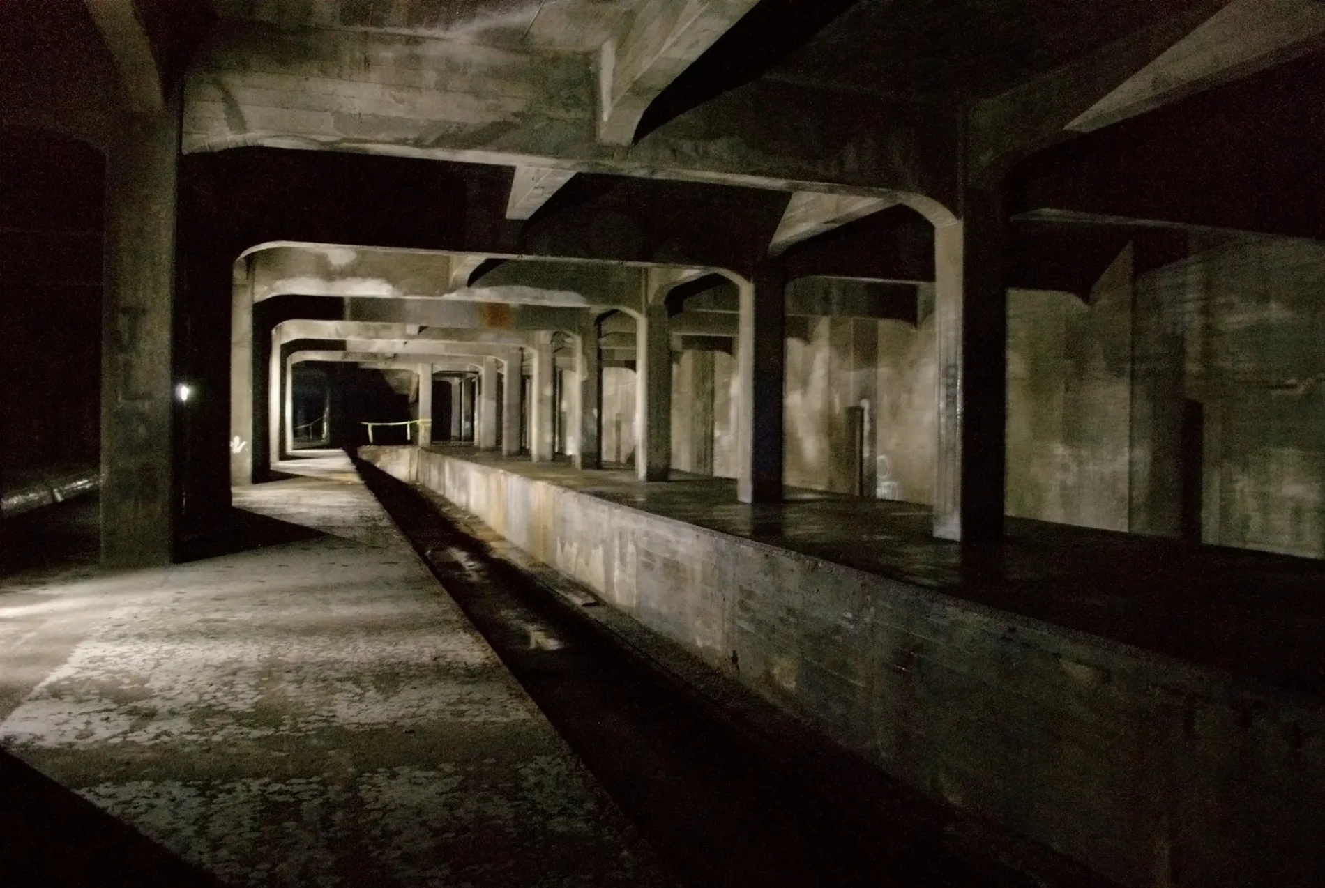
Cincinnati Subway in Clifton Heights–University Heights–Fairview in Cincinnati is an abandoned railway and it passes through a tunnel. Cincinnati Subway is also known as Cincinnati Rapid Transit Railway. Cincinnati Subway also exists in Camp Washington, Over-the-Rhine, Central Business District and West End. Ⓦ.
Restaurants
Bus stops
Viewpoints
Places of worship
Bars
Fast food restaurants
Tobacco shops
Cafes
Convenience stores
Parking entrances
Bookstores
Streets nearby
Ravine Street50 ft
Byron Street300 ft
Mohawk Street400 ft
Central AvenueCalloway's Barbershop & Beauty Bar, Box Office
400 ft
Wilmink Street500 ft
Manchester Avenue500 ft
Renner Place500 ft
Mohawk PlaceMohawk Pl & Central Pkwy
0.1 mi
Partridge Place0.1 mi
Whiteman Street0.1 mi
Goodin Alley0.1 mi
Nagel AlleyMcMicken Ave & Mohawk Pl
0.1 mi
Sohn Street0.1 mi
Amity Alley0.2 mi
Clearwater Street0.2 mi
City View Place0.2 mi
Stratford Avenue0.2 mi
Baymiller StreetBrighton
0.2 mi
Emming Street0.2 mi
Klotter Avenue0.2 mi
Horace Street0.2 mi
Atlas Alley0.2 mi
Corn Alley0.2 mi
Fox Street0.2 mi
Keywitt Alley0.3 mi
York Street0.3 mi
Bank StreetBank St & Freeman Ave, Red Bike - CityLink Center, Bank St & Baymiller St, Bank St 821, Bank St & Linn St, Bank St & Dalton Ave, Bank St & Patterson St
0.3 mi
Freeman Avenue0.3 mi
Central ParkwayCentral Pkwy & Findlay St, Central Pkwy & Baymiller St, Central Pkwy & Brighton Ramp, Central Pkwy & Brighton Bridge, Central Pkwy & 15th St, Central Pkwy & Ezzard Charles Dr, CET, WGUC 90.9 FM, WVXU 91.7 FM, Central Pkwy & Henry St, Central Pkwy 1913, Fraternal Order of Police
0.3 mi
Acme Alley0.3 mi
Beloit Alley0.3 mi
Fairview Place0.3 mi
Charlotte Street0.3 mi
Kimpell Alley0.3 mi
Gay Alley0.3 mi
Naeher Street0.3 mi
Abandoned railways nearby
Cincinnati Subway150 ft
Buildings nearby
Imperial Theatre0.1 mi
Churches nearby
Beams of Heaven Baptist Church0.2 mi
Fire stations nearby
Cincinnati Fire Department0.2 mi
Industrial buildings nearby
The Mockbee0.3 mi
Parks nearby
McMicken–Klotter Playground0.2 mi
Dyer Park0.2 mi
Places of worship nearby
York Street United Methodist Church0.2 mi
Bright Star Community Church0.3 mi
Recycling centers nearby
ChangingGears500 ft
Restaurants nearby
Hook Fish & Chicken0.2 mi
Social facilities nearby
CityLink Center450 ft
Tire dealers nearby
The Brothers Auto Tires0.2 mi
Water parks nearby
Dyer Sprayground0.2 mi
| Located in | Cincinnati |
|---|---|
| Country | United States |
| Key event | start of construction, end of construction |
Public transit map Clifton Heights–University Heights–Fairview Legend
| Railway | |
| Bus | |
| Streetcar |
Bicycle map Clifton Heights–University Heights–Fairview Legend
| Bike path | |
| Bike lane on roadway | |
| Cycling allowed on bus lane | |
| Bicycle street | |
| Open to cyclists | |
| Open to cyclists, good path | |
| Cycling prohibited | |
| Cobblestone |
| Long-distance bike route | (depending on scale) | |
| Long-distance bike route |
Pedestrian map Clifton Heights–University Heights–Fairview Legend
| Path |
| Long-distance hiking trail | (depending on scale) | |
| Long-distance hiking trail | ||
| Pedestrians prohibited |