
Dana Avenue in North Avondale
Dana Avenue in North Avondale in Cincinnati is a single-lane local road. It runs in an east-west direction and crosses Dakota Avenue, Winding Way, Victory Parkway, University Drive, Woodburn Avenue, Idlewild Avenue, Newton Avenue, Clarion Avenue, Brooks Avenue, Montgomery Road, Trimble Avenue and Bevis Avenue. It connects Evanston, Hyde Park, Avondale and North Avondale. Dana Avenue is also known as Dana Ave..
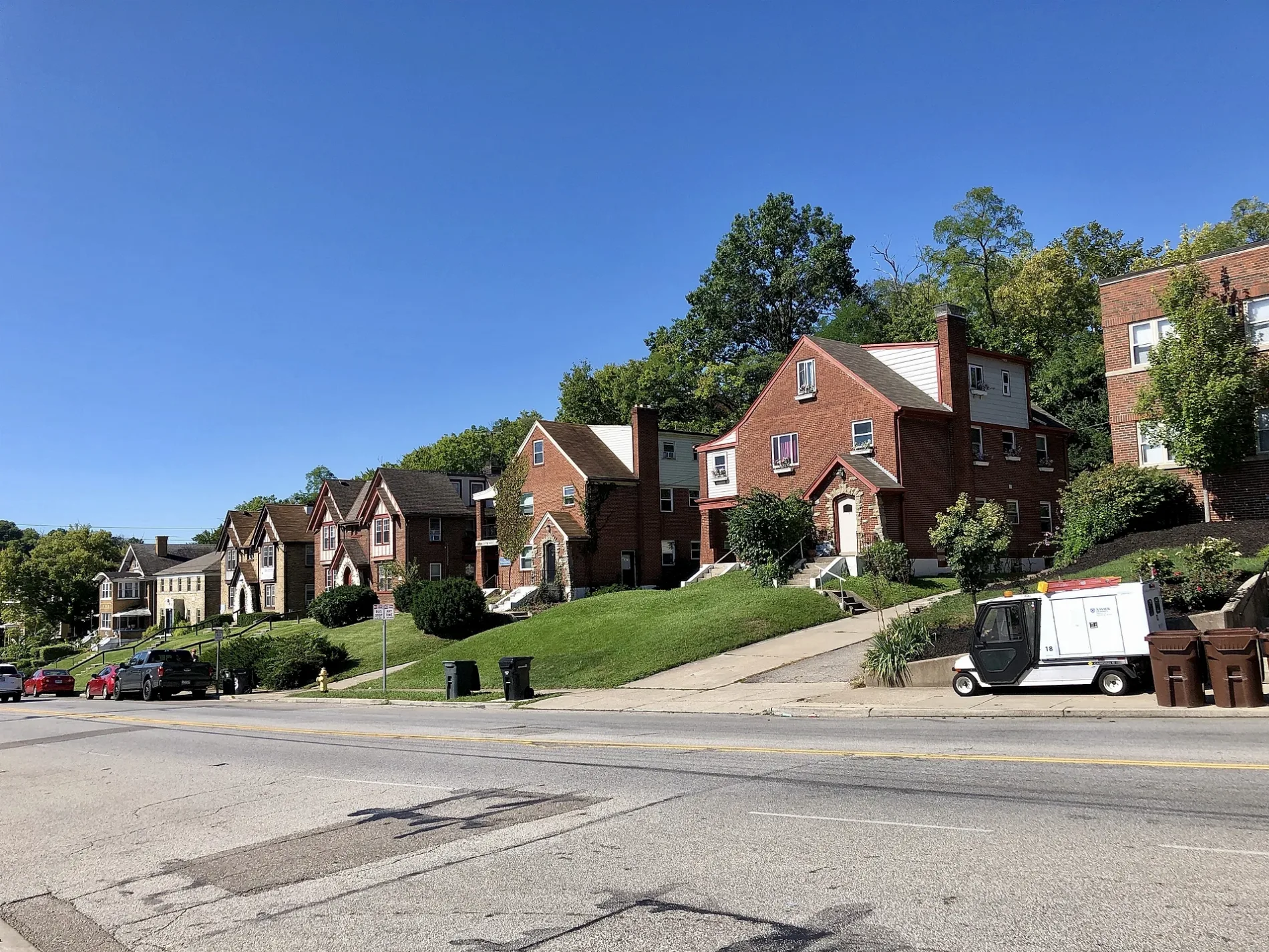
- Road Type
- local road
- Speed Limit
- 35 mph
- Lanes
- 1
- Route
- east-west
Bus stops
- bus lines 51
Artworks
Places of worship
Streets nearby
Dana Avenue150 ft
Clinton Springs Avenue450 ft
Burton Avenue500 ft
Marion Avenue0.1 mi
Lenox Lane0.2 mi
Redway Avenue0.2 mi
Beechwood Avenue0.2 mi
Dakota Avenue0.2 mi
Lenox Place0.2 mi
Beatrice Drive0.2 mi
Reading RoadReading Rd & Fred Shuttlesworth, Reading Rd & Gholson Ave, Reading Rd & Dana Ave, Reading Rd & Prospect Pl, Reading & Taft, Reading Rd & Clinton Springs Ave, Reading Rd & Burton Ave, Reading Rd & Chalfonte Pl, Reading Rd & Glenwood Ave, Reading Rd & Lexington Ave, Reading Rd & Rockdale Ave, Reading Rd & Cleveland Ave, Reading Rd & Blair Ave, Reading Rd & Hale Ave, Reading Rd & Carplin Pl, Reading Rd & Hickman Ave, Reading Rd & Union St, Reading Rd & Martin Luther King, Reading Rd & Lincoln Ave, Reading & Oak, Reading Road & Linton St
0.2 mi
Chalfonte Place0.3 mi
Valley Lane0.3 mi
Greenwood Avenue0.3 mi
Alter Place0.3 mi
Avondale Avenue0.3 mi
Byrnes Lane0.3 mi
Glenwood Avenue0.3 mi
Glenwood Place0.3 mi
Glen Lyon Avenue0.4 mi
Barry Lane0.4 mi
Goss Road0.4 mi
Paddock Road0.4 mi
East Mitchell Avenue0.4 mi
Burton Woods LaneNorth Avondale
0.4 mi
Victory Parkway0.4 mi
Lexington AvenueReading Rd & Lexington Ave, Southern Baptist Church
0.4 mi
Rose Hill Lane0.4 mi
Debbe Lane0.4 mi
Buildings nearby
Veteran's Affairs0.4 mi
Hospitals nearby
Sycamore Hall0.3 mi
Parks nearby
Seasongood Square0.1 mi
Mitchell Triangle0.1 mi
Martin Luther King Junior Park0.2 mi
Stella Park0.4 mi
Places of worship nearby
Zion Temple First Pentecostal Church0.1 mi
New Saint John Baptist Church0.2 mi
Saint Michael and All Angels Episcopal Church0.3 mi
Saint Thomas Aquinas Catholic Church0.4 mi
Retail areas nearby
North Avondale Business District150 ft
Schools nearby
Saint Thomas School0.4 mi
Sports fields nearby
Corcoran Field0.4 mi
Stadiums nearby
Hayden Field0.3 mi
University buildings nearby
Joseph Building0.3 mi
Elet Hall0.3 mi
Saint Barbara Hall0.3 mi
Armory0.3 mi
Schmidt Memorial Fieldhouse0.3 mi
Corbett Physical Education Building0.4 mi
O'Connor Sports Center0.4 mi
| Named after | Stephen F. Dana |
|---|---|
| Located in | Cincinnati |
| Country | United States |
| Location | North Avondale |
Public transit map North Avondale Legend
| Railway | |
| Bus | |
| Streetcar |
Bicycle map North Avondale Legend
| Bike path | |
| Bike lane on roadway | |
| Cycling allowed on bus lane | |
| Bicycle street | |
| Open to cyclists | |
| Open to cyclists, good path | |
| Cycling prohibited | |
| Cobblestone |
| Long-distance bike route | (depending on scale) | |
| Long-distance bike route |
Pedestrian map North Avondale Legend
| Path |
| Long-distance hiking trail | (depending on scale) | |
| Long-distance hiking trail | ||
| Pedestrians prohibited |