
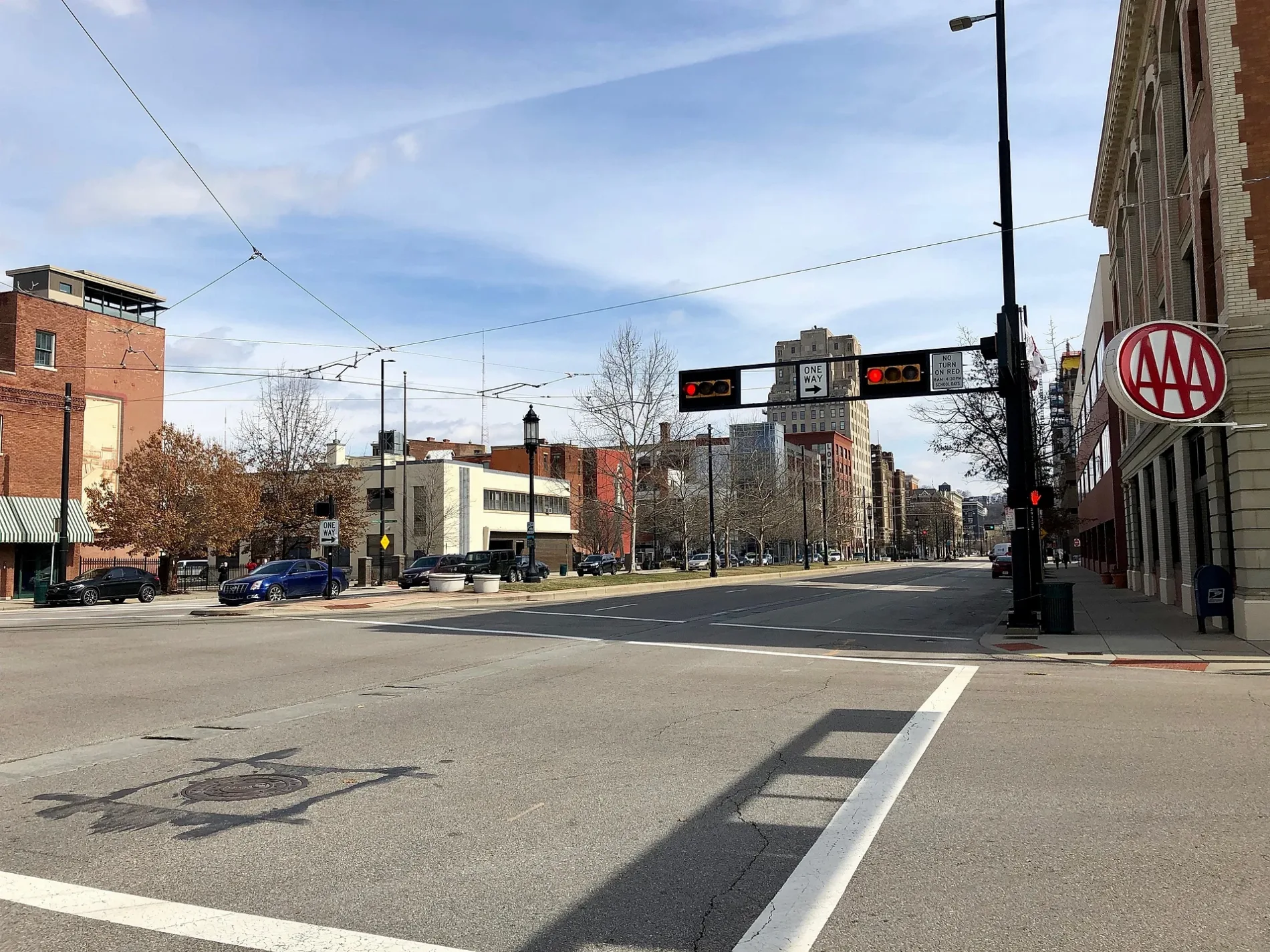
Central Parkway in Over-the-Rhine, Cincinnati, Ohio
Central Parkway in Over-the-Rhine in Cincinnati is a two-lane, asphalted main road. The street has bike paths (bike lane). It runs in a north-south direction and crosses West Elder Street, Langston Street, Findlay Street, Eton Place, Charlotte Street, Stark Street, Mohawk Place, Ravine Street, Brighton Place, Western Hills Viaduct (Upper Deck), Marshall Avenue and Bates Avenue. It ends in a cul-de-sac and connects Camp Washington, West End and Over-the-Rhine. Central Parkway is also known as Central Parkway West. This street is part of the highways 52, 127, 27 and 75 as well as the Bicycle route "US:US 25". The nearest stops are Central Pkwy & Liberty St and Central Pkwy & Ezzard Charles Dr. The bus lines 6 and 20 serve this stop.
- Bike Lane
- lane
- Road Type
- main road
- Lanes
- 2
- Speed Limit
- 35 mph
- Route
- north-south
Image
Bus stops
- bus lines 6, 20
Streets nearby
West Central Parkway150 ft
Short Alley250 ft
Plum Street250 ft
Charles Street250 ft
Gandolfo Alley350 ft
Lloyd Alley500 ft
Shute Alley500 ft
Emerson Alley500 ft
West Court StreetAji Ichiban, StudioKroner, Minges Candy
0.1 mi
Old Court Street0.1 mi
Longworth Square0.1 mi
Peale Alley0.2 mi
Clark StreetBetts-Longworth Historic District, Linn St & Clark St
0.2 mi
West 9th StreetElm St & 9th St, Red Bike, Bar 901
0.2 mi
Elizabeth StreetLinn St & Elizabeth St
0.2 mi
Ezzard Charles DriveWest End, Virtual High School, Red Bike
0.2 mi
John StreetTickets, Gate A, Mercy Health Center of Excellence
0.2 mi
Truman Alley0.2 mi
Hopkins Street0.2 mi
Isaac Alley0.2 mi
Mound Street0.2 mi
Weninger Circle0.2 mi
Fobes Alley0.3 mi
Milo Alley0.3 mi
Providence Street0.3 mi
Wesley Avenue0.3 mi
Abandoned railways nearby
Cincinnati Subway100 ft
Bars nearby
Queen City Radio400 ft
Buildings nearby
YMCA300 ft
Freestore Foodbank300 ft
Crosley Telecommunications Center0.1 mi
Sanger & Eby0.2 mi
Museums nearby
Lloyd Library and Museum0.1 mi
Cincinnati Fire Museum0.1 mi
The Betts House0.2 mi
Office buildings nearby
Court Street Center300 ft
Strietmann Center400 ft
The Exchange Building500 ft
Parking lots nearby
Town Center Garage0.1 mi
Parks nearby
Cincinnati Police Memorial0.2 mi
Places of worship nearby
The River Church Cincinnati0.2 mi
Memorial Baptist Church0.3 mi
Police stations nearby
District 1 Police Station0.2 mi
Restaurants nearby
The Lübecker500 ft
School buildings nearby
Queen City Vocational Center0.2 mi
Hays-Porter Elementary School0.3 mi
Stadiums nearby
Willard R. Stargel Stadium0.3 mi
Theaters nearby
Cincinnati Shakespeare Company500 ft
Music Hall0.2 mi
| Named after | Central Parkway |
|---|---|
| Located in | Cincinnati |
| Country | United States |
| Native name | West Central Parkway |
| Part of | Central Parkway, U.S. Route 42 |
 Public transit map Over-the-Rhine Legend
| Railway | |
| Bus | |
| Streetcar |
 Bicycle map Over-the-Rhine Legend
| Bike path | |
| Bike lane on roadway | |
| Cycling allowed on bus lane | |
| Bicycle street | |
| Open to cyclists | |
| Open to cyclists, good path | |
| Cycling prohibited | |
| Cobblestone |
| Long-distance bike route | (depending on scale) | |
| Long-distance bike route |
 Pedestrian map Over-the-Rhine Legend
| Path |
| Long-distance hiking trail | (depending on scale) | |
| Long-distance hiking trail | ||
| Pedestrians prohibited |