
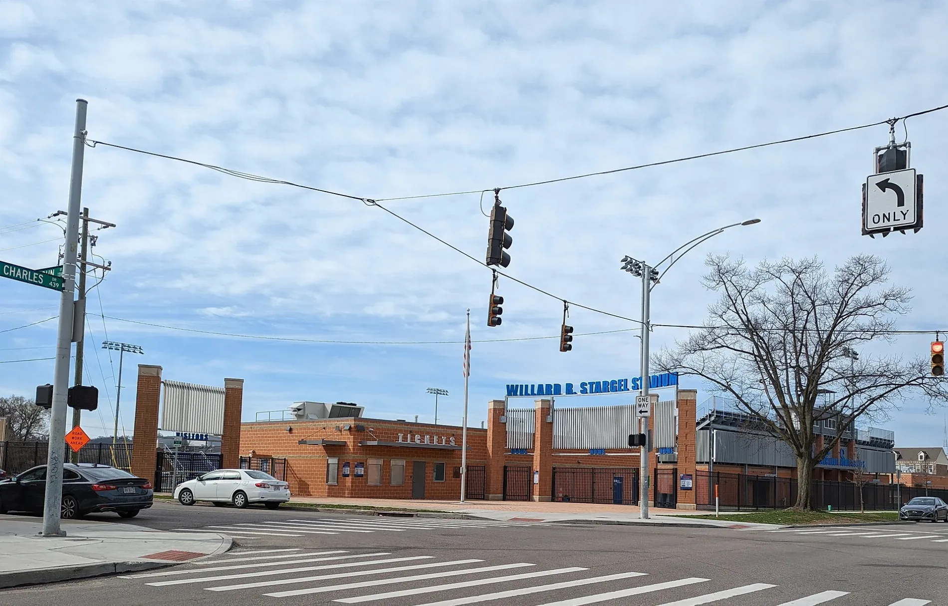
Stargel Stadium in West End, Cincinnati, Ohio
Stargel Stadium in West End in Cincinnati is a stadium (American football;soccer, Cincinnati Public Schools). Stargel Stadium is also known as Willard R. Stargel Stadium. Stargel Stadium is located near West 12th Street.
- Operator
- Cincinnati Public Schools
- Leisure
- stadium
Bus stops
Studios
Schools
Ticket offices
Cell phone stores
Dance schools
Cafes
Bike rentals
Hair salons
Clinics
Electronics stores
Convenience stores
Streets nearby
Ezzard Charles DriveWest End, Virtual High School, Red Bike
150 ft
Isaac Alley300 ft
Truman Alley400 ft
Milo Alley550 ft
John StreetGate A, Mercy Health Center of Excellence
0.1 mi
Wesley Avenue0.1 mi
Providence Street0.1 mi
Fobes Alley0.2 mi
Central ParkwayCentral Pkwy & 15th St, Central Pkwy & Ezzard Charles Dr, CET, WGUC 90.9 FM, WVXU 91.7 FM
0.2 mi
West 12th Street0.2 mi
Elizabeth StreetLinn St & Elizabeth St
0.2 mi
Mound Street0.2 mi
West 14th StreetRed Bike, Graeter's, Ole Republic Leader, Bee's Barbecue, Quan Hapa, Sugar, Symphony Hotel & Restaurant, Colette, Safi Wine Bar, Low Spark, Losanti
0.2 mi
Shute Alley0.2 mi
Charles Street0.2 mi
Central AvenueCalloway's Barbershop & Beauty Bar, Tower Mini Mart And Deli, Box Office
0.2 mi
Old Court Street0.3 mi
Longworth Square0.3 mi
Gandolfo Alley0.3 mi
West Court Street0.3 mi
Emerson Alley0.3 mi
Grant StreetWash Park Art
0.3 mi
Plum Street0.3 mi
Short Alley0.3 mi
Weninger Circle0.3 mi
Lloyd Alley0.3 mi
Richmond Street0.3 mi
Peale Alley0.4 mi
Bars nearby
Queen City Radio0.2 mi
Buildings nearby
Sanger & Eby0.2 mi
Crosley Telecommunications Center0.2 mi
Freestore Foodbank0.2 mi
Museums nearby
The Betts House0.1 mi
Cincinnati Fire Museum0.3 mi
Lloyd Library and Museum0.3 mi
Office buildings nearby
The Exchange Building0.2 mi
Strietmann Center0.3 mi
Court Street Center0.3 mi
Parking lots nearby
Town Center Garage0.2 mi
Parks nearby
Cincinnati Police Memorial0.1 mi
Places of worship nearby
The River Church Cincinnati0.1 mi
Memorial Baptist Church0.1 mi
Police stations nearby
District 1 Police Station0.1 mi
Restaurants nearby
The Lübecker0.2 mi
School buildings nearby
Queen City Vocational Center500 ft
Sports centers nearby
Central Parkway YMCA0.3 mi
Theaters nearby
Music Hall0.2 mi
Otto M. Budig Theater0.3 mi
Other nearby
Duke Energy Charles Substation0.3 mi
| Named after | Willard Stargel |
|---|---|
| Year built | 2019 |
| Official opening | 2019 |
| Located in | Cincinnati |
| Country | United States |
Public transit map West End Legend
| Railway | |
| Bus | |
| Streetcar |
Bicycle map West End Legend
| Bike path | |
| Bike lane on roadway | |
| Cycling allowed on bus lane | |
| Bicycle street | |
| Open to cyclists | |
| Open to cyclists, good path | |
| Cycling prohibited | |
| Cobblestone |
| Long-distance bike route | (depending on scale) | |
| Long-distance bike route |
Pedestrian map West End Legend
| Path |
| Long-distance hiking trail | (depending on scale) | |
| Long-distance hiking trail | ||
| Pedestrians prohibited |