
Marilyn Drive Northwest in Canton Township
Marilyn Drive Northwest in Stark County is a residential street and runs in a north-south direction starting from Valentine Circle Northwest and ends at Olive Drive Northwest.
- Road Type
- residential street
- Route
- north-south
Image
Clinics
Pastry shops
Pharmacies
Schools
Places of worship
Tourist information centers
Museums
Chocolate shops
Restaurants
Artworks
Attractions
Toy stores
Funeral homes
- Schneeberger-Oser Funeral Home (opening hours: Mon–Sun 0–24) at Fulton Road Northwest 2222 (44709). For over 85 years the Schneeberger Funeral Home has also been bringing you quality and assurance that the final wishes of your loved ones are implemented with compassion and accuracy. – approx. 0.7 mi.
Pubs
Gas stations
Streets nearby
Olive Drive Northwest300 ft
Stadium Overlook Street Northwest350 ft
Viola Parkway Northwest450 ft
Valentine Circle Northwest500 ft
Valentine Circle East0.1 mi
Helen Place Northwest0.1 mi
Harrison Avenue Northwest0.1 mi
Doctor's Offices0.1 mi
Joseph Street Northwest0.2 mi
Mercy Drive Northwest0.2 mi
Broad Avenue Northwest0.2 mi
17th Street NorthwestLakeview Heights, Goal Post Electricity Tower West
0.2 mi
14th Street Northwest0.3 mi
Edmeyer Avenue Northwest0.3 mi
Pop Place Northwest0.3 mi
School Bus LoopAllen Elementary School, Fairmount Elementary School, Sauers Junior High School, Our Lady of Peace School, Our Lady of Peace Catholic Church
0.3 mi
Clarendon Avenue Northwest0.3 mi
Abbott Place Northwest0.3 mi
12th Street NorthwestFirst Evangelical United Brethren Church, West Park
0.3 mi
Rosemont Court Northwest0.4 mi
Patton Place Northwest0.4 mi
13th Street NorthwestCrisis Intervention & Recovery
0.4 mi
Wertz Avenue Northwest0.4 mi
16th Street Northwest0.4 mi
Sebek Court Northwest0.4 mi
Jamestown Manor Apartment0.4 mi
Parkway Street Northwest0.4 mi
18th Street Northwest0.4 mi
19th Street Northwest0.4 mi
Ford Court Northwest0.4 mi
Parkway Avenue Northwest0.4 mi
15th Street NorthwestFirst Evangelical Congregational Church
0.5 mi
Blake Avenue Northwest0.5 mi
Lakewood Court Northwest0.5 mi
Mariners Island Drive Northwest0.5 mi
Clearview Avenue Northwest0.5 mi
Mariner's Island Drive0.5 mi
21st Street Northwest0.6 mi
Homedale Avenue Northwest0.6 mi
20th Street Northwest0.6 mi
Buildings nearby
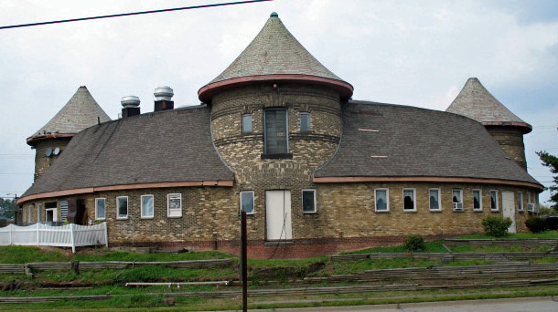
Timken Stable (Historic)0.1 mi
The Brew Kettle Canton & Topgolf Swing Suites0.5 mi
Clinics nearby
Crisis Intervention & Recovery Center, Inc.0.1 mi
Public buildings nearby
Veterans Retreat0.2 mi
Schools nearby
Lehman Middle School0.2 mi
Social facilities nearby
Hall of Fame Rehabilitation and Nursing Center0.2 mi
Sports centers nearby
Don Scott Field0.2 mi
C T Branin Natatorium0.3 mi
Stadiums nearby
Tom Benson Hall of Fame Stadium0.4 mi
Public transit map Canton Township Legend
| Railway | |
| Bus | |
| Streetcar |
Bicycle map Canton Township Legend
| Bike path | |
| Bike lane on roadway | |
| Cycling allowed on bus lane | |
| Bicycle street | |
| Open to cyclists | |
| Open to cyclists, good path | |
| Cycling prohibited | |
| Cobblestone |
| Long-distance bike route | (depending on scale) | |
| Long-distance bike route |
Pedestrian map Canton Township Legend
| Path |
| Long-distance hiking trail | (depending on scale) | |
| Long-distance hiking trail | ||
| Pedestrians prohibited |