
Olive Drive Northwest in Canton Township
Olive Drive Northwest in Stark County is a residential street. It runs in an east-west direction and crosses Valentine Circle Northwest and Marilyn Drive Northwest and ends at Viola Parkway Northwest, while the other end is a cul-de-sac.
- Road Type
- residential street
- Route
- east-west
Image
Streets nearby
Viola Parkway Northwest250 ft
Marilyn Drive NorthwestEdmeyer Park
300 ft
Valentine Circle East500 ft
Stadium Overlook Street Northwest500 ft
Valentine Circle Northwest0.1 mi
Doctor's Offices0.1 mi
Harrison Avenue Northwest0.1 mi
Helen Place Northwest0.2 mi
Mercy Drive Northwest0.2 mi
14th Street Northwest0.2 mi
Pop Place Northwest0.2 mi
Arlington Avenue Northwest0.2 mi
Joseph Street Northwest0.3 mi
Abbott Place Northwest0.3 mi
Edmeyer Avenue Northwest0.3 mi
12th Street NorthwestFirst Evangelical United Brethren Church, West Park
0.3 mi
Nicholas Place Northwest0.3 mi
Lake Road Boulevard Northwest0.3 mi
Columbus Avenue NorthwestSaint Josephs School, Saint Josephs Catholic Church
0.3 mi
13th Street NorthwestCrisis Intervention & Recovery
0.4 mi
Sebek Court Northwest0.4 mi
Patton Place Northwest0.4 mi
11th Street Northwest0.4 mi
Parkway Street Northwest0.4 mi
Wertz Avenue Northwest0.4 mi
16th Street Northwest0.4 mi
Ford Court Northwest0.4 mi
9th Street Northwest0.4 mi
Parkway Avenue Northwest0.4 mi
Scott Place Northwest0.5 mi
Rosemont Court Northwest0.5 mi
Varn Place Northwest0.5 mi
Lakewood Court Northwest0.5 mi
Homedale Avenue Northwest0.5 mi
Broad Avenue Northwest0.5 mi
Bedford Avenue Northwest0.5 mi
Sunshine Court Northwest0.5 mi
10th Street Northwest0.5 mi
8th Street NorthwestSummit Elementary School, Downtown Canton
0.5 mi
Milton Court Northwest0.5 mi
Clarendon Avenue Northwest0.5 mi
Christian Place Northwest0.5 mi
Buildings nearby
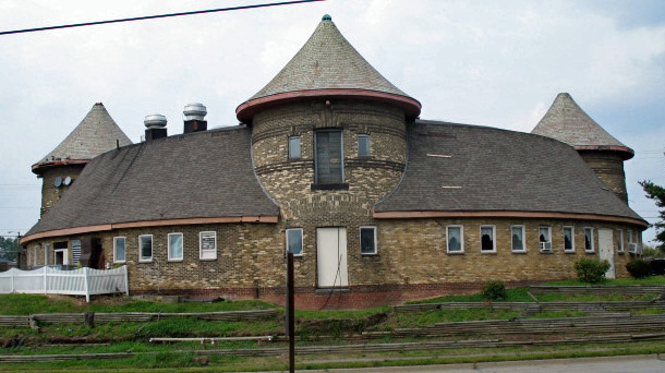
Timken Stable (Historic)0.1 mi
Clinics nearby
Crisis Intervention & Recovery Center, Inc.550 ft
Parks nearby
Westbrook Veterans Memorial Park0.3 mi
Public buildings nearby
Veterans Retreat0.2 mi
Schools nearby
Lehman Middle School0.1 mi
Social facilities nearby
Hall of Fame Rehabilitation and Nursing Center0.2 mi
Sports centers nearby
Don Scott Field0.2 mi
Public transit map Canton Township Legend
| Railway | |
| Bus | |
| Streetcar |
Bicycle map Canton Township Legend
| Bike path | |
| Bike lane on roadway | |
| Cycling allowed on bus lane | |
| Bicycle street | |
| Open to cyclists | |
| Open to cyclists, good path | |
| Cycling prohibited | |
| Cobblestone |
| Long-distance bike route | (depending on scale) | |
| Long-distance bike route |
Pedestrian map Canton Township Legend
| Path |
| Long-distance hiking trail | (depending on scale) | |
| Long-distance hiking trail | ||
| Pedestrians prohibited |