
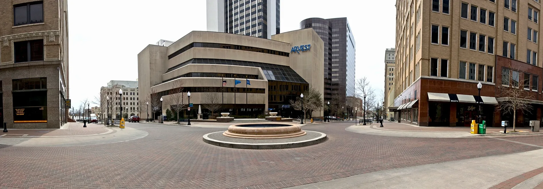
East 8th Street in Tulsa, Oklahoma
East 8th Street in Tulsa is a four-lane, asphalted footpath. It runs in a northeast-southwest direction starting from West 8th Street and crosses South Main Street, South Boston Avenue, South Cincinnati Avenue and South Detroit Avenue East and ends at East 8th Street South. East 8th Street also exists in Owasso and Sand Springs.
- Road Type
- main road
- Lanes
- 4
- Speed Limit
- 25 mph
- Route
- northeast-southwest
Image
Streets nearby
East 7th StreetPlain View Heights
450 ft
East 9th Street500 ft
West 8th Street0.1 mi
East 10th Street10th Street & Detroit Avenue, (8246) 10th St & Detroit Ave EB, 10th Street & Elgin Avenue, Foolish Things Coffee Company, et al., 10th Street & Boston Avenue, 10th Street & Cincinnati Avenue, (8295) 10th St & Elgin Ave WB, (7017) 10th St & Cincinnati Ave EB, (6422) 10th St & Boston Ave, (7014) 10TH ST & BOSTON AVE WB
0.2 mi
East 6th StreetIBM, Bonston Title & Abstract
0.2 mi
South Detroit Avenue East(8988)DETROIT & 10TH ST NB
0.2 mi
West 6th StreetRoppongi Ramen, Dire Wolf Tattoo, (8190) 6th St & Elwood Ave WB, 6th Street & Denver Avenue
0.2 mi
East 7th Street SouthCovenant Fellowship Bible Church
0.2 mi
West 10th Street0.2 mi
South Cincinnati AvenueTulsa City Hall, Cincinnatti Avenue & 8th Street, Cincinnatti Avenue & 6th Street, Cincinnatti Avenue & 5th Street, Chamber Restaurant, Bank of America, Coracle Coffee, Who's Truth TV & Productions, Bonray Barber, The Temple Studio, Episcopal Diocese of Oklahoma
0.2 mi
West 11th Street South0.2 mi
South Boston AvenueBoston Avenue & 6th Street, TTCU Federal Credit Union, Oklahoma Jazz Hall of Fame, Chase, Deco Deli, Reign Glory, Galvanize Salon, 415 Grille, Boston Avenue Grille, The Placery Bar and Restaurant, Jimmy John's, Elote, Meridia, Decopolis, DGX, (8299) Boston Ave & 4th St NB, Boston Avenue & 9th Street, (8296) Boston Ave & 9th St NB, FarmBar
0.2 mi
South Main StreetThe Bart Center for Music, The Box Nail Salon, Vessel Skin Studio, Lou's Deli, Oklahoma Spud, QuikPrint, Tabouli's, Treat's, Mayo 420 Apartments, Belvedere Barber, Tulsa Police, Eerie Abbey Taphouse, Deco District, Take 2, (8893) Main St & 10th St SB, PonyCoffee
0.2 mi
East 5th StreetRose Rock Microcreamery, IBC Bank, Litgistix Business Solutions, Jack's, Copy, Scan & More, Arby's, Oil Capital Historic District
0.2 mi
Bartlett Square0.2 mi
West 7th Street0.3 mi
South Cheyenne Avenue WestDenver Avenue Station, Ti Amo, Fresa Fusion Kitchen, Cheyenne Avenue & 5th Street, Oakshire
0.3 mi
Shops nearby
Cash Finance of Tulsa0.2 mi
Money Services INC0.2 mi
Apartment buildings nearby
Enterprise Building0.2 mi
ARCO Apartments0.2 mi
Sinclair Building0.2 mi
Vandever's Building0.2 mi
Mayo Building0.2 mi
Banks nearby
Communication Federal Credit Union250 ft
Arvest0.2 mi
Energy One Federal Credit Union0.3 mi
Buildings nearby
Philtower0.2 mi
Pythian Building0.2 mi
Clinics nearby
Palmer0.3 mi
Commercial buildings nearby
Thompson Building0.2 mi
Office buildings nearby
Oklahoma Natural Gas450 ft
Center for Architecture & Design500 ft
Hillcrest Building0.2 mi
IBM0.2 mi
Petroleum Club0.2 mi
Public Service Company of Oklahoma0.2 mi
McFarlin Building0.2 mi
ONEOK Plaza0.2 mi
Parking lots nearby
The Birdcage0.1 mi
Oneok Parking Garage0.2 mi
Hillcrest Parking Garage0.2 mi
Parks nearby
H.A. Chapman Centennial Green0.1 mi
Places of worship nearby
First Presbyterian Church450 ft
First Church Christ0.2 mi
Religious areas nearby
First United Methodist Church0.2 mi
Restaurants nearby
The Vault0.1 mi
Single-family houses nearby
PeopleReady0.2 mi
Universities nearby
Tulsa Community College0.2 mi
 Public transit map Tulsa Legend
| Railway | |
| Bus | |
| Streetcar |
 Bicycle map Tulsa Legend
| Bike path | |
| Bike lane on roadway | |
| Cycling allowed on bus lane | |
| Bicycle street | |
| Open to cyclists | |
| Open to cyclists, good path | |
| Cycling prohibited | |
| Cobblestone |
| Long-distance bike route | (depending on scale) | |
| Long-distance bike route |
 Pedestrian map Tulsa Legend
| Path |
| Long-distance hiking trail | (depending on scale) | |
| Long-distance hiking trail | ||
| Pedestrians prohibited |