
Mississippi River in Joiner, AR 72350
Mississippi River in Joiner, AR 72350 (Tipton County) is a river. Mississippi River is also known as The Mississippi. Mississippi River also exists in Dyer County, Lauderdale County and Lake County. Ⓦ.
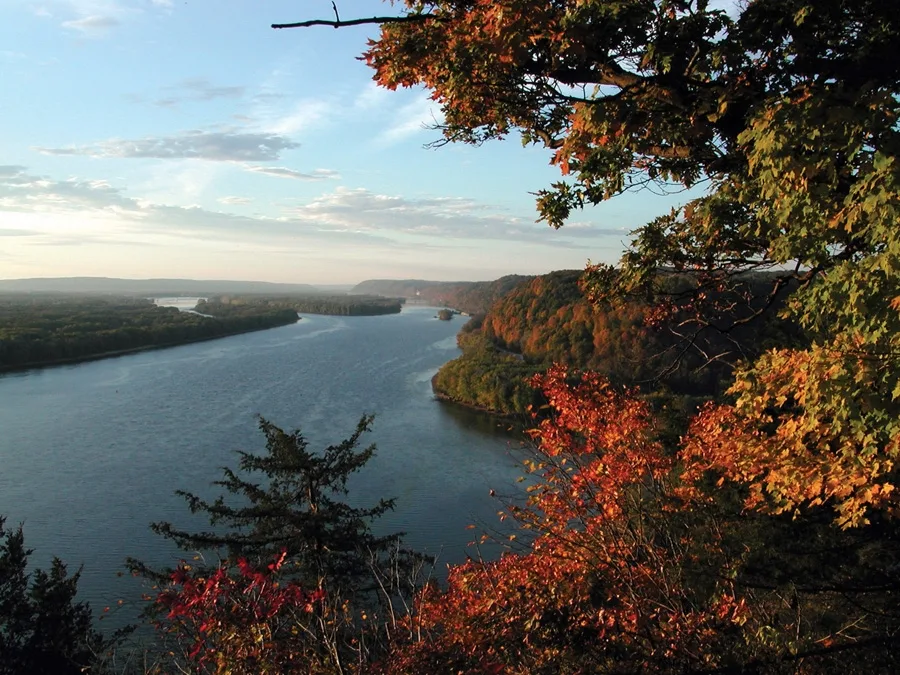
- Waterway Type
- river
Streets nearby
County Road 4911.3 mi
South County Road 4912.0 mi
Herring Hill Road2.3 mi
Ruby Street2.3 mi
Glen Cove2.5 mi
Tippy Drive2.5 mi
Rogers Lane2.6 mi
Ray Bluff RoadDixonville
2.8 mi
Nancy Drive2.8 mi
Barney Cove2.9 mi
Jackie Cove2.9 mi
Perry Lane3.0 mi
Moore Road3.0 mi
Monasco Road3.0 mi
River Bluff Road3.1 mi
Marshall Cove3.1 mi
River Road3.1 mi
Harkness Cove3.1 mi
Pannell Road3.1 mi
Blacksprings Cove3.2 mi
Black Springs Road3.2 mi
Faulk Road3.3 mi
Hilldale Cove3.4 mi
Brooks Meadows Road3.4 mi
Hilldale Lane3.5 mi
Chickasaw Bluff Cove3.5 mi
Hilltop Lane3.5 mi
Gore Road3.6 mi
Robinson Hill Road3.6 mi
Organized Camp Road3.8 mi
Pryor RoadWord of Deliverance Ministries
3.8 mi
Four-L-Dike Road3.8 mi
Jackson Hill Road3.8 mi
Island 37 RoadCorona
3.9 mi
Craig Road3.9 mi
Saint Paul RoadSaint Pauls Church
3.9 mi
Smith Road4.0 mi
New Bethel RoadNew Bethel Church
4.1 mi
Delashmit Road4.2 mi
Tompkins Lane4.2 mi
Susie Cove4.2 mi
Bluff Road4.2 mi
West Locke Road4.2 mi
Corona Road4.3 mi
Faith Road4.3 mi
Rast Road4.4 mi
Bass Road4.5 mi
West Union RoadShake Rag, West Union Cumberland Presbyterian Church
4.5 mi
Cemeteries nearby
Saint Paul Cemetery3.9 mi
| Length | 3766 |
|---|---|
| Located in | United States |
| Country | United States |
| Source | Lake Itasca |
| Mouth | Gulf of Mexico |
| Tributary | Black River, Arkansas River, Ohio River, Saint Croix River, Wisconsin River, Rock River, Illinois River, Kaskaskia River, Minnesota River, Des Moines River, White River, Apple River, Big Muddy River, St. Francis River, Yazoo River, Big Black River, Maquoketa River, Wolf River, Rice Creek, Iowa River, Turkey River, Loosahatchie River, Meramec River, Wapsipinicon River, Chippewa River, River des Peres, Bayou Pierre, Catfish Creek, Crow River, Duck Creek, Hatchie River, Henderson Creek, Little Maquoketa River, Marys River, Obion River, Prairie River, Rum River, Rush River, Salt River, Schoolcraft River, Skunk River, Swan River, Trempealeau River, Turtle River, Upper Iowa River, Vermillion River, Wind River, Yellow River, Village Creek, Brazeau Creek, Cinque Hommes Creek, Nokasippi River, Apple Creek, Coles Creek, River aux Vases, Minnehaha Creek, Fox River, Bassett Creek, Sucker Creek, Missouri River |
| Native name | Mississippi River |
| Described by | Sytin Military Encyclopedia, Small Brockhaus and Efron Encyclopedic Dictionary, Brockhaus and Efron Encyclopedic Dictionary, Jewish Encyclopedia of Brockhaus and Efron, The Nuttall Encyclopædia, Great Soviet Encyclopedia (1926–1947), The Encyclopedia Americana, The American Cyclopædia, Encyclopædia Britannica 11th edition, Collier's New Encyclopedia, 1921, The New Student's Reference Work, New International Encyclopedia, Meyer’s Universum, Fünfzehnter Band, Meyer’s Universum, Siebzehnter Band, Meyer’s Universum, Achtzehnter Band, Granat Encyclopedic Dictionary |
Public transit map Tipton County Legend
| Railway | |
| Bus | |
| Streetcar |
Bicycle map Tipton County Legend
| Bike path | |
| Bike lane on roadway | |
| Cycling allowed on bus lane | |
| Bicycle street | |
| Open to cyclists | |
| Open to cyclists, good path | |
| Cycling prohibited | |
| Cobblestone |
| Long-distance bike route | (depending on scale) | |
| Long-distance bike route |
Pedestrian map Tipton County Legend
| Path |
| Long-distance hiking trail | (depending on scale) | |
| Long-distance hiking trail | ||
| Pedestrians prohibited |