
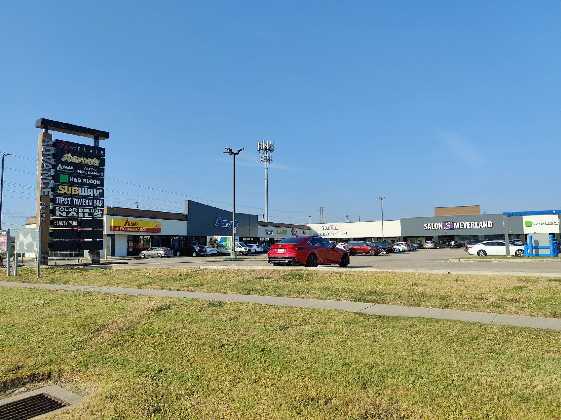
Advance Plaza in Houston
Advance Plaza in Houston is a retail area.
- Land Use
- retail area
Image
Tourist information centers
Artworks
Ice cream shops
Nightclubs
Public bookcases
Restaurants
Tobacco shops
Pubs
Veterinary clinics
Cell phone stores
Charging stations
Fast food restaurants
Pharmacies
Vending machines
Streets nearby
Doud Street0.1 mi
South Post Oak RoadHunter's Pub, 168 Szechuan, Houston Smoke, Cricket Wireless, Burger King, Texaco, Subway, Domino's, Welcome gas station, ACE Cash Express, Boost Mobile, Holy Trinity Missionary Baptist Church, Walgreen, Family Dollar, Phap Luan Buddhist Culture Center, Jack in the Box, South Post Oak Self Storage, Little Caesars, Redbox, La Monarca Michoacana, Perú Gourmet, Metro by T-Mobile, Big Deal Furniture, Wilson Glass Tint, La Sierra
0.1 mi
BBlink
0.1 mi
A0.1 mi
West Bellfort StreetStella, Meyerland, Westbury, The Samaritan Furniture, Braes Resale, Bakery Inka Havana, Fannin South Transit Center, Fannin South, Solid Rock Baptist Church, McDonald's, United Sisters, Grace Episcopal Church
0.1 mi
Hazelton Street0.1 mi
Clematis Lane0.1 mi
Lymbar Drive0.2 mi
Endicott LaneMassage Envy, Firehouse Subs
0.2 mi
Cheena DriveCorpus Christi School, Corpus Christi Catholic Church
0.2 mi
Waycross Street0.2 mi
West Belfort Street0.2 mi
Scofield Lane0.3 mi
Willowbend BoulevardMeyerland, Plant It Forward, Walgreens
0.3 mi
Balmforth Lane0.3 mi
Wigton Drive0.3 mi
Runnymeade Drive0.3 mi
Amenities nearby
One Hope Preschool0.2 mi
Shops nearby
TitleMax0.3 mi
Auto parts stores nearby
O'Reilly Auto Parts0.2 mi
Auto repair shops nearby
Meyerland Collision0.1 mi
Midas0.2 mi
Banks nearby
Chase450 ft
Buildings nearby
Cabana Car Wash and Lube Center400 ft
Cafes nearby
Kolache Factory0.1 mi
Car washes nearby
Mister Car Wash0.2 mi
Community centers nearby
McPhail Hall0.2 mi
Convenience stores nearby
Star Stop0.2 mi
Fast food restaurants nearby
Subway250 ft
Tacos “El Zeba’s”550 ft
Whataburger0.1 mi
Shipley Do-Nuts0.1 mi
Taco Cabana0.2 mi
McDonald's0.2 mi
Jack in the Box0.2 mi
Gas stations nearby
Chevron0.2 mi
Music stores nearby
Gabbanelli200 ft
Pharmacies nearby
CVS Pharmacy0.2 mi
Places of worship nearby
Sanctuary0.2 mi
Playgrounds nearby
Bunnell Family Playground0.2 mi
Religious areas nearby
St. John's Presbyterian Church0.2 mi
Residential areas nearby
Willow Bend0.1 mi
Glen Willow Apartments0.2 mi
Houston Programs0.2 mi
Meyerland Section 8W0.3 mi
Retail buildings nearby
10421 South Post Oak0.2 mi
Sports centers nearby
Bayou City Fencing Academy50 ft
Supermarkets nearby
Kroger0.1 mi
Veterinary clinics nearby
Meyerland Animal Clinic400 ft
| Located in | Houston |
|---|---|
| Country | United States |
| Location | Westbury |
 Public transit map Houston Legend
| Railway | |
| Bus | |
| Streetcar |
 Bicycle map Houston Legend
| Bike path | |
| Bike lane on roadway | |
| Cycling allowed on bus lane | |
| Bicycle street | |
| Open to cyclists | |
| Open to cyclists, good path | |
| Cycling prohibited | |
| Cobblestone |
| Long-distance bike route | (depending on scale) | |
| Long-distance bike route |
 Pedestrian map Houston Legend
| Path |
| Long-distance hiking trail | (depending on scale) | |
| Long-distance hiking trail | ||
| Pedestrians prohibited |