
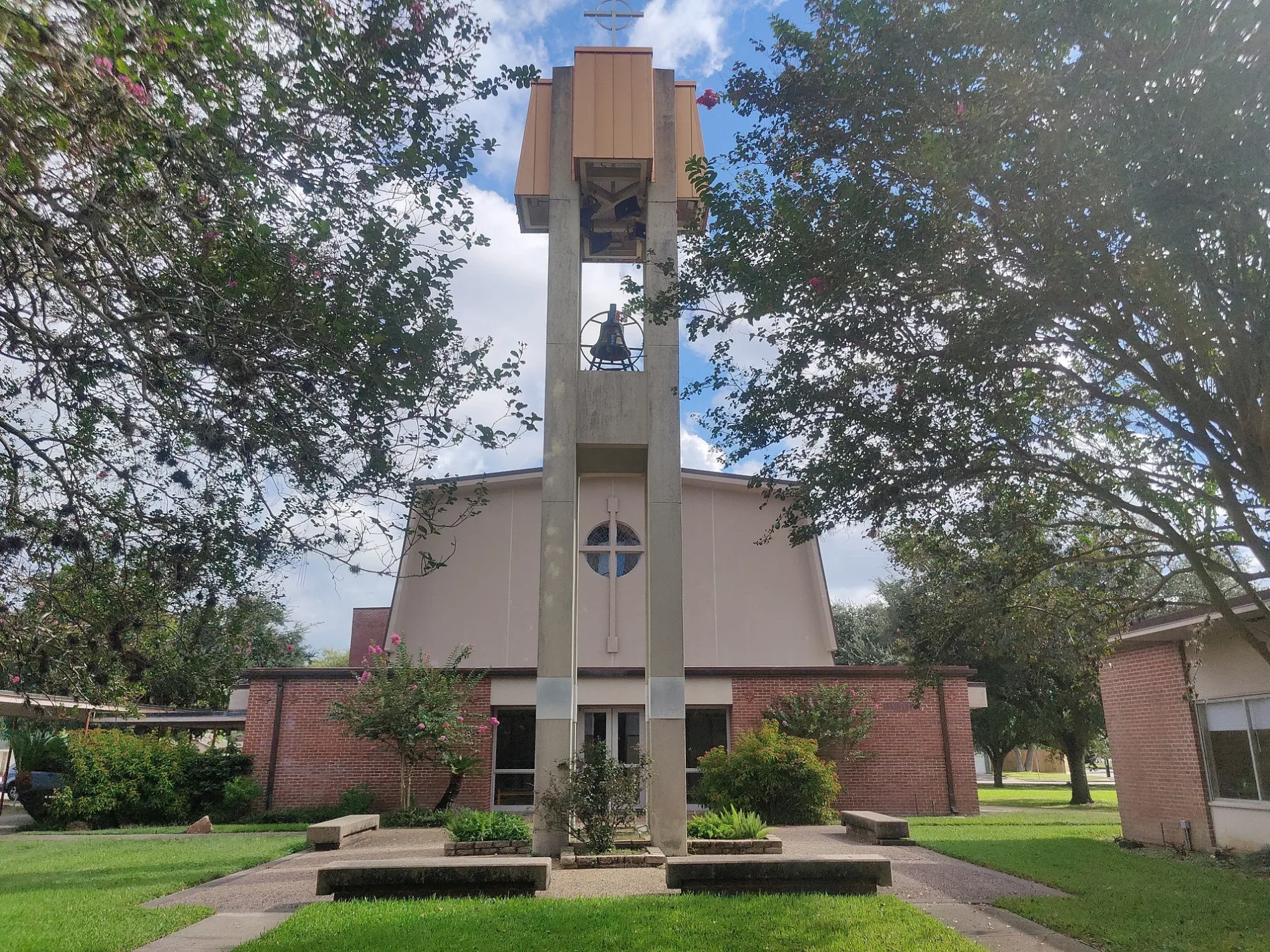
St. John's Presbyterian Church in Houston
St. John's Presbyterian Church in Houston is a religious area, West Bellfort Street 5020 (77035).
- House Number
- 5020
- Postal Code
- 77035
- Street
- West Bellfort Street
- Land Use
- religious area
- Website
- https://www.stjohnspresby.org
Image
Cell phone stores
Fast food restaurants
Ice cream shops
Nightclubs
Public bookcases
Restaurants
Tobacco shops
Pubs
Vending machines
Tourist information centers
Charging stations
Artworks
Pharmacies
Veterinary clinics
Streets nearby
Scofield Lane450 ft
Cheena DriveCorpus Christi School, Corpus Christi Catholic Church
0.1 mi
Hazelton Street0.2 mi
Clematis Lane0.2 mi
Balmforth Lane0.2 mi
Waycross Street0.2 mi
Doud Street0.2 mi
Lymbar Drive0.2 mi
West Bellfort StreetStella, Meyerland, Westbury, The Samaritan Furniture, Braes Resale, Bakery Inka Havana, Fannin South Transit Center, Fannin South, Solid Rock Baptist Church, McDonald's, United Sisters, Grace Episcopal Church
0.2 mi
Cedarhurst Drive0.3 mi
Yarwell Drive0.3 mi
BBlink
0.3 mi
Manhattan Drive0.3 mi
Wigton Drive0.3 mi
Creekbend Drive0.3 mi
Dumfries DriveAvalon Medical Career Academy
0.3 mi
Torchlight DriveLittle Free Library, The Festive PIgs
0.3 mi
Rutherglenn Drive0.4 mi
Valkeith Drive0.4 mi
Endicott LaneMassage Envy, Firehouse Subs
0.4 mi
Contour Place0.4 mi
Stillbrooke Drive0.4 mi
Moonlight DrivePilgrim School
0.4 mi
Queensloch DriveLittle Red School House;Sephardic Gan;Torat Emet;Yeshiva Torat Emet
0.4 mi
Briarbend DriveLittle Free Library
0.5 mi
Runnymeade Drive0.5 mi
Paisley Street0.5 mi
Redstart StreetLittle Free Library
0.5 mi
Willowbend BoulevardMeyerland, Plant It Forward, Walgreens
0.5 mi
Chimney Rock RoadCVS Pharmacy, Domino's, Metro by T-Mobile, Lo Price Liquor & Tobacco, Dr. Philip A. Matorin MD, Pilgrim Lutheran Church, Line 32, Church's Chicken, Chipotle, Natural Pawz, Bird's Eye View Optometry, Line 49, Uptown Shears, Rich Cleaners, Kolache Factory, Burganic Hub, Lauren’s Fragrances, Asian Cafe, The Hat Store, THS Ranch, TitleMax, French Riviera Bakery & Cafe, Massage Heaven
0.6 mi
Amenities nearby
One Hope Preschool350 ft
Auto repair shops nearby
Meyerland Collision0.3 mi
Banks nearby
Chase0.3 mi
Buildings nearby
Cabana Car Wash and Lube Center0.2 mi
Community centers nearby
McPhail Hall300 ft
Godwin Community Center0.3 mi
Fast food restaurants nearby
Subway0.3 mi
Music stores nearby
Gabbanelli0.2 mi
Parks nearby
Godwin Park0.3 mi
Pharmacies nearby
CVS Pharmacy0.3 mi
Places of worship nearby
Sanctuary400 ft
Playgrounds nearby
Bunnell Family Playground200 ft
Residential areas nearby
Houston Programs50 ft
Meyerland Section 8W0.2 mi
Retail areas nearby
Advance Plaza0.2 mi
Single-family houses nearby
Evan and Mumine Estate0.4 mi
Sports centers nearby
Bayou City Fencing Academy0.2 mi
Supermarkets nearby
Kroger0.3 mi
Veterinary clinics nearby
Meyerland Animal Clinic0.2 mi
| Named after | John the Apostle |
|---|---|
| Located in | Houston |
| Country | United States |
| Has part | columbarium, community garden, McPhail Hall, Bunnell Family Playground |
| Location | Meyerland |
 Public transit map Houston Legend
| Railway | |
| Bus | |
| Streetcar |
 Bicycle map Houston Legend
| Bike path | |
| Bike lane on roadway | |
| Cycling allowed on bus lane | |
| Bicycle street | |
| Open to cyclists | |
| Open to cyclists, good path | |
| Cycling prohibited | |
| Cobblestone |
| Long-distance bike route | (depending on scale) | |
| Long-distance bike route |
 Pedestrian map Houston Legend
| Path |
| Long-distance hiking trail | (depending on scale) | |
| Long-distance hiking trail | ||
| Pedestrians prohibited |