
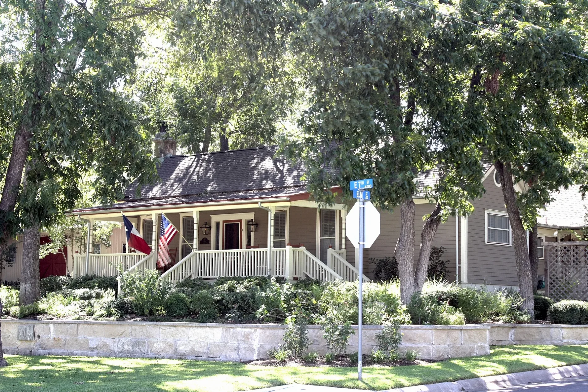
South Holly Street in Georgetown, Texas
South Holly Street in Georgetown is a residential street. It runs in a north-south direction starting from North Holly Street and crosses East 2nd Street, East 3rd Street, East 4th Street and East 5th Street and ends at East 7th Street. South Holly Street also exists in Brazoria County, Lamar County, Wichita County and Dallas County.
- Road Type
- residential street
- Route
- north-south
Image
Places of worship
Cafes
Drugstores
Supermarkets
Ice cream shops
Restaurants
- Gumbo's North (Regional cuisine, Cajun, Creole, Steak, Seafood, outdoor seating, takeout, delivery service, Wi-Fi, gluten-free options, wheelchair accessible, opening hours: Tue–Sat 11–22; Sun 11–21) at South Main Street 701 (78626). All food is cooked to order. Bar is open until midnight each night (crowd permitting). Outdoor seating is upstairs on the balcony. – approx. 0.5 mi.
Veterinary clinics
Interior decorators
Bakeries
Hair salons
Guest houses
Schools
Wine shops
Beauty salons
Event venues
Streets nearby
South Pine StreetPine Street Cottage
350 ft
Olive StreetSan Gabriel House Bed & Breakfast
0.1 mi
Wesleyan Drive0.1 mi
South Walnut StreetGus's Drug Store
0.1 mi
East 8th StreetGeorgetown Alternative Center, 600 Degrees Pizzeria and Drafthouse, City Barber Shop, La Riv Wood Fired Italian, Union Merchant
0.1 mi
Windridge Village Cove0.2 mi
East 5th Street0.2 mi
South College StreetSaving Grace Christian Bible Fellowship
0.2 mi
East 6th StreetWish Well House
0.2 mi
East 7th StreetThe Baked Bear, Galaxy Bakery & CoffeeHouse, Jaiwai Thai Kitchen, Deluxe Nails & Spa, 600 Degrees Marketplace, Gumbo's North
0.2 mi
Retreat Place0.2 mi
Maple Street0.2 mi
McKenzie Drive0.2 mi
East 9th Street0.2 mi
Smith Creek Road0.2 mi
East 9 1/2 Street0.2 mi
East 4th Street309 Coffee
0.3 mi
East 3rd StreetNatio Church
0.3 mi
East 2nd StreetSidney Childminder
0.3 mi
Southwestern Boulevard0.3 mi
Brendon Lee Lane0.4 mi
North Holly Street0.4 mi
Sierra Rose Loop0.4 mi
Buildings nearby
Fountainwood Observatory0.4 mi
Chapels nearby
Lois Perkins Chapel0.3 mi
Commercial areas nearby
Suddenlink Communications0.2 mi
Dog parks nearby
Bark Park0.3 mi
Dormitories nearby
Sharon Lord Caskey Community Center (including Sorority Chapter Rooms)0.1 mi
Moody-Shearn Residence Hall0.2 mi
Herman Brown Residence Hall0.2 mi
Dorothy Manning Lord Residential Center0.2 mi
Charline Hamblin McCombs Residential Hall0.2 mi
Martin Ruter Residence Hall0.3 mi
Gardens nearby
Southwestern University Community Garden0.3 mi
Parks nearby
Windridge Village Park0.4 mi
Police stations nearby
Old Field House (Campus Police)0.3 mi
Residential areas nearby
Windridge Village0.3 mi
Holly Street Village0.3 mi
Sports fields nearby
Robert K. Moses, Jr. Field0.2 mi
East Softball Field0.3 mi
Central Softball Field0.4 mi
Technical colleges nearby
Pi Kappa Alpha House0.2 mi
Kappa Sigma House0.2 mi
Kappa Alpha House0.2 mi
Phi Delta Theta House0.3 mi
McCombs Campus Center0.3 mi
Rufus Franklin Edwards Studio Arts Building0.3 mi
Joe S. Mundy Hall0.4 mi
Physical Plant Building & Warehouse0.4 mi
 Public transit map Georgetown Legend
| Railway | |
| Bus | |
| Streetcar |
 Bicycle map Georgetown Legend
| Bike path | |
| Bike lane on roadway | |
| Cycling allowed on bus lane | |
| Bicycle street | |
| Open to cyclists | |
| Open to cyclists, good path | |
| Cycling prohibited | |
| Cobblestone |
| Long-distance bike route | (depending on scale) | |
| Long-distance bike route |
 Pedestrian map Georgetown Legend
| Path |
| Long-distance hiking trail | (depending on scale) | |
| Long-distance hiking trail | ||
| Pedestrians prohibited |