
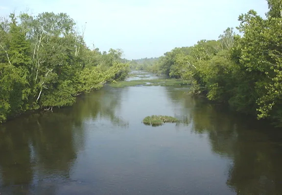
Appomattox River in Chesterfield County, Virginia
Appomattox River in Chesterfield County is a river. Appomattox River is also known as Apamatuck River. Appomattox River also exists in Petersburg, Amelia County, Appomattox County, Cumberland County and Dinwiddie County. Ⓦ.
- Waterway Type
- river
Image
Fast food restaurants
Fire stations
Gas stations
Beauty salons
Supplement stores
Restaurants
Cemeteries
Gift shops
Auto repair shops
Hair salons
Cafes
Dentist offices
Attractions
Food courts
Convenience stores
Veterinary clinics
Paint stores
Streets nearby
Greenes Road0.9 mi
River RoadWyatt Cemetery
1.4 mi
Oak Grove Loop1.5 mi
Deep Creek Court1.9 mi
Deep Creek Drive1.9 mi
Deep Creek Place1.9 mi
Cedar Creek Road2.7 mi
Crooked Run Branch Lane2.7 mi
Richmond RoadSalem Cemetery
3.0 mi
Wilson Road3.1 mi
Rocky Run Lane3.1 mi
Sparks Lane3.3 mi
Hembrick Road3.3 mi
Woodley Drive3.3 mi
Eppes Falls Road3.3 mi
Cralles Road3.4 mi
Stonewall Place3.6 mi
Rock Castle Lane3.6 mi
Stonewall Drive3.7 mi
Bevils Bridge RoadBevils Bridge, Goat Love Info
3.8 mi
Coleman Drive3.8 mi
Taylor Road3.9 mi
Hickery Mill Road4.1 mi
Eppes Falls Lane4.1 mi
Military RoadScotts Fork, Albright Presbyterian Church, Wilsons Corner
4.1 mi
Merlin Way4.2 mi
Cousins Lane4.4 mi
Crayton Lane4.4 mi
Namozine RoadMannboro, Amelia County Volunteer Fire Department Company 2 Mannboro, Namozine
4.4 mi
Coalboro Road4.5 mi
Wills Road4.6 mi
Hull Street RoadJ&S Flooring, Balance Massage, Premier, Raising Cane's, Magnolia Green Foot & Ankle Center, Jarratt Volunteer Fire Department, In N Out, Diamond Motor, BP, Childcare Network, Cousin Vinny's Pizza, Tommy's Express Car Wash, Allen Tire, Complete Care for Children, Juice Bar Cafe, Wing Command Bar & Restaurant, Smokers World, La Fuente, Lucky Chinese, Buddy South Auto Parts & Service, Take 5 Oil Change, Sheetz, Bank of America, Valvoline, Chick-fil-A, Advance Auto Parts, Dunkin', AAMCO, Qdoba, New Beginnings, Style Bi-Rite, Firestone, El Sabor Restaurante, Frazzles to Dazzles, The Tire Depot, Mini Price Storage, $2.50 Cleaners, Little Caesars, Sherwin-Williams, 7Brew, Mattress Firm, Taziki's Mediterranean Cafe, Starbucks, First Watch, Dogtopia, Sona Medspa, Baskin-Robbins, MOD Pizza, Discount Tire, His or Hers Salon, Feinstein 360 Orthdontics, Great Clips, Casa Tezcal, MyEyeDr., Maple Street Biscuit Company, Alora, Saladworks, T-Mobile, Fest Restaurant, Chipotle, Panera Bread, The Vitamin Shoppe, Wingstop, 360 Express Mart, Shell, La Milpa, Leete Tire and Auto, Boost Mobile, New Flow, Exxon, Subway, Cafe & Sabor Bakery and Restaurant, Luxury Furniture, Bello Amenecer, Enterprise, Bargain Books, Apple Door Systems
4.6 mi
Buildings nearby
Eppington1.4 mi
Eppington Plantation3.8 mi
Cemeteries nearby
Oak Grove Cemetery2.8 mi
Branches Runn Church Cemetery3.2 mi
Craddock Cemetery4.5 mi
Fire stations nearby
Amelia County Volunteer Fire Department Company 2 Mannboro3.6 mi
General stores nearby
Sydnor's General Store3.6 mi
Landfills nearby
Taylor Road Landfill2.3 mi
Parks nearby
Eppington Park3.7 mi
Places of worship nearby
Oak Grove Church2.9 mi
Branchs Run Church3.4 mi
Mount Hope Baptist Church4.0 mi
Post offices nearby
Mannboro Post Office3.6 mi
Streams nearby
East Sappony Creek2.6 mi
Sappony Creek3.1 mi
Winterpock Stream4.6 mi
Other nearby
Mannboro Medical Center Heliport3.7 mi
| Length | 253 |
|---|---|
| Located in | Virginia, Chesterfield County, Hopewell, Colonial Heights, Petersburg, Dinwiddie County, Amelia County, Powhatan County, Cumberland County, Prince Edward County, Buckingham County, Appomattox County |
| Country | United States |
| Mouth | James River |
| Tributary | Saylers Creek, Buffalo Creek, Bush River, Cabin Creek, Deep Creek, Flat Creek, Namozine Creek, Swift Creek |
| Described by | Sytin Military Encyclopedia |
 Public transit map Chesterfield County Legend
| Railway | |
| Bus | |
| Streetcar |
 Bicycle map Chesterfield County Legend
| Bike path | |
| Bike lane on roadway | |
| Cycling allowed on bus lane | |
| Bicycle street | |
| Open to cyclists | |
| Open to cyclists, good path | |
| Cycling prohibited | |
| Cobblestone |
| Long-distance bike route | (depending on scale) | |
| Long-distance bike route |
 Pedestrian map Chesterfield County Legend
| Path |
| Long-distance hiking trail | (depending on scale) | |
| Long-distance hiking trail | ||
| Pedestrians prohibited |