
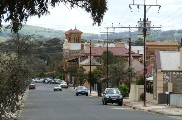
Christchurch Street in Kapunda
Christchurch Street in Light Regional Council is a residential street. It runs in a northeast-southwest direction and crosses Jordan Street and Thiele Highway and ends at Branson Crescent, while the other end is a cul-de-sac.
- Road Type
- residential street
- Route
- northeast-southwest
Image
Attraction
Tourist information offices
Chalet
Cafés
Fast food restaurants
Library
Artwork
Clothing shops
Greengrocers
Pharmacy
Wine shops
Pubs
Roads nearby
Jordan Street100 m
Light Street150 m
Amelia Street150 m
Crane Street150 m
Clifford Street250 m
Thiele HighwayAlma Vale, Map the Miner
250 m
Rowett Street250 m
McCormack Street350 m
Stirling Street350 m
Branson Crescent350 m
Oldham Street400 m
Middlesex Street400 m
Strickland Street450 m
Blackwell Street450 m
Elizabeth Street450 m
Jeffs Street450 m
South Terrace450 m
Maxwell Street450 m
John Street450 m
Rees Crescent500 m
White Street500 m
Crase StreetKapunda Ghost Tours
500 m
Havelock Street500 m
Main StreetOne White Kite, Kapunda, TerryWhite Chemmart, Coopers Fresh, 2b Nourished, Winston's, Bliss, Bullrush, Sir John Franklin, Light Country Visitor Information Centre
550 m
Hogan Street550 m
Whittaker Street550 m
Kapunda Street550 m
Carey Street550 m
Mary Street550 m
Bagot Street550 m
High Street550 m
Smedley Street550 m
Cameron Street600 m
Chapel Street600 m
Mugg Street600 m
Antique shops nearby
Sally's Treasure Hunt500 m
Bakeries nearby
Litl Mo's Bakery & Cafe500 m
Buildings nearby
Dito Plus Pty Ltd550 m
Professionals Kapunda550 m
Community centres nearby
Kapunda Country Women's Association550 m
Curtain shops nearby
Defined Interiors550 m
Farm supplies shops nearby
AG Warehouse550 m
Fire stations nearby
Kapunda Metropolitan Fire Service550 m
Hairdresser's nearby
Modern Image Hair & Beauty550 m
Houseware shops nearby
Koko Home550 m
Places of worship nearby
Christ Church Anglican Church400 m
Pubs nearby
Prince of Wales550 m
North Kapunda Hotel600 m
Restaurants nearby
Kapunda Pizza Bar550 m
Public transport map Kapunda Legend
| Railway | |
| Bus | |
| Tram |
Cycling map Kapunda Legend
| Cycle path | |
| Cycle lane on road | |
| Cycling on bus lane | |
| Bicycle street | |
| Cyclists allowed | |
| Cyclists allowed, good surface | |
| No cycling | |
| Cobblestones |
| Long-distance cycle route | (depending on scale) | |
| Long-distance cycle route |
Walking map Kapunda Legend
| Path |
| Long-distance hiking trail | (depending on scale) | |
| Long-distance hiking trail | ||
| No pedestrians |