
Paquette Drive in Fort McMurray, Alberta
Paquette Drive in Fort McMurray is an asphalted tertiary road. It runs in a north-south direction starting from Loutit Road and crosses Confederation Way, Powder Drive, Parsons Creek Drive, Plamondon Drive, Pebble Lane, Red Lily Gate, Pearl Bay and Rainbow Creek Drive and ends at Millennium Drive.
- Road Type
- tertiary road
- Route
- north-south
Image
Off-licences
Restaurants
Bank
Tourist information offices
Beauty salons
Fast food restaurants
Supermarkets
School
Clinic
Benches
Cafés
Convenience stores
Petrol stations
Tobacconist's
Places of worship
Roads nearby
Confederation WayReal Canadian Liquor Store, Jomaa's Pizza, Liquor Depot
200 m
Paish Place250 m
Pickles Crescent300 m
Laffont Bay350 m
Powder Drive400 m
Pickles Bay400 m
Plamondon Drive400 m
Leitner Gate400 m
Loutit RoadSpring moon
400 m
Potts Bay450 m
Laffont Way450 m
Lightbown Way500 m
Lightbown Bay500 m
Parry Crescent500 m
Philpott Bay500 m
Laffont Place550 m
Plamondon Way600 m
Peterson Lane600 m
Sandpiper Road600 m
Lazarde Place600 m
Lanauze Street650 m
Laboucane Bay650 m
Laboucane Crescent700 m
Berens Place700 m
Parsons Creek Drive700 m
Eagle Ridge Gate700 m
Paulson Street700 m
Lawrence Street750 m
Pike Bay750 m
Lacombe Street750 m
Prospect Drive750 m
Lougheed Drive750 m
Pew Lane750 m
Warbler Avenue800 m
Paulin Bay800 m
Starling Street800 m
Swallow Way800 m
Lougheed Bay850 m
Lavallee Bay850 m
Thrush Street900 m
Apartment buildings nearby
Eagle Ridge, The Peaks Building A650 m
Banks nearby
CIBC850 m
Fire stations nearby
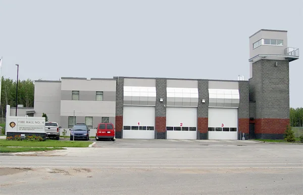
Fire Hall #4100 m
Petrol stations nearby
Independent400 m
Esso700 m
Petro-Canada750 m
Police stations nearby
RCMP Station150 m
Retail buildings nearby
Eagle ridge strip mall750 m
Save on Foods800 m
 Public transport map Fort McMurray Legend
| Railway | |
| Bus | |
| Tram |
 Cycling map Fort McMurray Legend
| Cycle path | |
| Cycle lane on road | |
| Cycling on bus lane | |
| Bicycle street | |
| Cyclists allowed | |
| Cyclists allowed, good surface | |
| No cycling | |
| Cobblestones |
| Long-distance cycle route | (depending on scale) | |
| Long-distance cycle route |
 Walking map Fort McMurray Legend
| Path |
| Long-distance hiking trail | (depending on scale) | |
| Long-distance hiking trail | ||
| No pedestrians |