
Pickles Crescent in Fort McMurray, Alberta
Pickles Crescent in Fort McMurray is a two-lane residential street.
- Road Type
- residential street
- Lanes
- 2
Image
Restaurants
Convenience stores
Clinic
Tourist information
Places of worship
Café
Off-licences
Petrol station
Tobacconist's
Benches
Fast food restaurants
Supermarkets
School
Bank
Beauty salons
Roads nearby
Pickles Bay50 m
Potts Bay200 m
Philpott Bay200 m
Paish Place200 m
Plamondon Drive250 m
Peterson Lane350 m
Paquette Drive400 m
Prospect Drive450 m
Eagle Ridge Gate450 m
Paulson Street450 m
Loutit RoadSpring moon
450 m
Sandpiper Road500 m
Parry Crescent500 m
Confederation WayReal Canadian Liquor Store, Jomaa's Pizza, Liquor Depot
550 m
Leitner Gate600 m
Plamondon Way600 m
Paulin Bay600 m
Thrush Street600 m
Pew Lane600 m
Warbler Avenue650 m
Swallow Way650 m
Starling Street650 m
Laffont Bay700 m
Powder Drive700 m
Laffont Way700 m
Lanauze Street700 m
Lawrence Street750 m
Lightbown Way750 m
Lightbown Bay750 m
Pike Bay800 m
Laffont Place800 m
Lavallee Bay850 m
Lougheed Drive850 m
Laboucane Bay850 m
Laboucane Crescent850 m
Lacombe Street900 m
Lougheed Bay900 m
Lazarde Place900 m
Berens Place900 m
Parsons Creek Drive1000 m
Apartment buildings nearby
Eagle Ridge, The Peaks Building A400 m
Banks nearby
CIBC500 m
Fire stations nearby
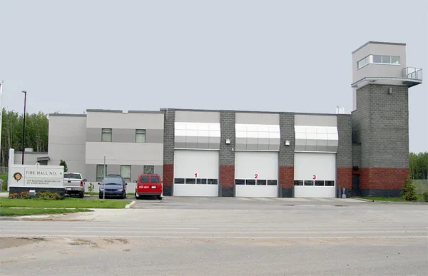
Fire Hall #4450 m
Petrol stations nearby
Petro-Canada400 m
Independent750 m
Esso1,0 km
Police stations nearby
RCMP Station450 m
Retail buildings nearby
Save on Foods450 m
Eagle ridge strip mall550 m
 Public transport map Fort McMurray Legend
 | Railway | |
| Bus | |
| Tram |
 Cycling map Fort McMurray Legend
 | Cycle path | |
| Cycle lane on road | |
| Cycling on bus lane | |
| Bicycle street | |
| Cyclists allowed | |
| Cyclists allowed, good surface | |
| No cycling | |
| Cobblestones |
| Long-distance cycle route | (depending on scale) | |
| Long-distance cycle route |
 Walking map Fort McMurray Legend
 | Path |
| Long-distance hiking trail | (depending on scale) | |
| Long-distance hiking trail | ||
| No pedestrians |