
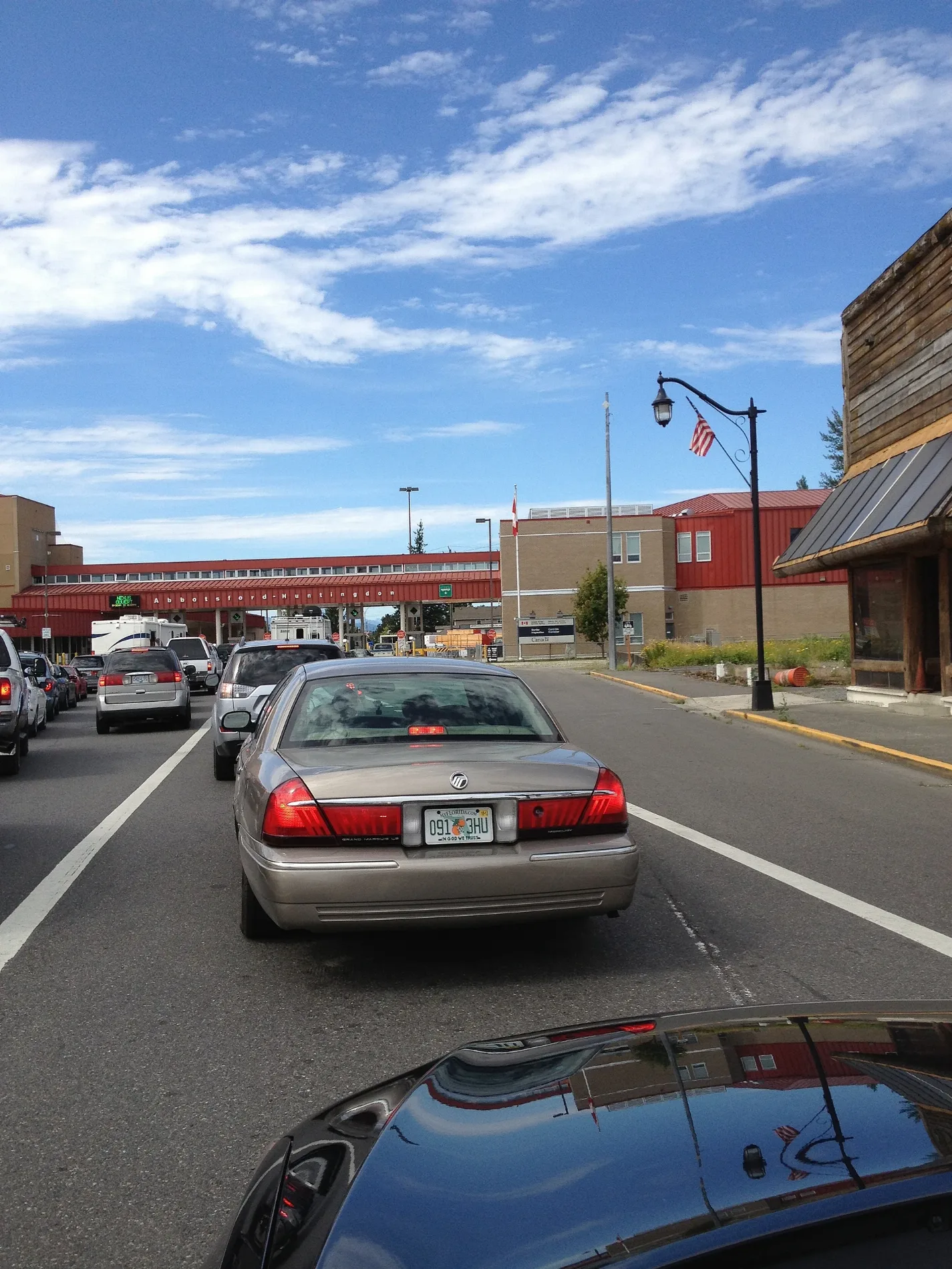
Sumas Way in Abbotsford, British Columbia
Sumas Way in Abbotsford is an asphalted expressway (50 km/h). The road has cycle paths in some sections. It runs in a north-south direction and crosses Lonzo Road, DeLair Road, Marshall Road, South Fraser Way, Abbotsford-Mission Highway, 2nd Avenue, NEXUS ONLY, 1st Avenue, Gladys Avenue, McClary Avenue, South Parallel Road and Barron's Way. It ends in a cul-de-sac and connects Abbotsford, Abbotsford Centre and McMillan. This road is part of the long-distance road "11" and the bicycle route "BC Highway 11 (Abbotsford-Mission)". In the vicinity, you can find among other things 2 cafés, an artwork, an attraction and a charging station. The nearest stops are Sumas at Vye (SB) and Sumas 1250 Block (SB). The bus line 3 stops here.
- Bicycle
- yes
- Cycle Path
- no
- Road Type
- expressway
- Speed Limit
- 50
- Route
- north-south
Image
Charging stations
Pet shops
Bus stops
- bus lines 3
Artwork
Opticians
Cafés
Attraction
Fast food restaurants
Roads nearby
2nd Avenue2nd Ave at Sumas (WB), Abbotsford
100 m
NEXUS ONLYPort of Entry - Sumas
150 m
Railway Avenue200 m
B StreetB St and 6th Ave, B at 4th Lane (SB)
200 m
Harrison AvenuePort of Entry - Sumas, Sumas Truck Border Crossing
250 m
Harrison Street250 m
Sumas AvenueSumas Ave at Columbia St
300 m
Fisk Street300 m
West Cleveland Street300 m
Cleveland Street300 m
3rd AvenueTransformations Hair Design, Gallery 7 Theatre, Schaffer
400 m
Barker Avenue400 m
Cherry StreetBob's Burgers & Brew, Sumas Mountain Lodge, Cherry St at Vancouver St, Cherry St at 1st St, Pic It Up
400 m
West Garfield Street400 m
Garfield StreetSumas
450 m
Victoria Court450 m
5th Avenue450 m
Railroad Street500 m
D Street500 m
Riverside RoadCrop Production Services Evergro Division, Ryder
500 m
6th Avenue550 m
Johnson Street550 m
Washington Avenue550 m
Walnut Avenue600 m
Arthur's Way650 m
4th AvenueHuntingdon
650 m
Shops nearby
F1rst Truck Centre500 m
Buildings nearby
Canada Border Services Agency150 m
US Customs200 m
Car dealerships nearby
Golden Gate Auto Sales Ltd.200 m
CAT Restorations200 m
Convenience stores nearby
Speedway Express250 m
Industrial buildings nearby
RMS Industrial Maintenance Ltd350 m
Motel nearby
B & B Border Inn350 m
Office buildings nearby
Pacific Customs Brokers Ltd50 m
Pacific Customs Brokers Ltd.50 m
Petrol stations nearby
Speedway250 m
Places of worship nearby
Solid Rock Church650 m
Post offices nearby
Package Express400 m
Railway lines nearby
Southern Railway of British Columbia50 m
Burlington Northern Santa Fe R150 m
CPKC200 m
BNSF250 m
BNSF Sumas Subdivision250 m
Retail buildings nearby
Abbotsford Duty Free100 m
Roof structures nearby
Secondary Inspection100 m
Primary Inspection100 m
Shopping malls nearby
Huntingdon Station250 m
Specialist shops nearby
Handlers Equipment Ltd.550 m
 Public transport map Abbotsford Legend
| Railway | |
| Bus | |
| Tram |
 Cycling map Abbotsford Legend
| Cycle path | |
| Cycle lane on road | |
| Cycling on bus lane | |
| Bicycle street | |
| Cyclists allowed | |
| Cyclists allowed, good surface | |
| No cycling | |
| Cobblestones |
| Long-distance cycle route | (depending on scale) | |
| Long-distance cycle route |
 Walking map Abbotsford Legend
| Path |
| Long-distance hiking trail | (depending on scale) | |
| Long-distance hiking trail | ||
| No pedestrians |