Durham Region

This page is the City map of Durham Region, showing the roads, paths and places of the Regional Municipality of Durham in Ontario, Canada. Located east of Toronto in the Golden Horseshoe, the region covers approximately 2,523.8 square kilometres and lies at about 91 metres above sea level. About 645,862 people lived in Durham Region in 2016, which is divided into 8 municipalities. Durham Region was founded in 1792 and extends along the eastern part of the Greater Toronto Area, including communities on the north shore of Lake Ontario.

City map Durham Region
Peter Balcerzak, CC BY-SA 3.0 – Wikimedia Commons
City map Oshawa
P199, CC BY-SA 3.0 – Wikimedia Commons

Oshawa

Oshawa is a city in Durham Region with a population of 175,383 and an area of approximately 145.68 square kilometres. The city stands at about 106 metres above sea level on the northern shore of Lake Ontario, east of Toronto.

Oshawa became a city in the industrial and transport corridor of southern Ontario, with its municipal history recorded from 1850. The Canadian Automotive Museum in downtown Oshawa documents the city’s long connection with automobile manufacturing in Ontario.

City map Pickering
Cookmc, CC BY-SA 3.0 – Wikimedia Commons

Pickering

Pickering is a city in Durham Region with 91,771 residents and an area of approximately 231.59 square kilometres. Its elevation is listed at about 217 metres, and the city extends from Lake Ontario north toward the Oak Ridges Moraine.

Pickering was established as a municipality in 1811 and lies directly east of Toronto. The Pickering Nuclear Generating Station is located on the Lake Ontario waterfront and is one of the most recognisable industrial sites in the region.

City map Ajax
The Town of Ajax, CC BY 3.0 – Wikimedia Commons

Ajax

Ajax is a town in Durham Region with a population of 126,666 and an area of approximately 67 square kilometres. It occupies the Lake Ontario shoreline east of Pickering and west of Whitby, with a recorded elevation of about 90 metres.

The town was named Ajax after the Royal Navy cruiser HMS Ajax and developed rapidly during the Second World War around wartime manufacturing. Ajax is connected to the Greater Toronto Area by Highway 401 and the Lakeshore East rail corridor.

City map Whitby
Dillan Payne, CC BY-SA 4.0 – Wikimedia Commons

Whitby

Whitby is a town in Durham Region with 138,501 residents and an area of approximately 146.69 square kilometres. The municipality stands at about 91 metres above sea level and includes a Lake Ontario waterfront east of Ajax and west of Oshawa.

Whitby’s municipal history dates from 1855, and the town is the administrative centre of Durham Region. Whitby Harbour and the historic downtown are located near the southern end of the community, while northern Whitby reaches toward the Oak Ridges Moraine.

City map Clarington
Dillan Payne, CC BY-SA 4.0 – Wikimedia Commons

Clarington

Clarington is a municipality in Durham Region with a population of 92,013 and an area of approximately 611.3 square kilometres. It extends from Lake Ontario north into rural landscapes around communities such as Bowmanville, Courtice, Newcastle and Orono.

The present municipality was formed in 1974, and its elevation is listed at about 106 metres. Clarington contains the Darlington Nuclear Generating Station on the Lake Ontario shore and Darlington Provincial Park near Courtice.

City map Scugog
P199, CC BY-SA 3.0 – Wikimedia Commons

Scugog

Scugog is a township in Durham Region with 21,617 residents and an area of approximately 474.71 square kilometres. Its territory surrounds much of Lake Scugog, a large inland lake connected with the Scugog River and the Kawartha Lakes waterway system.

The township was formed in 1974, and Port Perry is its principal community on the eastern shore of Lake Scugog. The lake and the surrounding agricultural land distinguish Scugog from the more urbanised municipalities along Lake Ontario.

City map Brock
Dillan Payne, CC BY-SA 4.0 – Wikimedia Commons

Brock

Brock is a township municipality in Durham Region with 11,642 residents and an area of approximately 423.73 square kilometres. It occupies the northern and northeastern part of Durham Region, bordering Lake Simcoe and extending across rural Ontario landscapes.

The present township municipality dates from 1974, and its communities include Beaverton, Cannington and Sunderland. The Beaver River flows through the area toward Lake Simcoe, providing a direct geographic connection between Brock’s inland settlements and the lake.

City map Uxbridge
P199, CC BY-SA 3.0 – Wikimedia Commons

Uxbridge

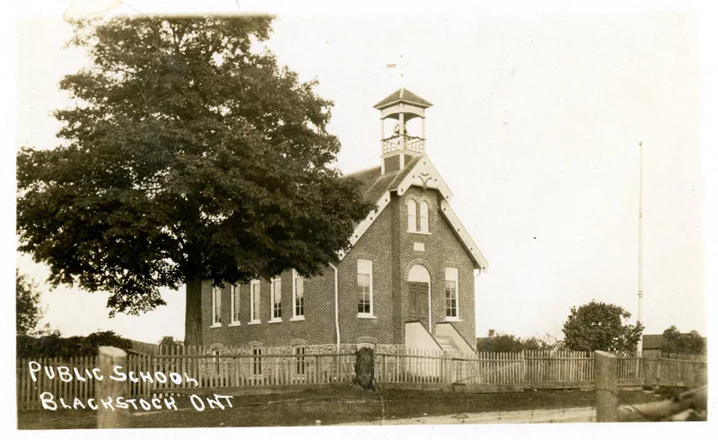
Uxbridge is a township municipality in Durham Region established in 1850. It has an area extending across the northern part of the region, and its recorded elevation is about 273 metres, higher than the Lake Ontario municipalities to the south.

The township includes the town of Uxbridge and rural communities near the Oak Ridges Moraine. Uxbridge lies beside the protected natural landscapes of the Oak Ridges Moraine and connects Durham Region with the agricultural and forested areas north of Toronto.

Data sources: OpenStreetMap (ODbL), Wikidata (CC0) · Image: Wikimedia Commons

Durham Region – Facts

Inhabitants 645862
Area 2523.8 km²
Subregions 8
Inception 1792
Elevation 91.3 m
Located in Ontario
Country Canada
Part of Greater Toronto Area
Website https://www.durham.ca/en/index.aspx

Data source: Wikidata (CC0)

Important and frequently searched streets
Longspur Trail Worfolk Place Clayton Road Bobbin Gate