
Balfour Place in Marlow, Buckinghamshire
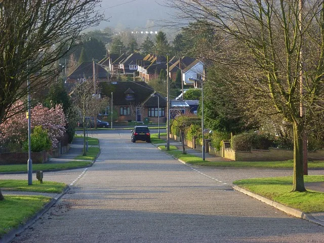
Balfour Place in Buckinghamshire, Marlow is a residential street. It runs in a southeast-northwest direction and ends at Sunnybank, while the other end is a cul-de-sac.
- Road Type
- residential street
- Route
- southeast-northwest
Image
Post offices
Convenience stores
Fast food restaurants
Tyre shops
Guest house
Furniture shops
Car repair shops
Tourist information offices
Dentist
Funeral directors
Restaurants
Kindergarten
Cafés
Bicycle parkings
Veterinary clinic
Jewellers
Roads nearby
Coach Ride100 m
Sunnybank100 m
Pinecroft200 m
Barnhill Close300 m
Barnhill Road300 m
Barnhill Gardens350 m
Berwick Road350 m
Seymour Park Road350 m
Seymour Court Road400 m
Berwick Lane450 m
Sandygate Road450 m
Oak Tree Close450 m
Seymour Plain500 m
Oak Tree RoadLondis
500 m
Sandygate Close500 m
Manor Court550 m
Burford Close600 m
Berwick Close650 m
Dean StreetMerityre, Saddle Safari
700 m
Primrose Lea700 m
Prospect Road750 m
Chiltern Road750 m
Queen's Road800 m
 Public transport map Marlow Legend
| Railway | |
| Bus | |
| Tram |
 Cycling map Marlow Legend
| Cycle path | |
| Cycle lane on road | |
| Cycling on bus lane | |
| Bicycle street | |
| Cyclists allowed | |
| Cyclists allowed, good surface | |
| No cycling | |
| Cobblestones |
| Long-distance cycle route | (depending on scale) | |
| Long-distance cycle route |
 Walking map Marlow Legend
| Path |
| Long-distance hiking trail | (depending on scale) | |
| Long-distance hiking trail | ||
| No pedestrians |