
Longcliffe Road in Grantham
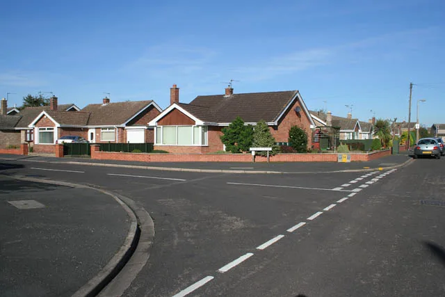
Longcliffe Road in Grantham in South Kesteven is a residential street. It runs in a southeast-northwest direction and crosses Wensleydale Close, Bishopdale Close, Mossdale Close, Hatcliffe Close, Ravendale Close, Kingscliffe Road, Langdale Crescent, Peascliffe Drive, Sandcliffe Road, Dovedale Close, Redcliffe Road and Highcliffe Road. This road is part of the bicycle route "UK:South Kesteven 22". The nearest stops are Highcliffe Road, Langdale Crescent, Redcliffe Road and Dovedale Close. The bus line 1 stops here.
- Road Type
- residential street
- Route
- southeast-northwest
Image
Bus stops
- bus lines 1
Roads nearby
Glaisdale Gardens300 m
Low Road300 m
Highcliffe Road300 m
Dale Road300 m
High RoadManthorpe, Low Road, The Well
350 m
Rosedale Drive350 m
Ryedale Close350 m
Redcliffe Road400 m
Grizedale Close400 m
Mill Close400 m
Belton Grove400 m
Granta Crescent400 m
Eskdale Road450 m
Dovedale Close450 m
Baysdale Grove450 m
Teesdale Road450 m
Borrowdale Way450 m
Princess DriveAlmond Grove
500 m
Acorn Close500 m
Belton Lane500 m
Sandcliffe RoadRushcliffe Road, Darley Dale Crescent
500 m
Darley Dale Crescent550 m
Braemar Close550 m
Green Lane600 m
Belton AvenueElm Grove
600 m
Formby Close600 m
Tyson Close600 m
Cornwall Close600 m
Hawksdale Close600 m
Rushcliffe RoadThe Priory Ruskin Academy
600 m
Langford Gardens650 m
Progress Way650 m
Elsie Davies Close650 m
Cottesmore Close650 m
Manthorpe RoadHospital, Slate Mill Place
700 m
QueenswayAsh Grove, Hamilton Road, Canterbury Close, Melbourne Road, Canberra Crescent
700 m
Harrowby Close700 m
Lime Grove750 m
Elm Grove750 m
The Orchards800 m
Harrowby LaneNew Beacon Road, Beacon Fish Bar, Methodist Church, Byron Avenue, Tennyson Avenue
850 m
Convenience stores nearby
Manthorpe Convenience Store450 m
Industrial areas nearby
Belton Lane Industrial Estate650 m
Kindergartens nearby
Manthorpe Hall and Preschool Playgroup350 m
Places of worship nearby
St. John the Evangelist500 m
Grantham Christian Fellowship Community Church600 m
Rivers nearby
River Witham500 m
Social facilities nearby
Harrowby Lodge Nursing Home850 m
Other nearby
Nursery Factories / Grantham650 m
Public transport map Grantham Legend
| Railway | |
| Bus | |
| Tram |
Cycling map Grantham Legend
| Cycle path | |
| Cycle lane on road | |
| Cycling on bus lane | |
| Bicycle street | |
| Cyclists allowed | |
| Cyclists allowed, good surface | |
| No cycling | |
| Cobblestones |
| Long-distance cycle route | (depending on scale) | |
| Long-distance cycle route |
Walking map Grantham Legend
| Path |
| Long-distance hiking trail | (depending on scale) | |
| Long-distance hiking trail | ||
| No pedestrians |