
Chipstead Road in London Borough of Bexley
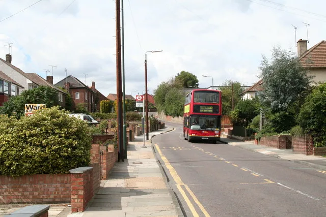
Chipstead Road in London Borough of Bexley is a residential street.
- Road Type
- residential street
- Speed Limit
- 20 mph
Image
Bus stops
Roads nearby
Callender Road100 m
Brasted Road100 m
Halstead Road100 m
Myrtle Close200 m
Badlow Close200 m
Elmstead Road200 m
FP218250 m
Highstead Crescent250 m
Colyers LaneMyrtle Close, Colyers Walk, Northumberland Way, Barnehurst Avenue, Hurst Road
250 m
Brendon Close250 m
Twigg Close250 m
Waterhead Close300 m
Doyle Close300 m
Drummond Close300 m
Largo Walk300 m
Dell View Road300 m
Selkirk Drive300 m
Larner Road300 m
Defoe Close300 m
Hurstwood Avenue350 m
Furners Close350 m
Northend RoadPeareswood Road, Eversley Avenue, Mr Chippy, Northend Mini Market, Daysol Pharmacy, Parkside Restaurant & Cafe, Kebab Side, Northend Road / Colyers Lane, Bridge Road
400 m
Boundary Street400 m
Maple Court400 m
The Nursery400 m
Thanet Road400 m
Fairview450 m
Guild Road450 m
Peareswood Road500 m
South RoadLarner Road
500 m
Page Crescent550 m
The Cinder Path550 m
Queens Road550 m
Festival Close600 m
Shermanbury Close600 m
Maynard Close650 m
Hamilton Walk650 m
Sayers Way650 m
Betsham Road650 m
Compton Place650 m
Britannia Close650 m
Collins Way700 m
Reddy Road700 m
Allotment gardens nearby
Bexley Allotments - Lesney Farm300 m
Apartment buildings nearby
Orchard House350 m
Convenience stores nearby
Tesco Express350 m
Fitness centres nearby
Erith Leisure Centre500 m
Places of worship nearby
Northend Baptist Church300 m
Railway lines nearby
North Kent Line - Woolwich Branch500 m
 Public transport map London Borough of Bexley Legend
 | Railway | |
| Bus | |
| Tram |
 Cycling map London Borough of Bexley Legend
 | Cycle path | |
| Cycle lane on road | |
| Cycling on bus lane | |
| Bicycle street | |
| Cyclists allowed | |
| Cyclists allowed, good surface | |
| No cycling | |
| Cobblestones |
| Long-distance cycle route | (depending on scale) | |
| Long-distance cycle route |
 Walking map London Borough of Bexley Legend
 | Path |
| Long-distance hiking trail | (depending on scale) | |
| Long-distance hiking trail | ||
| No pedestrians |