
Northend Road in London Borough of Bexley
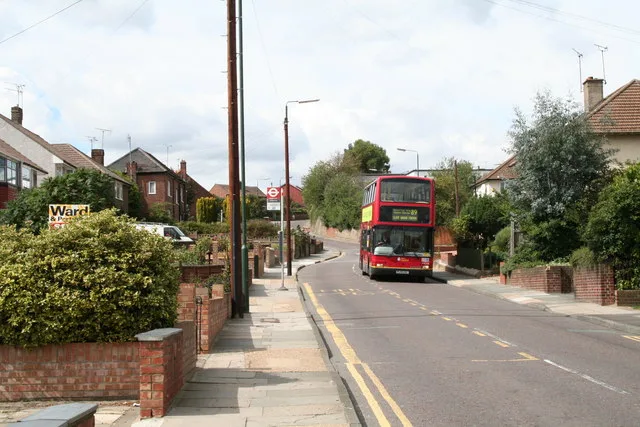
Northend Road in London Borough of Bexley is a two-lane, asphalted, lit main road. It runs in a north-south direction and crosses Dell View Road, Boundary Street, South Road, Thames Road, Bridge Road, Peareswood Road, Colyers Lane, Wessex Drive and Eversley Avenue. This road is part of the bicycle route "GB:London Cycle Network" and the long-distance road "A206". In the vicinity, you can find among other things 2 restaurants, a convenience store, a pharmacy and a fast food restaurant. The nearest stops are Peareswood Road, Eversley Avenue and Bridge Road. The bus lines 89, 428 and N89 serve this stop. Northend Road also exists in Greater Manchester.
- Road Type
- main road
- Lanes
- 2
- Speed Limit
- 40 mph
- Route
- north-south
Image
Pharmacy
Bus stops
- bus lines 89, 428, N89
Roads nearby
Maple Court150 m
The Nursery200 m
Myrtle Close200 m
Peareswood Road250 m
Callender Road250 m
Defoe Close250 m
Selkirk Drive250 m
Largo Walk250 m
Drummond Close250 m
Waterhead Close250 m
Chipstead Road250 m
Boundary Street300 m
Doyle Close300 m
Page Crescent300 m
Fairview350 m
Furners Close350 m
Guild Road350 m
Dell View Road350 m
Brasted Road350 m
Halstead Road350 m
Brendon Close350 m
The Cinder Path400 m
Badlow Close400 m
Hurstwood Avenue400 m
Larner Road450 m
South RoadLarner Road
450 m
Elmstead Road450 m
FP218450 m
Festival Close450 m
Sayers Way450 m
Colyers LaneMyrtle Close, Colyers Walk, Northumberland Way, Barnehurst Avenue, Hurst Road
450 m
Thanet Road450 m
Collins Way450 m
Twigg Close500 m
Highstead Crescent500 m
Hamilton Walk500 m
Shermanbury Close500 m
Betsham Road550 m
Queens Road550 m
Maynard Close550 m
Reddy Road600 m
Britannia Close650 m
Compton Place650 m
Allotment gardens nearby
Bexley Allotments - Lesney Farm550 m
Apartment buildings nearby
Orchard House150 m
Convenience stores nearby
Tesco Express250 m
Fitness centres nearby
Erith Leisure Centre550 m
Places of worship nearby
Northend Baptist Church400 m
Railway lines nearby
North Kent Line - Woolwich Branch400 m
Public transport map London Borough of Bexley Legend
| Railway | |
| Bus | |
| Tram |
Cycling map London Borough of Bexley Legend
| Cycle path | |
| Cycle lane on road | |
| Cycling on bus lane | |
| Bicycle street | |
| Cyclists allowed | |
| Cyclists allowed, good surface | |
| No cycling | |
| Cobblestones |
| Long-distance cycle route | (depending on scale) | |
| Long-distance cycle route |
Walking map London Borough of Bexley Legend
| Path |
| Long-distance hiking trail | (depending on scale) | |
| Long-distance hiking trail | ||
| No pedestrians |