
Exeter Road in London Borough of Barking and Dagenham
Exeter Road in London Borough of Barking and Dagenham is a minor road. It runs in a north-south direction starting from Blackborne Road and crosses Plumtree Close and Salisbury Road and ends at Church Street. Exeter Road also exists in London Borough of Barnet, London Borough of Enfield, London Borough of Bexley, London Borough of Croydon and London Borough of Waltham Forest.
- Road Type
- minor road
- Route
- north-south
Image
Post offices
Stations
Bus stops
Roads nearby
Salisbury Road100 m
Honey Close100 m
Plumtree Close100 m
Buttfield Close150 m
Rodwll Place150 m
Dewey RoadHigh Road Post Office
200 m
Crown Street200 m
Glebe Road200 m
Church Lane250 m
Lewis Way250 m
St Giles Avenue250 m
St Giles Close250 m
Richardson Gardens250 m
Church Street250 m
Charlotte Road250 m
Royal Parade250 m
Coopers Close250 m
Blackborne Road300 m
Radleys Mead300 m
John Parker Close300 m
Pavet Close350 m
Wilthorne Gardens350 m
Siviter WaySt Giles Avenue
400 m
Brook Avenue400 m
Hollidge Way400 m
Amenities nearby
Dagenham Conservative Club100 m
Leisure nearby
Dagenham Trades Hall200 m
Bookmakers nearby
William Claridge Ltd250 m
Buildings nearby
Dagenham Parish Hall100 m
Oldmead House150 m
Thaxted House400 m
Bartletts House400 m
Cafés nearby
Pietro's Cafe350 m
Clinics nearby
Church Elm Lane Health Centre300 m
Commercial areas nearby
Petronne House200 m
Essex Hand Car Wash350 m
Convenience stores nearby
Krishna's Village Stores150 m
Dagenham Food Centre300 m
Fast food restaurants nearby
Gah Moon House200 m
Chunky250 m
Golden Dragon250 m
Pizza GoGo300 m
Orient350 m
Hospital nearby
Grays Court Community Hospital250 m
Places of worship nearby
Dagenham Community Church200 m
Pubs nearby
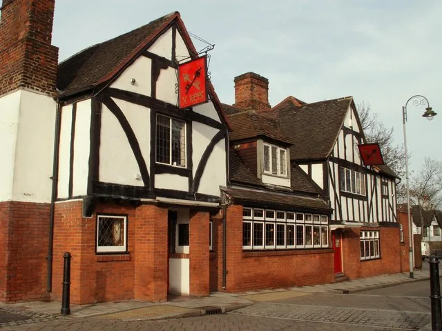
The Cross Keys150 m
Sports centres nearby
Pavillion450 m
Tracks nearby
BMX Track450 m
Village greens nearby
Dagenham Village Green150 m
Public transport map London Borough of Barking and Dagenham Legend
| Railway | |
| Bus | |
| Tram |
Cycling map London Borough of Barking and Dagenham Legend
| Cycle path | |
| Cycle lane on road | |
| Cycling on bus lane | |
| Bicycle street | |
| Cyclists allowed | |
| Cyclists allowed, good surface | |
| No cycling | |
| Cobblestones |
| Long-distance cycle route | (depending on scale) | |
| Long-distance cycle route |
Walking map London Borough of Barking and Dagenham Legend
| Path |
| Long-distance hiking trail | (depending on scale) | |
| Long-distance hiking trail | ||
| No pedestrians |