
Colyers Walk, FP219 in London Borough of Bexley
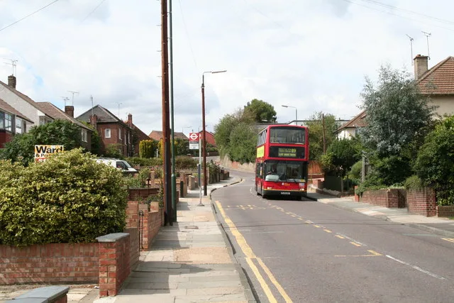
Colyers Walk, FP219 in London Borough of Bexley is an asphalted footpath (trail number 219). The road has a width of 4 m. It runs in a north-south direction starting from Highstead Crescent and crosses Birling Road and ends at Colyers Lane.
- Bicycle
- permissive
- Road Type
- footpath
- Route
- north-south
Image
Bus stops
Roads nearby
Birling Road50 m
Highstead Crescent100 m
Elmstead Road100 m
FP218100 m
Hemsted Road150 m
Colyers LaneMyrtle Close, Colyers Walk, Northumberland Way, Barnehurst Avenue, Hurst Road
150 m
Halstead Road150 m
Brasted Road200 m
Stuart Mantle Way200 m
Swallow Close250 m
Stuart Mantle Rise250 m
Stelling Road250 m
Chipstead Road250 m
Twigg Close250 m
Normandy Way250 m
Brendon Close300 m
FP217300 m
Detling Road300 m
Badlow Close300 m
Valence Road300 m
Mendip Road350 m
Callender Road350 m
Myrtle Close350 m
Hurstwood Avenue400 m
Frinsted Road400 m
Doyle Close400 m
Larner Road450 m
Colyers Close450 m
Edendale Road450 m
Peartree Close450 m
Beechfield Road450 m
Broadoak Road450 m
Northumberland Way450 m
Heathway450 m
Dell View Road500 m
Ramsden Road500 m
Heath Way500 m
Coniston Close500 m
Avenue RoadHail & Ride Lesney Park, Hail & Ride Avenue Road, Pickford Road, King Henry School, Glynde Road, Avenue Road / Crook Log
550 m
Thanet Road550 m
Lesney Park550 m
Clydon Close650 m
Grovebury Close650 m
Elm Grove650 m
Buxton Road650 m
Lesney Park Road700 m
Allotment gardens nearby
Bexley Allotments - Lesney Farm300 m
Fitness centres nearby
Erith Leisure Centre600 m
Places of worship nearby
Northend Baptist Church450 m
Public transport map London Borough of Bexley Legend
| Railway | |
| Bus | |
| Tram |
Cycling map London Borough of Bexley Legend
| Cycle path | |
| Cycle lane on road | |
| Cycling on bus lane | |
| Bicycle street | |
| Cyclists allowed | |
| Cyclists allowed, good surface | |
| No cycling | |
| Cobblestones |
| Long-distance cycle route | (depending on scale) | |
| Long-distance cycle route |
Walking map London Borough of Bexley Legend
| Path |
| Long-distance hiking trail | (depending on scale) | |
| Long-distance hiking trail | ||
| No pedestrians |