
Crabtree Manorway South in London Borough of Bexley
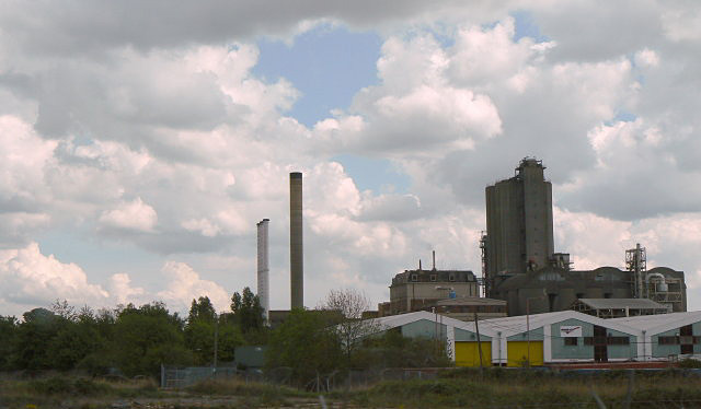
Crabtree Manorway South in London Borough of Bexley is a minor road and it runs in a north-south direction and crosses Capital Industrial Estate and Keats Road. This road is part of 1 bicycle route.
- Road Type
- minor road
- Route
- north-south
Image
Platforms
Cafés
Bus stops
Roads nearby
Capital Industrial Estate150 m
Keats Road300 m
St Thomas Road300 m
Cables Close300 m
Station Road NorthBelvedere
350 m
Caldy Road350 m
Bronze Age WayErith
350 m
Poppy Close350 m
Mulberry WayMulberry Way
350 m
Jenning Tree Way350 m
Baltimore Close400 m
Little Brights Road400 m
Culling RoadGuru Nanak Durbar Sikh Temple
400 m
Picardy ManorwayEastern Way / Norman Road, Picardy Manorway / Eastern Way, Picardy Manorway / Belvedere Station, Asda Café
400 m
Mitchell Close400 m
Anderson WayAnderson Way
400 m
North Road450 m
Lower RoadHalfway House, Halt Robin Lane, Mayfield Road, Poplar Mount, Lower Road Post Office, Lower Road / Church Manorway, Lower Road / Belvedere Station, Belvedere Station
450 m
Viking Way450 m
Beltwood Road450 m
Bullbanks Road500 m
Mayfield Road500 m
Crabtree Manorway NorthMillennium Milepost Belvedere
550 m
Methuen Road550 m
Poplar Mount550 m
Clydesdale WayLidl
550 m
Halt Robin Lane550 m
Waterfield Close600 m
Sutherland Road650 m
Yarnton WayYarnton Way / Harrow Manorway, Lakeside Medical Practice, Hartslock Drive, Harris Garrard Academy, Yarnton Way / Norman Road, Hailey Road, Thames Innovation Centre, Northwood Place, Limestone Walk, Centurion Way, Welcome
650 m
Station RoadBelvedere, Bexleyheath, Royston Road, Station Road / Chastilian Road, Crescent Road, Station Road / Crescent Road, Papa John's, Tution Centre, Gel's barber Shop, New Star, Chicken Pizza Hot Service, Varsani Wine & Food, Station Road Pharmecy, Automatica, Old Farm Avenue, Domino's, Express Inn Dry Cleaners, Station Road Post Office, Gingers, Metropolitan Police Museum, Crayford Station, Lamorbey, Sidcup Station / Station Road, Sidcup Station, Invicta Model Rail, Melk Coffee, M&S Simply Food
650 m
Railway Place650 m
Eastern WayGreen Chain Walk Resting Place
700 m
Norman Road800 m
DIY stores nearby
B&Q600 m
Cafés nearby
Starbucks550 m
Commercial buildings nearby
ASDA750 m
Hotels nearby
Travelodge London Belvedere550 m
Industrial areas nearby
OYO Business Units200 m
Industrial buildings nearby
Concorde Metals400 m
HTC Belvedere750 m
Nature reserves nearby
Crossness Nature Reserve700 m
Pubs nearby
The Morgan600 m
Railway lines nearby
North Kent Line - Woolwich Branch350 m
Railway stations nearby
Belvedere Railway Station650 m
Schools nearby
Belvedere Infant School400 m
Belvedere Junior School450 m
Warehouses nearby
Ocado Customer Fulfillment Centre350 m
Tuffnells Parcels Express700 m
Public transport map London Borough of Bexley Legend
| Railway | |
| Bus | |
| Tram |
Cycling map London Borough of Bexley Legend
| Cycle path | |
| Cycle lane on road | |
| Cycling on bus lane | |
| Bicycle street | |
| Cyclists allowed | |
| Cyclists allowed, good surface | |
| No cycling | |
| Cobblestones |
| Long-distance cycle route | (depending on scale) | |
| Long-distance cycle route |
Walking map London Borough of Bexley Legend
| Path |
| Long-distance hiking trail | (depending on scale) | |
| Long-distance hiking trail | ||
| No pedestrians |