
Mulberry Parade in London Borough of Hillingdon
Mulberry Parade in London Borough of Hillingdon is a lit tertiary road. It runs in a northeast-southwest direction and crosses Mulberry Crescent, Mullberry Crescent and Porters Way. In the vicinity, there is among other things a pharmacy. The bus line U5 stops here.
- Road Type
- tertiary road
- Speed Limit
- 30 mph
- Route
- northeast-southwest
Image
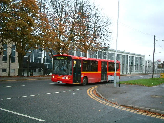
Roads nearby
Almond Avenue100 m
Mullberry CrescentMulberry Parade
100 m
Spring PromenadeSainsbury's Local
150 m
South Close150 m
South Road250 m
Four Seasons Terrace250 m
Mulberry Crescent250 m
Oak Avenue250 m
West Road250 m
Lavender RiseLavender Rise / Stockley Road
250 m
Hazel Avenue300 m
Walnut Avenue300 m
Smaldon Close300 m
Thornton Close300 m
Briar WayStockley
300 m
Evergreen Drive350 m
Firtree AvenueBell Farm Church
350 m
Jasmine Terrace350 m
Rutters Close350 m
Kebony Close400 m
Autumn Way400 m
Eastwood Road450 m
Summer Drive450 m
Stockley Farm Road450 m
Beech Close450 m
Archie Close500 m
Iron Bridge Road SouthSmart Cells International Ltd
550 m
Bourne AvenueGuinness Close, The Music Box, Conway Drive, Bourne news Box, Strawberry Local, Sun Sun, Skipton Drive
550 m
Emden Close550 m
Iron Bridge Road NorthArtorius
550 m
Old Stockley Road600 m
Stockley Close600 m
Stockley RoadStockley Road
650 m
Body of waters nearby
Stockley Road Lake500 m
Buildings nearby
Stockley Farmhouse450 m
Trout Tool Co. Ltd500 m
Welding Mobility500 m
Automatic Motors Ltd550 m
Canals nearby
Grand Union Canal550 m
Car repair shops nearby
Robbings Motors500 m
Commercial areas nearby
Stockley Farm350 m
Derelict canals nearby
Starveall Dock550 m
Military areas nearby
RAF 1381 Squadron Air Cadets (West Drayton & Yiewsley)450 m
Parks nearby
Four Seasons Green250 m
Spring Green350 m
Railway lines nearby
Great Western Main Line600 m
Recreation grounds nearby
Stockley Recreation Ground100 m
Residential areas nearby
Stockley Est.50 m
Drayton Garden Village100 m
Public transport map London Borough of Hillingdon Legend
| Railway | |
| Bus | |
| Tram |
Cycling map London Borough of Hillingdon Legend
| Cycle path | |
| Cycle lane on road | |
| Cycling on bus lane | |
| Bicycle street | |
| Cyclists allowed | |
| Cyclists allowed, good surface | |
| No cycling | |
| Cobblestones |
| Long-distance cycle route | (depending on scale) | |
| Long-distance cycle route |
Walking map London Borough of Hillingdon Legend
| Path |
| Long-distance hiking trail | (depending on scale) | |
| Long-distance hiking trail | ||
| No pedestrians |