
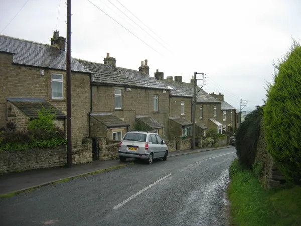
Shield Ash in Stanhope, County Durham
Shield Ash in County Durham, Stanhope is a building. Shield Ash is near Bolihope Cross. Ⓦ.
- Building Type
- building
Image
Cafés
Boat hires
Platforms
Tourist information offices
Hairdressers
Bus stops
Fountains
Fast food restaurants
Hofläden
Guest house
Stations
Attraction
Pubs
Roads nearby
Bolihope CrossMoor House
900 m
Unthank BankUnthank
1,4 km
Stanhope Bridge1,6 km
Park View1,9 km
Waterside CourtNewtown House, Memorial Fountain
1,9 km
Allerton BridgeBurnside Brae Guest House
1,9 km
The ButtsChristine's Hair and Beauty
1,9 km
Cowgarth Hill2,0 km
The Market PlaceMarket Place, Pizza Barn
2,0 km
Crawleyside BankWest Terrace, Crawleyside Bank (Ashers Ho.), Crawleyside, Lane Head
2,0 km
Church LaneThe Bonny Moorhen
2,1 km
Front StreetStanhope, Fondant & Apron Strings, Fossil Tree, Rookhope, Village, Rookhope Newsagent, Durham Dales Centre, Durham Dales Centre Tea Room, Red Lodge, Welcome to Stanhope, Regenerare, Fire Station, The Grey Bull, Front Street-Former Queens Head, Bakers Loaf and Tea Shop, Woodhalls Greengrocers, Castle Bank Butchers, Stanhope Post Office, The Paper Shop, Dales and Moor Kitchens, Stanhope Pharmacy, Sports & Social Club, Ford, The Barber's of Stanhope, Woollyback, Stanhope Travel, Everyday Cafe, Roots of India
2,1 km
Cross StreetStanhope Fish & Chips
2,1 km
Cross Hill2,1 km
Union Street2,1 km
Garden Close2,1 km
Castle GardensAccess Land in the North Pennines, Welcome to the Durham Dales Centre
2,1 km
Chapel Street2,1 km
Art galleries nearby
Alex Clark @ Lime Tree2,0 km
Beauty salons nearby
The Beauty Barn1,8 km
Body of waters nearby
Greenfoot Quarry1,6 km
Buildings nearby
High House550 m
The Bungalow1,2 km
Aller Gill House1,3 km
West Newlandside1,4 km
Stanhope Castle2,0 km
Stanhope Hall Mill2,0 km
(Former) Town Hall2,1 km
North Lodge2,1 km
Stanhope Silver band2,1 km
Caravan site nearby
Stanhope Caravan Park1,9 km
Community centres nearby
Stanhope Community Centre2,1 km
Farmyards nearby
Bushy Flatt Farm1,3 km
Horsley Burn Farm1,4 km
Unthank Mill1,8 km
Funeral directors nearby
Charlotte Fleming Funeral Services2,0 km
Hospital nearby
Weardale Community Hospital1,8 km
Houses nearby
Stanhope Hall2,0 km
Pubs nearby
Pack Horse Inn2,0 km
Quarries nearby
Newlandside Quarry400 m
Sports centres nearby
Weardale Open Air Pool1,9 km
Sports pitches nearby
Stanhope Cricket Club1,8 km
Streams nearby
Moorhouse Sike750 m
Brackenbridge Sike750 m
Cow Burn1,0 km
Horsley Burn1,5 km
Sound Burn1,5 km
Dry Burn1,6 km
Other nearby
Wedging Shield1,9 km
| Located in | Stanhope |
|---|---|
| Country | United Kingdom |
 Public transport map Stanhope Legend
| Railway | |
| Bus | |
| Tram |
 Cycling map Stanhope Legend
| Cycle path | |
| Cycle lane on road | |
| Cycling on bus lane | |
| Bicycle street | |
| Cyclists allowed | |
| Cyclists allowed, good surface | |
| No cycling | |
| Cobblestones |
| Long-distance cycle route | (depending on scale) | |
| Long-distance cycle route |
 Walking map Stanhope Legend
| Path |
| Long-distance hiking trail | (depending on scale) | |
| Long-distance hiking trail | ||
| No pedestrians |