
Uttoxeter Road in Stoke-on-Trent
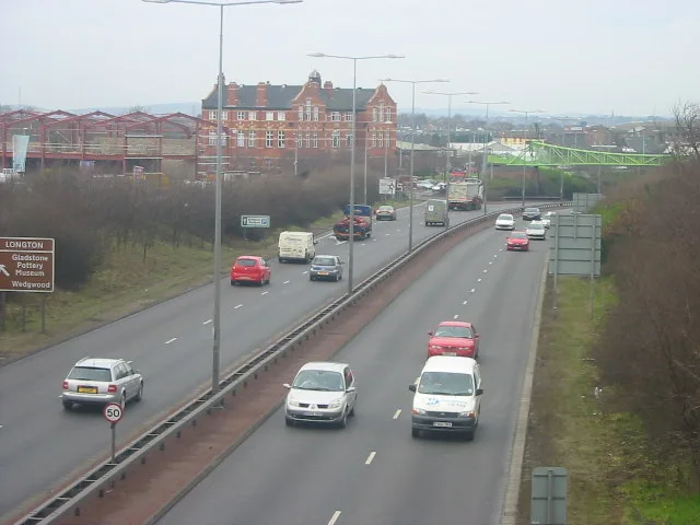
Uttoxeter Road in Stoke-on-Trent is an asphalted expressway. There is no cycle path. It runs in a southeast-northwest direction starting from Market Street and crosses Commerce Street, Bridgewood Street, Chadwick Street, Landon Street, Harber Street, Morpeth Street, Barlow Street, Chelson Street, Short Street, Barker Street and Warren Street. This road is part of the long-distance road "A50". In the vicinity, you can find among other things a fast food restaurant, a hairdresser's, a museum and a car repair shop. The nearest stops are Broadway and St James' Church. The bus lines 6, 6A, 6B, 26 and 26A serve this stop.
- Road Type
- main road
- Speed Limit
- 30 mph
- Route
- southeast-northwest
Image
Convenience stores
Bus stops
- bus lines 6, 6A, 6B, 26, 26A
Museum
- Gladstone Pottery Museum (fee required, web).
Roads nearby
New Hall Road50 m
Herbert Road50 m
Pitsford Street Link Road100 m
Pitsford Street150 m
Bell Avenue150 m
Meirhay Road150 m
Normacot Road200 m
Melville Road200 m
Haig Street200 m
Reservoir Road200 m
Sutherland RoadBP, Congress Inn
200 m
Recreation Road200 m
Chatfield Place200 m
Queensberry Road250 m
Recreation Bridge250 m
Furnace Road250 m
Rothesay Road250 m
Herbert Street250 m
Upper Normacot RoadPreject Pizza
250 m
Lower Spring RoadTam O'Shanter Inn
300 m
Albert AvenueNormacot Junction
300 m
Eversley Road300 m
Lawley Street350 m
Spring Road350 m
Argyll Road350 m
Weston Coyney RoadThe Blue Ocean
350 m
Sandgate Street350 m
Court No. 1400 m
Tunnicliffe Close400 m
Stockwell Grove400 m
Blackheath Close400 m
Kendrick Street450 m
Waterdale Grove450 m
Millfield Footbridge450 m
Pinhoe Place550 m
Neath Close550 m
Amenities nearby
Westfield Nursery School250 m
DIY stores nearby
Timberland500 m
Buildings nearby
Ace Taxis150 m
Tailored Floors200 m
HH Jackson400 m
Community centres nearby
Westfield Children's Centre300 m
Fire stations nearby
Longton Fire Station100 m
Industrial areas nearby
Store Safe300 m
Places of worship nearby
Newhall Christian Church100 m
Gillani Noor Mosque200 m
Gillani Noor Masjid250 m
Railway lines nearby
Crewe to Derby Line250 m
Retail areas nearby
Milfield Garage400 m
 Public transport map Stoke-on-Trent Legend
| Railway | |
| Bus | |
| Tram |
 Cycling map Stoke-on-Trent Legend
| Cycle path | |
| Cycle lane on road | |
| Cycling on bus lane | |
| Bicycle street | |
| Cyclists allowed | |
| Cyclists allowed, good surface | |
| No cycling | |
| Cobblestones |
| Long-distance cycle route | (depending on scale) | |
| Long-distance cycle route |
 Walking map Stoke-on-Trent Legend
| Path |
| Long-distance hiking trail | (depending on scale) | |
| Long-distance hiking trail | ||
| No pedestrians |