
Limekiln Lane in Wellington, Shropshire
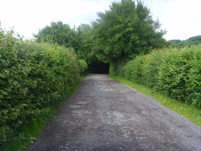
Limekiln Lane in Telford and Wrekin, Wellington is a residential street. It runs in a north-south direction starting from Holyhead Road and crosses Cherrytree Close, John Broad Avenue, Mount Gilbert, Barn Farm Drive and Bayley Road. It ends in a cul-de-sac and connects Wellington and Little Wenlock. This road is part of the hiking trail "Telford T50". Limekiln Lane also exists in Lilleshall.
- Road Type
- minor road
- Speed Limit
- 30 mph
- Route
- north-south
Image
Hairdressers
Convenience stores
Computer shops
Petrol stations
Bus stops
Butcher's
Newsagent's
Bicycle shops
Pubs
Fast food restaurants
DIY stores
Off-licences
Chemist's
Roads nearby
Barn Farm Drive100 m
Birch Coppice100 m
Elmwood Road250 m
Mount Gilbert250 m
Birchwood Close300 m
Cherrytree Close300 m
Churchill Road350 m
Florence Close400 m
Abbey Road450 m
Limekiln Lane450 m
Festival Gardens450 m
John Broad Avenue450 m
Forester Grove450 m
Valley Road500 m
Primrose Grove500 m
Hayes Road500 m
Wiseman Crescent500 m
Dawley RoadDawley Road, Char Char, Loco, T & M Parts & Tools
550 m
Old Hall Gardens550 m
Holyhead RoadBP, Red Lion, Subway, Nisa, Fantasy Castles, The Wickets Inn, Ercall Lane
600 m
Hillside Close600 m
Bayley Road600 m
Old Hall Close600 m
Rose Grove650 m
Wellings Grove650 m
School Lane650 m
Belmont court650 m
Prince's Street650 m
St Giles Close650 m
KingslandPC Stop, Sidhu, Slick Cutz, The Vanity Room, Zee's Halal Meat
700 m
Mill BankCock Hotel, Princes Street
700 m
Manor Road700 m
New Church Road700 m
Toll Road700 m
Bank Road700 m
Kingsway Crescent700 m
Griffin Drive750 m
Charles Road750 m
Mary Lewis Close750 m
Watling Street750 m
Regent Street800 m
Princess AvenueArleston
800 m
Withering Close800 m
Community centres nearby
Arleston Community Centre700 m
Convenience stores nearby
One Stop650 m
Fast food restaurants nearby
A1 Pizza and Kebab700 m
Pubs nearby
The Cock Hotel650 m
Recreation grounds nearby
John Broad Play Ground450 m
Residential areas nearby
Willowhouse650 m
Restaurants nearby
Swan700 m
Public transport map Wellington Legend
| Railway | |
| Bus | |
| Tram |
Cycling map Wellington Legend
| Cycle path | |
| Cycle lane on road | |
| Cycling on bus lane | |
| Bicycle street | |
| Cyclists allowed | |
| Cyclists allowed, good surface | |
| No cycling | |
| Cobblestones |
| Long-distance cycle route | (depending on scale) | |
| Long-distance cycle route |
Walking map Wellington Legend
| Path |
| Long-distance hiking trail | (depending on scale) | |
| Long-distance hiking trail | ||
| No pedestrians |