
Game Scar Lane in Keighley
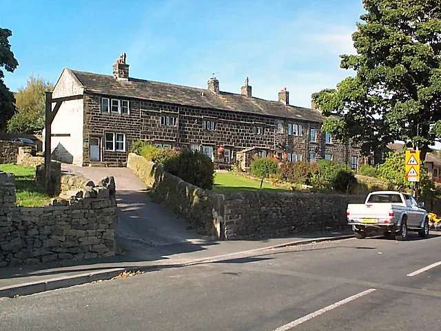
Game Scar Lane in Keighley in Bradford is a tertiary road and it descends towards the south-east at 20%. It runs in a north-south direction starting from Green Sykes Road and crosses Laycock Lane and Lund Lane and ends at Goose Eye. Game Scar Lane is also known as Goose Eye Brow. This road is part of the foot route "Bradford Millennium Way".
- Alternative Name
- Goose Eye Brow
- Road Type
- tertiary road
- Speed Limit
- 30 mph
- Route
- north-south
Image
Hofläden
Bus stops
- bus lines K14
Roads nearby
Roberts Street200 m
Lund Lane200 m
Shay Gap Road250 m
Wood Cote FoldGoose Eye
250 m
Goose EyeTurkey Inn
300 m
Braithwaite RoadBraithwaite Road Whinfield Drive, Braithwaite Road West Lane, Braithwaite Road Braithwaite Avenue
350 m
Chapel LaneOakworth, Colne Road Chapel Lane Dockroyd Lane, Oakworth Methodist Church, Sterling Workwear and Embroidery, Sequines, Laycock
350 m
Clough Bank Lane450 m
Back Lane450 m
Todley Hall Road450 m
Fallow Lane550 m
Holme House Lane750 m
Hill Clough Grove750 m
Tarn Lane800 m
Green Sykes Road900 m
Braithwaite VillageKeighley New Church
1000 m
Laycock LaneBraithwaite Road New Church, Braithwaite Road Braithwaite Avenue, Laycock Chapel Lane, Laycock Lane Chapel Lane, Laycock Lane Hill Clough Grove, Laycock Lane Hillclough Grove
1,2 km
Bank Lane1,2 km
Stell Hill1,2 km
Mackingstone LaneMackingstone Lane Holme House Lane
1,2 km
Bunker's Hill Lane1,2 km
High Whin Fold1,2 km
Far Whin Gate1,2 km
Low White Close1,2 km
Low Whin Fold1,2 km
Wheathead LaneWheat Head Lane Wheat Head Crescent, Exley Head
1,2 km
Staincliffe Drive1,2 km
Braithwaite Edge Road1,3 km
Ryan Grove1,3 km
Highfell Rise1,3 km
Newsholme New Road1,3 km
Browfield View1,3 km
The Knoll1,3 km
Braithwaite AvenueBraithwaite, Braithwaite Avenue Coronation Mount, Braithwaite Avenue West Lane, Braithwaite Avenue Bankfield Mount
1,3 km
Gill LaneNewsholme
1,3 km
Pole Road1,3 km
Dean Lane1,5 km
Body of waters nearby
Teapot Dam500 m
Community centres nearby
Laycock Village Hall400 m
Farmyards nearby
Bunker's Hill Farm1,2 km
Places of worship nearby
St John1,3 km
Quarries nearby
Branshaw Quarries1000 m
Streams nearby
North Beck400 m
Butter Clough1000 m
Newsholme Beck1,3 km
Woodlands nearby
Goose Eye Wood350 m
Higher Holme House Wood350 m
Whorks Hill Plantation750 m
Lower Holme House Wood1000 m
Public transport map Keighley Legend
| Railway | |
| Bus | |
| Tram |
Cycling map Keighley Legend
| Cycle path | |
| Cycle lane on road | |
| Cycling on bus lane | |
| Bicycle street | |
| Cyclists allowed | |
| Cyclists allowed, good surface | |
| No cycling | |
| Cobblestones |
| Long-distance cycle route | (depending on scale) | |
| Long-distance cycle route |
Walking map Keighley Legend
| Path |
| Long-distance hiking trail | (depending on scale) | |
| Long-distance hiking trail | ||
| No pedestrians |