
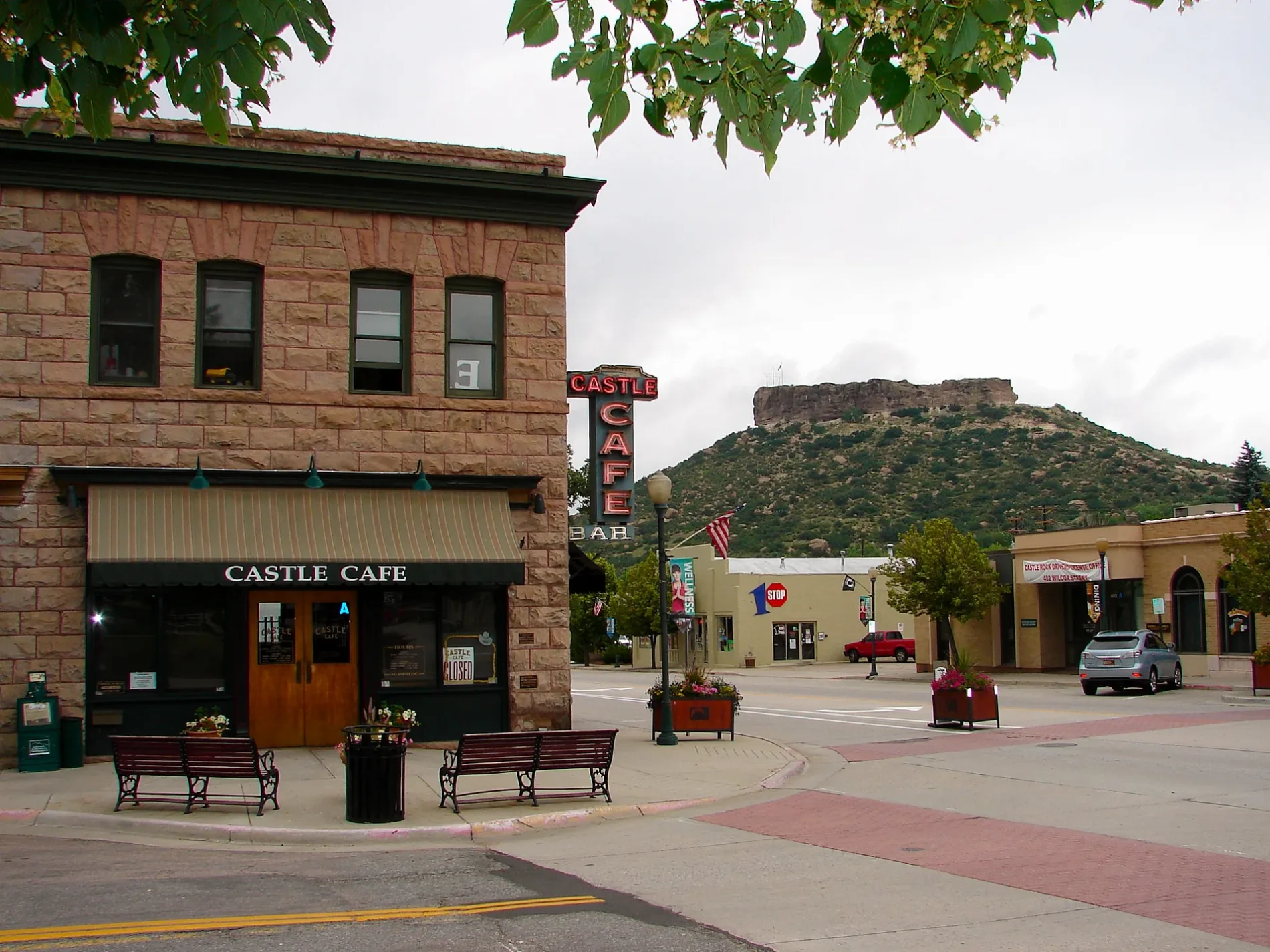
6th Street in Castle Rock, Colorado
6th Street in Castle Rock is a two-lane local road. It runs in an east-west direction starting from Jerry Street and crosses North Wilcox Street and ends at North Perry Street. 6th Street also exists in Jackson County, Routt County, Prowers County, Baca County and Bent County.
- Road Type
- local road
- Lanes
- 2
- Route
- east-west
Image
Restaurants
Tailor shops
Hair salons
Fire stations
Antique stores
Cafes
Clinics
Banks
Computer stores
Museums
- Castle Rock Museum (opening hours: Wed–Fri 12–17; Sat 11–16, Web) at Elbert Street 420 (80104) – approx. 0.2 mi.
Convenience stores
Bars
Clothing stores
Bike shops
Beauty salons
Toy stores
Places of worship
Streets nearby
North Wilcox StreetGreat Divide Brewery, 7-Eleven, Crowfoot Valley Cafe & Crow Bar, Protech, Castle Rock Bank, Castle Rock Hormone Health, The Block & Bottle, Dos Santos
300 ft
North Cantril Street0.1 mi
Jerry StreetAngie's Restaurant, Hideaway Bar & Grill
0.2 mi
4th StreetJack of All Macs, Cantril School, Haute Charisma, Branigan's Irish Pub, Miss M's Tea House, Castle Cafe, Salon on 4th, Next Door, The Skin Company, Regina's Boutique
0.2 mi
5th StreetCastle Rock Museum, Castle Valley Dental, Country Pedaler Bike Shop, Bobbin' Along
0.2 mi
North Perry StreetLost Coffee, The Cake Company, Sienna, Castle Rock, The Emporium
0.2 mi
Elbert Street0.2 mi
East Plum Creek Trail0.2 mi
North Lewis Street0.2 mi
3rd StreetThe Barn - Antiques and Specialty Shops, Castle Rock Fire and Rescue Department - Station 151, The Mind Garden, Once upon a Horse, The Chapel
0.2 mi
Front StreetChuck & Don's Pet Food & Supplies, Discount Tire, Baskin-Robbins
0.2 mi
John Emerson Summit TrailCastle Rock
0.2 mi
Paul Hill Trail (Rock Street)0.3 mi
Sam Hall Boulevard0.3 mi
North Gilbert Street0.3 mi
Park StreetHelp & Hope Center, The Hair Shop, 4 Paws Pet Grooming, Coast2Coast Meal Prep, Bob's Roasted Nuts, Golden Toad, Dawns Styles Plus, City Electric Supply, Castle Oaks Covenant Church, Shine Church, Autobahn Auto Body
0.3 mi
8th Street0.4 mi
East Wolfensberger RoadKomo's Street Tacos, Christian Way School of Plum Creek, Shell, Circle K, Blue Rhino, Waffle House, McDonald's
0.4 mi
Paul Hill Trail (East Trail)0.4 mi
Kinner StreetSantiago's, Circle K, Burger King, Wendy's
0.4 mi
Front Street Trail0.5 mi
Attractions nearby
Castle Rock0.3 mi
Beauty salons nearby
Wind & Water Salon0.3 mi
Buildings nearby
CenturyLink200 ft
Iron Mule Brewery200 ft
KC Mortgage LLC350 ft
Wild Blue Yonder Brewing Co.400 ft
Douglas County Motor Vehicle0.2 mi
Cafes nearby
Starbucks0.4 mi
Car dealerships nearby
Berkenkotter Motors0.2 mi
Churches nearby
Calvary Castle Rock0.5 mi
Clothing stores nearby
Boho Boutique & Marketplace300 ft
The Estate Sale0.2 mi
Commercial buildings nearby
SmarterChaos.com0.2 mi
Ice rinks nearby
Rink at the Rock0.1 mi
Liquor stores nearby
Payless Liquors0.2 mi
Motels nearby
Castle Pines Motel0.2 mi
Office buildings nearby
Dr Unrun DC0.3 mi
Places of worship nearby
Mt. Zion Lutheran Church0.2 mi
Railways nearby
UP Colorado Springs Subdivision0.2 mi
Restaurants nearby
Tamarind Indian Cuisine250 ft
El Meson Mexican Grill0.2 mi
Yolanda's Tacos0.3 mi
Guadalajara0.4 mi
Retail buildings nearby
Sugar Spoon Candies0.2 mi
Shelters nearby
Picnic Pavilion0.5 mi
Sporting goods stores nearby
Play It Again Sports0.2 mi
Supplement stores nearby
Castle Rock Nutrition250 ft
Veterinary clinics nearby
Castle Rock Veterinary Clinic0.3 mi
 Public transit map Castle Rock Legend
| Railway | |
| Bus | |
| Streetcar |
 Bicycle map Castle Rock Legend
| Bike path | |
| Bike lane on roadway | |
| Cycling allowed on bus lane | |
| Bicycle street | |
| Open to cyclists | |
| Open to cyclists, good path | |
| Cycling prohibited | |
| Cobblestone |
| Long-distance bike route | (depending on scale) | |
| Long-distance bike route |
 Pedestrian map Castle Rock Legend
| Path |
| Long-distance hiking trail | (depending on scale) | |
| Long-distance hiking trail | ||
| Pedestrians prohibited |