
South Fulton Avenue in Evansville, Indiana
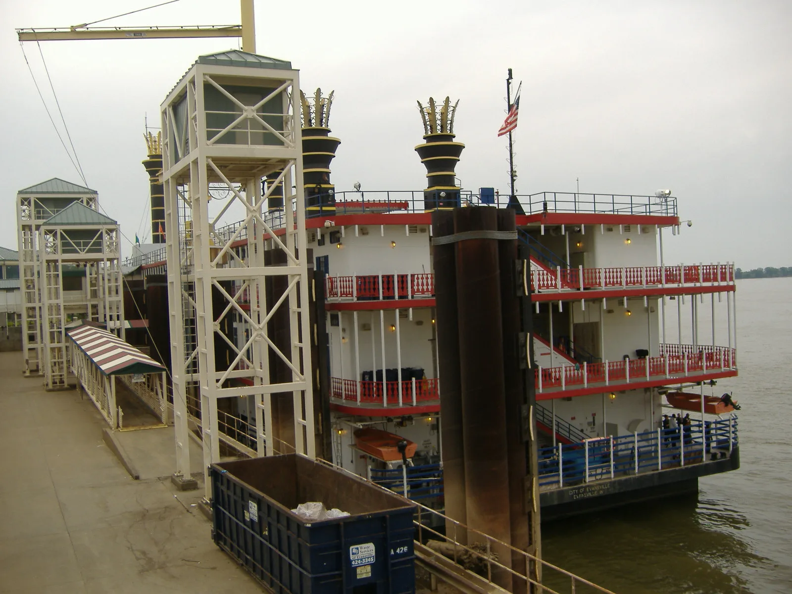
South Fulton Avenue in Evansville is a two-lane, asphalted expressway. It runs in a north-south direction starting from Northwest Riverside Drive and crosses Northwest 1st Street, Northwest 2nd Street, Ohio Street, John Street, North Fulton Avenue and West Indiana Street and ends at Northwest Riverside Drive. This street is part of the highway "Ohio River Scenic Byway".
- Road Type
- expressway
- Lanes
- 2
- Route
- north-south
Image
Banks
Viewpoints
Tourist information centers
Ice cream shops
Post offices
Hair salons
Restaurants
Bakeries
Hotels
Town halls
Schools
Beauty salons
Cafes
Bars
Theaters
Studios
Streets nearby
John Street0.2 mi
North Fulton Avenue0.2 mi
Pigeon Creek GreenwayMerchand Bridge Overlook, Lamasco Park Trailhead, Shirley James Gateway Plaza & Trailhead
0.2 mi
Goodsell Street0.2 mi
Ohio Street0.2 mi
North 4th Avenue0.2 mi
South 3rd Avenue0.2 mi
West Illinois StreetLeasing office, 5/3 ATM, Trinity Lutheran School
0.2 mi
West Indiana Street0.3 mi
West Lloyd Expressway0.3 mi
Clark Street0.3 mi
Northwest 1st Street0.3 mi
Carpenter Street0.3 mi
Bond Street0.3 mi
West John Street0.3 mi
Ingle Street0.3 mi
North 1st AvenueSecret Headquarters, Subway, Papa John's, Fifth Third Bank
0.4 mi
North 1st Street0.4 mi
Northwest 3rd Street0.4 mi
Court Street0.4 mi
Market Street0.4 mi
Northwest 4th StreetWired Coffee House
0.4 mi
Vine StreetThe Short Lived Canal
0.4 mi
Coliseum Court0.5 mi
Vine St Bike Path0.5 mi
Northwest Riverside Drive0.5 mi
Sycamore StreetMajor Munch, Fifth Third Bank, United States Post Office
0.5 mi
Northwest 5th StreetLic's Deli & Ice Cream
0.5 mi
Northwest 2nd Street0.6 mi
Main StreetOld National Bank, Peephole Bar and Grill, Piece of Cake, COMFORT, Signature School, Milanos Italian Cuisine, Gangnam Korean Cuisine
0.6 mi
Attractions nearby
USS LST-3250.3 mi
Buildings nearby
CenterPoint Energy0.4 mi
Fellwock Garage0.5 mi
Old Fellwock Auto Company0.5 mi
Old Post Office Place0.5 mi
Casinos nearby
Bally's Evansville Casino & Hotel0.2 mi
Courthouses nearby
Old County Courthouse0.5 mi
Dog parks nearby
Earthborn Holistic Dog Park0.4 mi
Event venues nearby
Veterans Memorial Coliseum0.4 mi
Garden centers nearby
Kiwi's Garden Center0.4 mi
Gas stations nearby
Circle K0.2 mi
Hotels nearby
Le Merigot at Tropicana0.2 mi
Industrial areas nearby
Mulzer Crushed Stone0.2 mi
Parks nearby
Le Merigot Park0.2 mi
Willard Library Park0.4 mi
Restaurants nearby
Ri Ra Irish Pub0.1 mi
Retail buildings nearby
Bru Burger0.5 mi
Studios nearby
CBS 440.6 mi
Other nearby
Ingle Station0.4 mi
 Public transit map Evansville Legend
| Railway | |
| Bus | |
| Streetcar |
 Bicycle map Evansville Legend
| Bike path | |
| Bike lane on roadway | |
| Cycling allowed on bus lane | |
| Bicycle street | |
| Open to cyclists | |
| Open to cyclists, good path | |
| Cycling prohibited | |
| Cobblestone |
| Long-distance bike route | (depending on scale) | |
| Long-distance bike route |
 Pedestrian map Evansville Legend
| Path |
| Long-distance hiking trail | (depending on scale) | |
| Long-distance hiking trail | ||
| Pedestrians prohibited |