
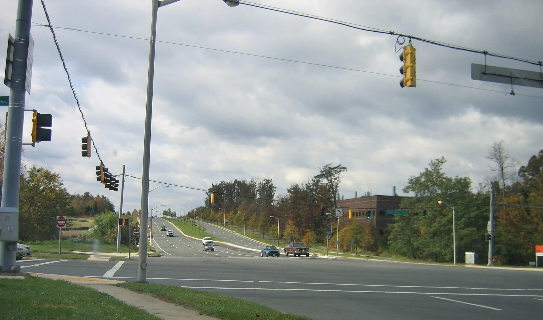
Great Seneca Highway in Montgomery County, Maryland
Great Seneca Highway in Montgomery County is a two-lane, asphalted main road. It crosses Wisteria Drive, Circle Gate Drive, Grotto Lane, Dawson Farm Road, Mateny Road, Fountain Club Drive, Clopper Road, Dairymaid Drive, Leaman Farm Road, Cottage Garden Drive and Queenstown Lane and comes from Middlebrook Road. It connects Montgomery County and Gaithersburg. This street is part of the highway "119". Nearby you can find among others a bed store, a fast food restaurant and an ice cream shop. The nearest bus stop is Medical Center Dr at Medical Center Way (about 600 m away).
- Road Type
- secondary road
- Lanes
- 2
- Speed Limit
- 50 mph
Image
Bed stores
Ice cream shops
Streets nearby
Dispatch Street550 ft
Swat Street0.1 mi
Blackwell RoadThe Ridge School Montgomery County
0.2 mi
Dalmatian Street0.2 mi
Key West AvenueDunkin', Key West Ave and Siesta Key Way, Hunting Hill Church, Taco Bell
0.3 mi
Medical Center Way0.3 mi
Darnestown Road Sidepath0.3 mi
Good Earth Court0.3 mi
Broschart Road0.3 mi
Darnestown RoadBeallsville, Fairhaven United Methodist Church, Gaithersburg Chinese Alliance Church, Shell, Surrey Saddlery, Lees Corner, Inferno Pizzeria Napoletana, Capital One, Sunoco, Chop Shop, Quickway, Pleasant View Church, Dawsonville, Hunting Hill
0.3 mi
Johns Hopkins Drive0.3 mi
Treble Court0.3 mi
Johns Hopkins Drive Sidepath0.3 mi
Great Seneca Highway SidepathTravilah Fire Station 32
0.4 mi
Traville Gateway DriveBukhara, Mattress Warehouse, Sushi Oishii Inc, Potomac Beer & Wine, Potomac Pizza, Wild Birds Unlimited, Quench, Priddy Library, Traville Gateway Dr and Gudelsky Dr, Bagel Town Deli, Nantucket's Reef, Traville Transit Center/USG, Traville Transit Center, Electric Car Charging Station
0.4 mi
Decoverly DriveDecoverly Dr & Great Seneca Hwy, Decoverly Dr & Diamondback Dr
0.4 mi
Traville Gardens Circle0.4 mi
Oakdale Drive0.5 mi
Sterling Drive0.5 mi
Foxborough Circle0.5 mi
Sterling Court0.5 mi
Gable Ridge Court0.5 mi
Gable Ridge Terrace0.5 mi
Diamondback DriveKey West Ave and Diamondback Dr
0.5 mi
Sterling Terrace0.6 mi
Medical Center DriveMedical Center Dr at JHU, Thai Cottage Bistro, Subway, Passion Bakery Café, Medical Center Dr at Medical Center Way, Katherine Thomas School
0.6 mi
Omega DriveResearch Blvd at Omega Dr
0.6 mi
Diamond Cove Terrace0.6 mi
Skyhill Way0.6 mi
Herron Pond Trail0.6 mi
Buildings nearby
Precision Labs0.4 mi
NCI Shady Grove0.5 mi
Commercial areas nearby
DANAC Stiles Corporate Campus0.4 mi
Decoverly Hall0.7 mi
Commercial buildings nearby
National Cybersecurity Center of Excellence0.2 mi
Rockville Research Center at Belward South0.3 mi
Rockville Research Center at Belward North0.4 mi
Dog parks nearby
Camden Bark Park0.4 mi
Office buildings nearby
Diamondback Corporate Center0.5 mi
Gordon S. Macklin Building0.5 mi
Decoverly II0.6 mi
Omega Medical Center0.6 mi
Parking lots nearby
Traville Gateway Garage0.4 mi
Residential areas nearby
Decoverly I0.5 mi
Retail areas nearby
Travilah Square Shopping Center0.3 mi
School buildings nearby
Johns Hopkins University0.4 mi
Sports fields nearby
Sports0.2 mi
Supermarkets nearby
Trader Joe's0.3 mi
Other nearby
Shady Grove Adventist Hospital Heliport0.4 mi
 Public transit map Montgomery County Legend
| Railway | |
| Bus | |
| Streetcar |
 Bicycle map Montgomery County Legend
| Bike path | |
| Bike lane on roadway | |
| Cycling allowed on bus lane | |
| Bicycle street | |
| Open to cyclists | |
| Open to cyclists, good path | |
| Cycling prohibited | |
| Cobblestone |
| Long-distance bike route | (depending on scale) | |
| Long-distance bike route |
 Pedestrian map Montgomery County Legend
| Path |
| Long-distance hiking trail | (depending on scale) | |
| Long-distance hiking trail | ||
| Pedestrians prohibited |