
Durham Performing Arts Center in Durham, North Carolina
Durham Performing Arts Center in Durham is a theater (wheelchair accessible), Vivian Street 123 (27701). Ⓦ.
- House Number
- 123
- Postal Code
- 27701
- Street
- Vivian Street
- Amenity
- theater
- Building Type
- building
- Wheelchair Access
- yes
Image
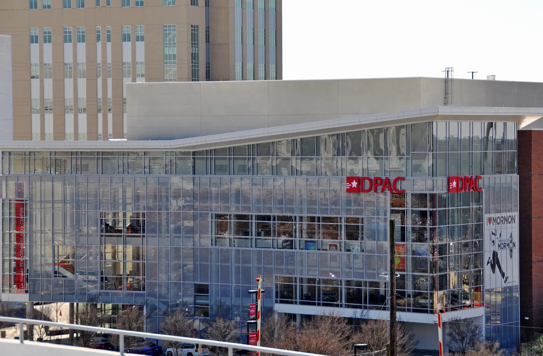
Streets nearby
East Pettigrew StreetPettigrew St at S Roxboro St (EB), D&S Junction, Pettigrew St at S Roxboro St (WB)
400 ft
Blackwell StreetBlackwell St at Forest Hills Apts (SB), Blackwell St at Forest Hills Apts (NB), Moe's Southwest Grill, QueenBurger, The Bullpen, Press Coffee, Crepes & Cocktails
550 ft
South Corcoran Street0.1 mi
West Pettigrew StreetAmbacco Fountain, Michael Jordan Nissan Collision Center, Pettigrew St at Mangum St (EB), Durham Station, Pettigrew St at Mangum St (WB)
0.2 mi
Julian Carr Street0.2 mi
North Corcoran Street21c Museum Hotel, Visionary Leadership in the New South
0.2 mi
Market StreetThe Parlour
0.2 mi
CCB PlazaPour, Durham, Major the bull
0.2 mi
Morris StreetBullseye Bicycle, Imperial Building (215 Morris St)
0.2 mi
East Chapel Hill StreetNinth Street Bakery, Pizzeria Toro, Chapel Hill St at Market St, M Sushi, Queeny's, Kingfisher, The Roof at The Durham Hotel, Rue Cler, Rock Paper Scissors Salon, Sacred Mandala, Dashi Ramen, Redheaded Help
0.2 mi
Ramseur Street0.3 mi
West Chapel Hill StreetChapel Hill St at Brewster St, Duke University Rd at Chapel Hill Rd, Durham, Chapel Hill St at Gregson St (EB), Chapel Hill St at Main St, Chapel Hill St at Duke St (Durham Police Dept), Chapel Hill St at Gregson St (WB), Chapel Hill St at Kent St (EB), Joe van Gogh, Local Yogurt, Durham Co Op, Chapel Hill St at Carroll St, LR Custom Fabrication
0.3 mi
South Great Jones Street0.3 mi
West Morgan StreetW Morgan St at Foster St (Downtown YMCA), Durham Centre Garage, Durham Armory
0.3 mi
North Great Jones StreetGreat Jones St at Main St (Museum of Durham History)
0.3 mi
Amenities nearby
Research Square0.3 mi
Buildings nearby
One City Center0.2 mi
Abandoned railways nearby
Durham Beltline0.3 mi
Apartment buildings nearby
Noell Building500 ft
Ashton Place0.2 mi
Willard Street Apartments0.3 mi
Arts centers nearby
Durham Arts Council0.3 mi
Banks nearby
PNC Bank0.4 mi
Bars nearby
Criterion0.2 mi
West End Wine Bar0.3 mi
Buildings nearby
Lucky Strike Water Tower0.1 mi
Commercial buildings nearby
Diamond View 3500 ft
Construction sites nearby
The Novus0.3 mi
Hotels nearby
Aloft Durham Downtown450 ft
Museum 21 Hotel0.2 mi
Durham Marriott City Center0.3 mi
Industrial buildings nearby
Power Plant0.1 mi
Museums nearby
The History Hub Museum0.4 mi
Office buildings nearby
Lucky Strike Building450 ft
Strickland Building550 ft
American Underground0.1 mi
Parking lots nearby
Corcoran Street Garage and Lot0.2 mi
North Parking Deck0.2 mi
Parks nearby
Diamond View Park300 ft
Pubs nearby
Bull McCabe's Irish Pub0.3 mi
Railways nearby
NS Danville District H Line0.3 mi
Restaurants nearby
Mateo0.3 mi
Retail buildings nearby
Kress Building0.1 mi
Washington Building0.2 mi
Snow Building0.2 mi
Stations nearby
Durham Station Transportation Center0.3 mi
Theaters nearby
Carolina Theatre0.3 mi
Train stations nearby
Durham Station0.4 mi
Other nearby
Convention Center Plaza0.3 mi
| Year built | 2008 |
|---|---|
| Official opening | 2008 |
| Operator | Nederlander Organization |
| Located in | Durham |
| Country | United States |
 Public transit map Durham Legend
| Railway | |
| Bus | |
| Streetcar |
 Bicycle map Durham Legend
| Bike path | |
| Bike lane on roadway | |
| Cycling allowed on bus lane | |
| Bicycle street | |
| Open to cyclists | |
| Open to cyclists, good path | |
| Cycling prohibited | |
| Cobblestone |
| Long-distance bike route | (depending on scale) | |
| Long-distance bike route |
 Pedestrian map Durham Legend
| Path |
| Long-distance hiking trail | (depending on scale) | |
| Long-distance hiking trail | ||
| Pedestrians prohibited |