
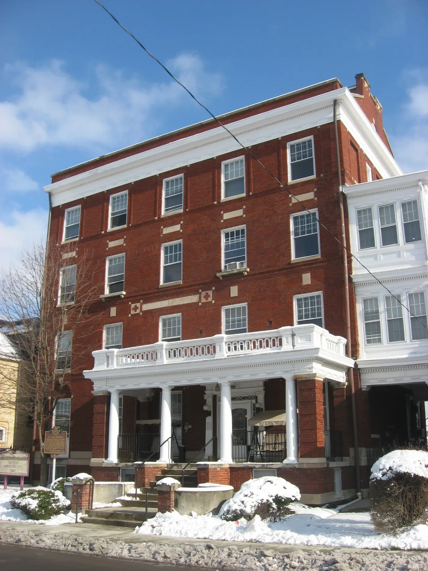
Hotel Saint Clair in Columbus, Ohio
Hotel Saint Clair in Columbus is an apartment building. Hotel Saint Clair is also known as Hotel St. Clair. Hotel Saint Clair is located near Sisco Alley. Hotel Saint Clair is built in the Colonial Revival architecture style. Ⓦ.
- Building Type
- apartment building
Image
Pharmacies
Police stations
Bus stops
Streets nearby
Edward StreetEmmanuel Tabernacle Baptist Church
300 ft
Buckingham Street350 ft
Otha Gilyard Street400 ft
Grove StreetColumbus State Police Department
0.1 mi
Mount Vernon AvenueBallet Met Dance Academy, CoGo Cleveland Ave and Mt Vernon Ave, Mt Vernon Ave & N Grant Ave
0.1 mi
Sisco Alley0.1 mi
North Monroe Avenue0.1 mi
Mayme Moore Place0.2 mi
Martin Luther King Junior Boulevard0.2 mi
Atcheson Street0.2 mi
North Freeway0.2 mi
Wespot Drive0.2 mi
Hamilton AvenueHamilton Ave & E 18th Ave, Hamilton Ave & E 17th Ave, Hamilton Ave & E 21st Ave, Hamilton Ave & E 24th Ave, Hamilton Ave & Clinton St, Hamilton Ave & Duxberry Ave
0.2 mi
North Garfield Avenue0.2 mi
Brier Alley0.2 mi
Talmadge Street0.2 mi
St Clair Avenue0.2 mi
Jack Gibbs Boulevard0.2 mi
East Innerbelt0.2 mi
Australia Alley0.2 mi
Garfield Place0.3 mi
Elijah Pierce Avenue0.3 mi
Jefferson AvenueEleventh Avenue School, Academy For Leadership
0.3 mi
East Long StreetWhat the Waffle, The Roosevelt Coffeehouse, E Long St & Normandy Ave, Slammers, Uptown District, E Long St & N Washington Ave, E Long St & Jefferson Ave, E Long St & N 4th St, Turkey Hill, E Long St & Cleveland Ave, Equitas Health Pharmacy, King-Lincoln Bronzeville
0.3 mi
Lester Drive0.3 mi
Willow Alley0.4 mi
Kiefer Avenue0.4 mi
Hamilton Park0.4 mi
Boone Street0.4 mi
East Spring StreetE Spring St & Mount Vernon Ave, E Spring St & N High St, FedEx Office, E Spring St & Neilston St, E Spring St & N Grant Ave, Warehouse District, E Spring St & N 4th St, E Spring St & Cleveland Ave
0.4 mi
North 11th Street0.4 mi
Hamilton Park West Service0.4 mi
Apartment buildings nearby
Ogden Apartments0.3 mi
Churches nearby
Shiloh Baptist Church0.1 mi
Commercial buildings nearby
Samuel D. Hooker Building500 ft
King Arts Complex0.1 mi
Lincoln Theater King Arts Complex0.3 mi
Theresa Building0.3 mi
Construction sites nearby
Diehl-Whittaker Development0.3 mi
Covered areas nearby
Mayme Moore Park Gazebo0.1 mi
Parks nearby
Mayme Moore Park400 ft
Hamilton & Spring Park0.2 mi
Places of worship nearby
Emmanuel Tabernacle Baptist Church200 ft
Bethany Presbyterian Church0.2 mi
Residential areas nearby
The Adelphi Quarter0.3 mi
Technical colleges nearby
Tele-Communications Trailer0.3 mi
Aquinas Hall0.4 mi
Franklin Hall0.4 mi
Rhodes Hall0.4 mi
| Year built | 1911 |
|---|---|
| Architectural style | Colonial Revival architecture |
| Heritage designation | National Register of Historic Places listed place |
| Located in | Columbus |
| Country | United States |
| Location | King-Lincoln Bronzeville |
 Public transit map Columbus Legend
| Railway | |
| Bus | |
| Streetcar |
 Bicycle map Columbus Legend
| Bike path | |
| Bike lane on roadway | |
| Cycling allowed on bus lane | |
| Bicycle street | |
| Open to cyclists | |
| Open to cyclists, good path | |
| Cycling prohibited | |
| Cobblestone |
| Long-distance bike route | (depending on scale) | |
| Long-distance bike route |
 Pedestrian map Columbus Legend
| Path |
| Long-distance hiking trail | (depending on scale) | |
| Long-distance hiking trail | ||
| Pedestrians prohibited |