
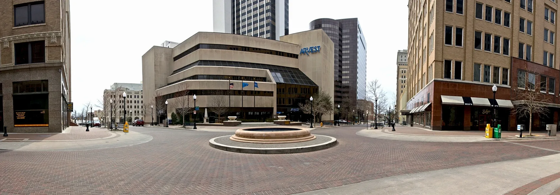
West 1st Street South in Tulsa, Oklahoma
West 1st Street South in Tulsa is a four-lane, concrete main road. The surface is fair. It runs in a northeast-southwest direction starting from East 1st Street South and crosses South Main Street, South Boulder Avenue West, South Cheyenne Avenue West, South Denver Avenue West, South Elwood Avenue, South Frisco Avenue and West Heavy Traffic Way South and ends at South Guthrie Avenue West. The nearest bus stop is Archer Street & Main Street (about 250 m away). West 1st Street South also exists in Owasso.
- Road Type
- main road
- Lanes
- 4
- Speed Limit
- 25 mph
- Route
- northeast-southwest
Image
Bus stops
- bus lines 130, 201, 250, 700, 900
Streets nearby
North Main StreetTulsa, (7119) Main ST & KING ST NB, Main Street & Oklahoma Street, Main Street & Newton Street, (7164) Main ST & Latimer ST SB, (7165) Main ST & JASPER ST SB, (7120) Main & Marshall ST NB
450 ft
South Main StreetThe Bart Center for Music, The Box Nail Salon, Vessel Skin Studio, Lou's Deli, Oklahoma Spud, QuikPrint, Tabouli's, Treat's, Mayo 420 Apartments, Belvedere Barber, Tulsa Police, Eerie Abbey Taphouse, Deco District, Take 2, (8893) Main St & 10th St SB, PonyCoffee
450 ft
North Boulder Avenue(7166) Boulder Ave & John Hope Franklin
550 ft
South Cheyenne Avenue WestDenver Avenue Station, Ti Amo, Fresa Fusion Kitchen, Cheyenne Avenue & 5th Street, Oakshire
0.1 mi
West Archer Street(7467) Archer St & Main St WB, (8378) Archer St & Maybelle Ave WB, (8377) Archer St & Elwood Ave WB, (8376) W Archer St & N ELWOOD Ave EB
0.2 mi
East Archer Street NorthArcher Street & Main Street, Etnika, (7365) Archer St & Main St EB, Archer Street & Cincinnati Avenue, ONEOK Field, Lone Wolf Banh Mi, Magic City Books, Shuffles, Topeca Coffee Roasters
0.2 mi
North Main Street EastAntoinette’s Bakery, Main Street & John Hope Franklin Boulevard
0.2 mi
North Cheyenne AvenueNorthgate, Saint Lukes United Methodist Church, Cheyenne Park
0.2 mi
North Boston Avenue EastArcher Nails
0.2 mi
North Denver AvenueMelrose Place
0.2 mi
North Cheyenne Avenue West0.2 mi
West Reconciliation WaySisserou's Caribbean Restaurant & Catering
0.2 mi
North Main Street WestTulsa Arts District
0.2 mi
West Cameron StreetThis Machine
0.3 mi
Shops nearby
OTASCO Warehouse0.2 mi
Apartment buildings nearby
Metro at Brady0.1 mi
Tribune Lofts0.1 mi
The Flats0.2 mi
Bars nearby
Mainline0.2 mi
Club Majestic0.2 mi
Valkyrie0.2 mi
Saturn Room0.2 mi
Buildings nearby
Amigo Bail Bonds0.2 mi
Fox Building0.2 mi
Ringgold Bail Bonds0.3 mi
3CG Studio0.3 mi
Affordable Bail Bonds0.3 mi
Doyle Davis Bail Bonds0.3 mi
Salvation Army0.3 mi
Rusty Roberts Bail Bonds0.4 mi
Candle shops nearby
Wick and Flame Candle Bar0.2 mi
Candy stores nearby
Glacier Chocolates0.2 mi
Commercial buildings nearby
Universal Ford Building0.3 mi
Hotels nearby
Fairfield Inn0.2 mi
Industrial areas nearby
Borden Dairy0.2 mi
Highland Dairy Foods0.3 mi
Parking lots nearby
Williams North Garage400 ft
Pubs nearby
Welltown Brewing0.2 mi
Railways nearby
Tulsa Subdivision400 ft
Cherokee Subdivision450 ft
Restaurants nearby
Prhyme Downtown Steakhouse0.2 mi
Mexicali Border Cafe0.2 mi
Misfit Kitchen0.2 mi
Amelia's Wood Fired Cuisine0.2 mi
The Tavern0.2 mi
Chimera0.3 mi
The Hunt Club0.3 mi
Self storages nearby
Extra Space Storage500 ft
Specialty stores nearby
Evan's Plating Works0.2 mi
Theaters nearby
Tulsa Theater0.3 mi
Public transit map Tulsa Legend
| Railway | |
| Bus | |
| Streetcar |
Bicycle map Tulsa Legend
| Bike path | |
| Bike lane on roadway | |
| Cycling allowed on bus lane | |
| Bicycle street | |
| Open to cyclists | |
| Open to cyclists, good path | |
| Cycling prohibited | |
| Cobblestone |
| Long-distance bike route | (depending on scale) | |
| Long-distance bike route |
Pedestrian map Tulsa Legend
| Path |
| Long-distance hiking trail | (depending on scale) | |
| Long-distance hiking trail | ||
| Pedestrians prohibited |