
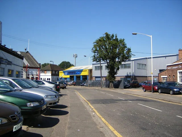
Fraser Road in London Borough of Ealing
Fraser Road in London Borough of Ealing is a residential street. It runs in an east-west direction starting from Aintree Road and crosses Francis Road and Sarsfield Road and ends at Federal Road. Fraser Road also exists in London Borough of Enfield and London Borough of Waltham Forest.
- Road Type
- residential street
- Speed Limit
- 20 mph
- Route
- east-west
Image
Post offices
Subway stops
Tourist information offices
Bus stops
Roads nearby
Bilton RoadHillview Surgery, Aintree Road, Brooklands Drive, Jubilee Road, Lee Road, Perivale Community Centre, Bilton Road Post Office, The Lunch Box
150 m
Francis Road150 m
Sarsfield Road200 m
Walmgate Road200 m
Lynmouth Road250 m
Torrington Road300 m
Aintree Road300 m
Launceston Road300 m
George V Way300 m
Jordan Road350 m
Wadsworth Road400 m
Lee Road450 m
Woodrow Close500 m
Lynmouth Gardens500 m
Torrington Gardens500 m
Jubilee Road550 m
Launceston Gardens550 m
Empire Road550 m
Bideford AvenuePerivale Tesco
550 m
Buckingham Avenue600 m
Chilham ClosePerivale
750 m
Sunley Gardens750 m
Periwood Crescent800 m
Doris Ashby Close800 m
Cecil Manning Close800 m
Grand Union Canal (Paddington Arm) towpathBallot Box Bridge
850 m
Horsenden Lane SouthDawlish Avenue, Perivale, Perivale Station, Perivale Library, Café Rendezvous, Buckingham Avenue
850 m
Amenities nearby
Perivale Community Centre800 m
Allotment gardens nearby
Jubilee Road allotments300 m
Body of waters nearby
Lower Farm Pond800 m
Upper Farm Pond850 m
Paddock Pond850 m
Buildings nearby
Wadsworth Business Centre350 m
Hope Christian Centre700 m
Golf courses nearby
Sudbury Golf Course600 m
Grass nearby
South Lawn800 m
North Lawn800 m
Huts nearby
3rd Perivale Scout Group750 m
Industrial areas nearby
Fleetway West350 m
Perivale Park450 m
Office buildings nearby
Celtheath Contract Furniture650 m
Railway lines nearby
New North Mainline750 m
Railway stations nearby
Perivale Station750 m
Railways under construction nearby
High Speed 2750 m
Residential areas nearby
The Woodlands Estate700 m
Subway lines nearby
Central Line - Eastbound550 m
Central Line - Westbound750 m
Subway stops nearby
Westbound Platform 1600 m
Eastbound Platform 2650 m
Woodlands nearby
Horsenden Farm Wood750 m
Public transport map London Borough of Ealing Legend
| Railway | |
| Bus | |
| Tram |
Cycling map London Borough of Ealing Legend
| Cycle path | |
| Cycle lane on road | |
| Cycling on bus lane | |
| Bicycle street | |
| Cyclists allowed | |
| Cyclists allowed, good surface | |
| No cycling | |
| Cobblestones |
| Long-distance cycle route | (depending on scale) | |
| Long-distance cycle route |
Walking map London Borough of Ealing Legend
| Path |
| Long-distance hiking trail | (depending on scale) | |
| Long-distance hiking trail | ||
| No pedestrians |