
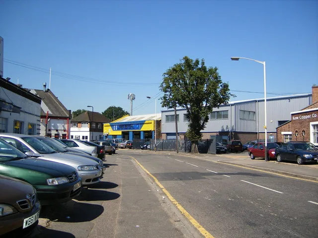
Rockford Avenue in London Borough of Ealing
Rockford Avenue in London Borough of Ealing is a residential street and it runs in a north-south direction starting from Tavistock Avenue and ends at Dawlish Avenue.
- Road Type
- residential street
- Speed Limit
- 20 mph
- Route
- north-south
Image
Beauty salons
Cafés
Kindergarten
Doctor's office
Bus stops
Dentist
Stations
Subway stops
Convenience stores
Restaurants
Library
Roads nearby
Dawlish AvenuePerivale
100 m
Tavistock Avenue150 m
Teignmouth GardensPerivale Dental Practice, Bideford Avenue, Teignmouth Gardens
200 m
Bideford AvenuePerivale Tesco
200 m
Western AvenueTarget Roundabout, Hanger Lane, BP, Spar, Middleton Avenue, Park Royal Junction, Wendover Court, Pausa, Lynwood Road, Perivale, Alperton Lane, Teignmouth Gardens, Alliance Road, Argyle Road, Central Parade, Cafe and Bakery, Mediterranean Food, Afendi Restaurant, Hanger Lane Station, Western Avenue / Savoy Circus, Ezzeitouna, Friary Road, Gypsy Corner, Carlisle Avenue, Foster Road, Wales Farm Road (Q), Wales Farm Road, Restaurant, Bar / Starbucks, Greenford Road Roundabout, Langdale Gardens, Allan Way, Pizza GoGo, Red Light Camera, Lidl, London-Park Royal Supercharger, Kendal Avenue, Concord Road, Park Royal Station, Perryn Road
250 m
Chilham ClosePerivale
250 m
Old Church LaneIsis Beauty Salon
300 m
Horsenden Lane SouthDawlish Avenue, Perivale, Perivale Station, Perivale Library, Café Rendezvous, Buckingham Avenue
350 m
Aintree Road400 m
Coniston Avenue450 m
Salvia Gardens450 m
Selborne Gardens450 m
Sunley Gardens500 m
Rydal Crescent500 m
Thirlmere Avenue550 m
Sarsfield Road550 m
Walmgate Road600 m
Wadsworth Road600 m
Wadsworth Close600 m
Buckingham Avenue600 m
Francis Road650 m
Fraser Road700 m
Bilton RoadHillview Surgery, Aintree Road, Brooklands Drive, Jubilee Road, Lee Road, Perivale Community Centre, Bilton Road Post Office, The Lunch Box
750 m
Leisure nearby
Perivale Residents Association350 m
Allotment gardens nearby
Jubilee Road allotments750 m
Buildings nearby
(Former school)650 m
Wadsworth Business Centre750 m
Children's Centre800 m
Cemeteries nearby
St Mary the Virgin Churchyard400 m
Community centres nearby
Ancient Church of St Mary The Virgin400 m
Hotels nearby
Premier Inn250 m
Huts nearby
3rd Perivale Scout Group400 m
Industrial areas nearby
Fleetway West450 m
Perivale Park550 m
Office buildings nearby
Celtheath Contract Furniture500 m
Places of worship nearby
Saint John Fisher Catholic Church650 m
Pubs nearby
The Myllet Arms300 m
Railway lines nearby
New North Mainline300 m
Railway stations nearby
Perivale Station300 m
Railways under construction nearby
High Speed 2300 m
Recreation grounds nearby
Ealing Central Sports Ground250 m
Restaurants nearby
Royal Nawaab London200 m
Retail buildings nearby
Central Parade300 m
Sports centres nearby
Ealing Golf Club300 m
Subway lines nearby
Central Line - Eastbound200 m
Central Line - Westbound300 m
Subway stops nearby
Westbound Platform 1150 m
Eastbound Platform 2200 m
Supermarkets nearby
Tesco300 m
Public transport map London Borough of Ealing Legend
| Railway | |
| Bus | |
| Tram |
Cycling map London Borough of Ealing Legend
| Cycle path | |
| Cycle lane on road | |
| Cycling on bus lane | |
| Bicycle street | |
| Cyclists allowed | |
| Cyclists allowed, good surface | |
| No cycling | |
| Cobblestones |
| Long-distance cycle route | (depending on scale) | |
| Long-distance cycle route |
Walking map London Borough of Ealing Legend
| Path |
| Long-distance hiking trail | (depending on scale) | |
| Long-distance hiking trail | ||
| No pedestrians |