
Keith Road in London Borough of Hillingdon
Keith Road in London Borough of Hillingdon is a residential street and runs in an east-west direction and crosses Albert Road and Station Road. This road is part of 1 bicycle route. Keith Road also exists in London Borough of Waltham Forest and London Borough of Barking and Dagenham.
- Road Type
- residential street
- Route
- east-west
Image
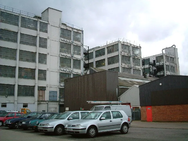
Kiosks
Platforms
Bicycle shops
Cafés
Stations
Bus stops
Convenience stores
Self-storages
Dry cleaner's
Public toilet
Car hires
Restaurants
Roads nearby
Station RoadClement Gardens, Petwell House Vets, Clayton Road, Ferrers Avenue, Popeyes Grill, Emporium Food Centre, Boots, Go Sing, Original Copy Centre, Drayton Barbers, Mylocal, West Drayton Food & Wine, About Tech, Nomdora, Ocean Dry Cleaners, Augu's Palace, M.A. Whenman Shoe Repairs & Key Cutting, Venus Convenience Store, Deccan Bawarchi, Freshbites, Sametta, Drayton Tandoori, Millington Road, Asda Café, Church Road, Brandville Road, Domino's, Smokin Patty, Step in Salon, Get Smart, Laundrette Dry Cleaners, Palace Tandoori, ISA News, Food & Wine, Best Food & Wine, King Paget Hotel, Personal Licence Courses UK Ltd, Harolds Opticians, Jas Internet Cafe, New Wing Luck, Butties Nigerian Takeaway, Hand Car Wash - Gulf, Redmead Road, House Box, Winter & Summer, Cleveland Road, Station Road, Porters Way, Hayes Town Centre, Hayes Post Office, McDonald's, Pound Plus Shop, Gulf Technology Ltd., Scope, The Village, Costa, WHSmith, Superdrug, Hayes Fresh Fish, Paul's Bakery, Greggs, Chicken Cottage, Siasa Telecom, MBN Services, Luck Hairdresser, Hari News, JenningsBet, Roy Barbers, Fone & Vape Off Licence, Iceland, Paddy Power, Trend...Z, Card Factory, Halifax, Boots Opticians, Mashaallah Food Centre, Poundland, William Hill, Hayes College London, Harrolds, H&T Pawnbrokers, Cheatmeals, T4 Tea For U, Mall in the Wall, Little Shiraz, Liquor 38, Fairey Corner, G S Cycles, Hayes & Harlington, Hayes & Harlington Station, Station Kiosk, Station toilets (Platform 4), Dry Cleaners and Launderette, KFC, Femina Hair & Beauty, Harry's Hairdressers, Save More Superstore, Nepalese Centre, Namaste Gurkha, Cafe Vaknat, Railway Arms, Huong Viet, West Drayton Post Office, Griddle Cafe, Kinzzu, Tina Star Nails, No 46
100 m
Albert Road150 m
Old Station Road200 m
Clarendon RoadClarendon Road
200 m
Sandow Crescent200 m
Pressing Lane250 m
Northfield Close250 m
Blyth RoadBlyth Road
300 m
Powerhouse Lane300 m
Material Walk300 m
North Hyde RoadNorth Hyde Road, London Hayes, Harold Avenue, Old Station Road, Roseville Road, Pizza Delicacia, Drinks Direct
350 m
Millington Road350 m
Walters Close400 m
Nield Road400 m
Trevor Road450 m
St Anselms Road500 m
Printing House LaneLexus Hayes (Service), Hayes Toyota (Service & Parts Only), Gate 2
550 m
Dawley RoadSwallowfield Way, Pinkwell Avenue, Bolingbroke Way, Blyth Road
550 m
Bourne AvenueGuinness Close, The Music Box, Conway Drive, Bourne news Box, Strawberry Local, Sun Sun, Skipton Drive
600 m
Guinness Close650 m
Clayton Road650 m
Kestrel WaySolo AV
800 m
Betam Road800 m
Buildings nearby
UBS Data Centre550 m
Apartment buildings nearby
Damont House150 m
Groove House150 m
Goldmark House150 m
Bluenotes Apartments200 m
Venue350 m
Banks nearby
Barclays350 m
Buildings nearby
Rackspace Car park400 m
Rackspace Training centre450 m
Canals nearby
Grand Union Canal450 m
Hotels nearby
Premier Inn London Hayes, Heathrow300 m
Industrial areas nearby
Caxton Trading Estate550 m
Office buildings nearby
The Powerhouse350 m
Rackspace450 m
Petrol stations nearby
Asda Petrol Station350 m
Places of worship nearby
St Anselm's400 m
Railway lines nearby
Great Western Main Line150 m
Elizabeth Line250 m
Heathrow Link Line600 m
Railway stations nearby
Hayes & Harlington Station250 m
Residential areas nearby
The Stylus200 m
Residential buildings nearby
Enterprise House400 m
Schools nearby
Global Academy400 m
Specialist shops nearby
Selco Builders Warehouse350 m
Supermarkets nearby
Asda250 m
Warehouses nearby
Dhamecha Cash & Carry700 m
Public transport map London Borough of Hillingdon Legend
| Railway | |
| Bus | |
| Tram |
Cycling map London Borough of Hillingdon Legend
| Cycle path | |
| Cycle lane on road | |
| Cycling on bus lane | |
| Bicycle street | |
| Cyclists allowed | |
| Cyclists allowed, good surface | |
| No cycling | |
| Cobblestones |
| Long-distance cycle route | (depending on scale) | |
| Long-distance cycle route |
Walking map London Borough of Hillingdon Legend
| Path |
| Long-distance hiking trail | (depending on scale) | |
| Long-distance hiking trail | ||
| No pedestrians |