
West Main Street in Princeton, Kentucky
West Main Street in Princeton is a two-lane main road (Road number US 62;KY 91;KY 139). It runs in a southeast-northwest direction starting from North Plum Street and crosses South Plum Street, North Donnivan Street, South Donnivan Street, North Cave Street, South Cave Street, North Seminary Street, South Seminary Street, North Harrison St, West Court Square and South Jefferson Street and ends at East Main Street. This street is part of the highways 139, 91, 293 and 62. Nearby you can find among others 2 florists, 2 tourist information centers, a copy shop and a hair salon. West Main Street also exists in Fayette County, Campbell County, Livingston County, Union County and Gallatin County.
- Road Type
- main road
- Lanes
- 2
- Route
- southeast-northwest
Image
Tattoo studios
Pharmacies
Car washes
Beauty salons
Interior decorators
Florists
Copy shops
Furniture stores
Gas stations
Auto parts stores
Fast food restaurants
Drugstores
Tourist information centers
- Cumberland Presbyterian College (Marker Number: 1453). Site of college founded March, 1826, by the Cumberland Presbyterian Church. First president was Rev. F. R. Cossitt. School opened with six students on some 500 acres of land bought for $6,000. A manual-labor school, students required to work 2 hours a d.
- Ogden Memorial United Methodist Church (Marker Number: 1932). Congregation organized in 1818 as Methodist Episcopal Church at home of Richard Barnes, a tanner. First meeting house later built beside his home on S. Jefferson St. Became M.E. Church, South, 1845, when national church split over slavery. Renamed to ho.
Hair salons
Banks
Motorcycle shops
Tobacco shops
Game stores
Streets nearby
West Market StreetNAPA Auto Parts
0.1 mi
North Seminary Street0.1 mi
West Court SquareBlack Patch War (Marker Number: 145), Courthouse Burned (Marker Number: 579)
0.1 mi
Alley 210.1 mi
East Court SquareCaldwell County Courthouse, Caldwell County Sheriff's Office, Spa Services and Gifts, Joshua Tree - Boutique, The Java Table, County Named, 1809 (Marker Number: 834)
0.2 mi
East Market StreetPrinceton, City of Princeton - City Hall, William Prince, 1752-1810 (Marker Number: 2330)
0.2 mi
Alley 140.2 mi
West Shephardson Street0.2 mi
North Franklin StreetPrinceton Tourist Welcome Center
0.2 mi
North Jefferson StreetAdsmore Museum
0.2 mi
Shops nearby
Coleman Shoe Repair and Bootery INC400 ft
Banks nearby
Planters Bank0.2 mi
Bookstores nearby
The Cat's Tale250 ft
Buildings nearby
Mark A. Wells - Attorney At Law250 ft
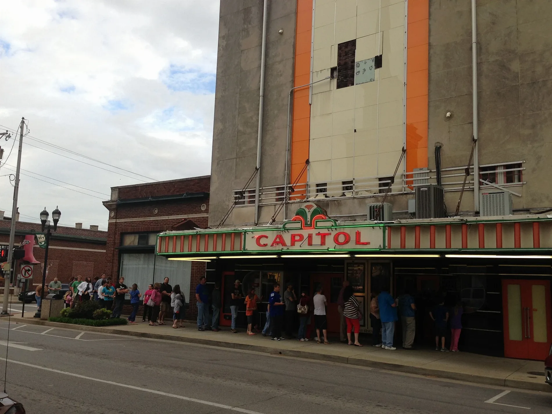
Capitol Cinemas250 ft
Goodwin Insurance350 ft
Perry's Floors and More400 ft
Caldwell Water District500 ft
118500 ft
Jennifer Nelson Law Office550 ft
Woodall Agency0.1 mi
Princeton Water and Wastewater0.2 mi
Barclay W. Banister - Attorney At Law0.2 mi
1160.2 mi
Clothing stores nearby
Ziobro's Weddings & Formals200 ft
Kopper & Daisy - Boys and Girls Clothing Store200 ft
Commercial areas nearby
Historic Princeton Downtown Commercial District350 ft
Community centers nearby
VFW Post 55590.2 mi
Courthouses nearby
Caldwell County Fiscal Court Annex550 ft
Caldwell County Courthouse0.1 mi
Dry cleaners nearby
Farmers Cleaners0.2 mi
Fire stations nearby
Princeton Fire Station0.2 mi
Florists nearby
Flowers and Arrangements550 ft
Furniture stores nearby
Brantley's Furniture450 ft
Brantley's Furnature450 ft
Galleries nearby
Princeton Art Guild0.2 mi
Hair salons nearby
Mane Attraction - Salon200 ft
Barber Shop350 ft
Classy Cuts Hair Salon0.1 mi
Hardware stores nearby
Joiner Hardware500 ft
Houses nearby
Adsmore0.2 mi
Libraries nearby
Glenn Martin Geneology Research Center and Library300 ft
Picnic areas nearby
Picnic/Park0.1 mi
Places of worship nearby
First Baptist Church200 ft
Cumberland Presbyterian Church200 ft
Police stations nearby
Princeton Police Dept0.2 mi
Secondhand stores nearby
Joseph's Storage Bin400 ft
Tobacco shops nearby
Princeton Smoke Shop0.1 mi
Variety stores nearby
Dollar General0.1 mi
 Public transit map Princeton Legend
| Railway | |
| Bus | |
| Streetcar |
 Bicycle map Princeton Legend
| Bike path | |
| Bike lane on roadway | |
| Cycling allowed on bus lane | |
| Bicycle street | |
| Open to cyclists | |
| Open to cyclists, good path | |
| Cycling prohibited | |
| Cobblestone |
| Long-distance bike route | (depending on scale) | |
| Long-distance bike route |
 Pedestrian map Princeton Legend
| Path |
| Long-distance hiking trail | (depending on scale) | |
| Long-distance hiking trail | ||
| Pedestrians prohibited |