
Louisiana

Louisiana
This page is the City map of Louisiana in the United States, showing streets, roads, paths and places across the state. Louisiana covers approximately 135,382 square kilometres and lies at an elevation of about 30 metres above sea level. Its population increased from 4,533,372 in 2010 to 4,657,757 in 2020. Founded as a state in 1812, Louisiana is divided into 71 subregions, including parishes, towns and villages along the Mississippi River, the Gulf Coast and the Atchafalaya Basin.
Delcambre

Delcambre is an administrative-level 8 locality in Louisiana. The town lies in the coastal region between Iberia Parish and Vermilion Parish, near Delcambre Canal and Vermilion Bay.
Its location connects Acadiana communities with the Gulf Coast and the waterways south of Lafayette. The surrounding landscape includes low-lying wetlands and agricultural land.
To the mapEunice
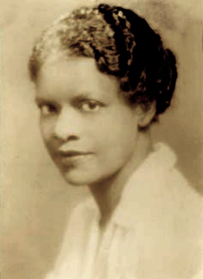
Eunice is an administrative-level 8 town in Louisiana, located on the border of Acadia Parish and St. Landry Parish. It is part of the Acadiana cultural region west of Lafayette.
The town is known for its Cajun and Creole musical traditions, while nearby routes connect Eunice with Opelousas, Crowley and Interstate 10.
To the mapArnaudville

Arnaudville is an administrative-level 8 village in Louisiana. It stands in St. Landry Parish and St. Martin Parish near the confluence of Bayou Teche and Bayou Fuselier.
Bayou Teche links Arnaudville with Breaux Bridge, Cecilia and New Iberia. The village lies within the Acadiana region, where French-influenced cultural traditions remain visible.
To the mapDuson

Duson is an administrative-level 8 town in Louisiana, situated in Lafayette Parish and Acadia Parish. It lies west of Lafayette along the transportation corridor formed by Interstate 10 and U.S. Highway 90.
The surrounding area consists largely of flat prairie and agricultural land. Duson provides a local connection between Lafayette, Rayne and nearby communities in Acadia Parish.
To the mapSpringfield

Springfield is an administrative-level 8 town in Livingston Parish, Louisiana. The settlement has a recorded population of 427 and an elevation of 5 metres.
It lies near the Tickfaw River and the north shore of Lake Maurepas. Roads around Springfield connect the town with Livingston, Albany and other communities in southeastern Louisiana.
To the mapDownsville

Downsville is an administrative-level 8 village and human settlement on the border of Lincoln Parish and Union Parish in Louisiana. It has a recorded population of 120 and an elevation of 77 metres.
The village lies in northern Louisiana near the boundary between the two parishes. Nearby roads connect Downsville with Farmerville, Ruston and the upland forests of the North Louisiana hill country.
To the mapJunction City

Junction City is an administrative-level 8 locality on the Louisiana–Arkansas border. The community is associated with Union Parish in Louisiana and Union County in Arkansas.
Its name reflects the meeting of regional roads and the state boundary north of Farmerville. The surrounding landscape belongs to the forested uplands of northern Louisiana.
To the mapMorehouse Parish

Morehouse Parish was established in 1844 and has a recorded population of 25,629. Its area is approximately 2,085 square kilometres.
The parish lies in northeastern Louisiana near the Ouachita River and the boundary with Arkansas. Bastrop is the parish seat, and agricultural land extends across the lowlands of the Mississippi Delta.
To the mapUnion Parish

Union Parish was established in 1839 and has a recorded population of 21,107. It covers approximately 2,345 square kilometres in northern Louisiana.
Farmerville is the parish seat, located near Lake D’Arbonne and the D’Arbonne River. The parish contains extensive pine and hardwood forests between the Ouachita and Arkansas border regions.
To the mapBossier Parish

Bossier Parish was established in 1843 and has a recorded population of 128,746. Its area is approximately 2,245 square kilometres.
The parish lies across the Red River from Shreveport and forms part of the Shreveport–Bossier City metropolitan area. Bossier City, Interstate 20 and Barksdale Air Force Base are major geographic features.
To the mapCaddo Parish

Caddo Parish was established in 1838 and has a recorded population of 237,848. It covers approximately 2,427 square kilometres in northwestern Louisiana.
Shreveport is the parish seat and lies on the Red River near the Texas and Arkansas borders. Caddo Lake, the Red River and Interstate 20 connect the parish with the wider Ark-La-Tex region.
To the mapClaiborne Parish

Claiborne Parish was established in 1828 and has a recorded population of 14,170. Its area is approximately 1,988 square kilometres in northwestern Louisiana.
Homer is the parish seat, while Lake Claiborne forms a major reservoir in the northern part of the parish. The landscape includes pine forests and rolling terrain near the Arkansas boundary.
To the mapDeSoto Parish

DeSoto Parish was established in 1843 and has a recorded population of 26,812. It covers approximately 2,317 square kilometres in western Louisiana.
Mansfield is the parish seat, and the parish is crossed by the Sabine River basin and Interstate 49. DeSoto Parish is also associated with the 1864 Battle of Mansfield during the American Civil War.
To the mapWebster Parish

Webster Parish was established in 1871 and has a recorded population of 36,967. It lies in northwestern Louisiana between Bossier Parish and Claiborne Parish.
Minden is the parish seat, and the Dorcheat Bayou runs through the area. Lakes Bistineau and Claiborne are nearby water bodies within the forested landscape of North Louisiana.
To the mapEast Carroll Parish

East Carroll Parish was established in 1877 and has a recorded population of 7,459. Its area is approximately 1,146 square kilometres in northeastern Louisiana.
Lake Providence is the parish seat and lies beside Lake Providence, an oxbow lake connected to the Mississippi River system. The parish consists largely of flat Mississippi Delta farmland.
To the mapWest Carroll Parish

West Carroll Parish was established in 1877 and has a recorded population of 9,751. It occupies part of the agricultural lowlands of northeastern Louisiana.
Oak Grove is the parish seat, and the parish borders East Carroll Parish to the east. The surrounding terrain belongs to the Mississippi Delta, with drainage channels and cultivated fields.
To the mapOrleans Parish

Orleans Parish was established in 1807 and has a recorded population of 383,997. It forms a consolidated city–parish with New Orleans and covers approximately 907 square kilometres.
New Orleans lies along the Mississippi River near Lake Pontchartrain and the Gulf Coast. The parish contains the French Quarter, Jackson Square, the St. Louis Cathedral and the historic Garden District.
To the mapPlaquemines Parish

Plaquemines Parish has a recorded population of 23,495 and occupies the lower Mississippi River delta in southeastern Louisiana. The parish extends southward along both sides of the river toward the Gulf of Mexico.
Communities include Belle Chasse, Buras and Venice, with Venice located near the river’s terminal distributaries. Marshes, barrier islands and estuarine waterways cover much of the parish.
To the mapSaint Bernard Parish

Saint Bernard Parish was established in 1807 and has a recorded population of 43,764. Its area is approximately 11,929 square kilometres, much of it consisting of coastal water and wetlands.
Chalmette is the parish seat and site of the Chalmette Battlefield, associated with the Battle of New Orleans in 1815. The parish lies southeast of New Orleans between the Mississippi River and the Gulf Coast marshes.
To the mapSt. Tammany Parish

St. Tammany Parish was established in 1810 and has a recorded population of 264,570. It covers approximately 2,212 square kilometres on the north shore of Lake Pontchartrain.
Covington is the parish seat, while Slidell lies near Lake Pontchartrain and the Pearl River. The parish includes parts of the north shore’s pine forests, wetlands and bayous.
To the mapAscension Parish

Ascension Parish has a recorded population of 119,455 and lies along the Mississippi River between Baton Rouge and New Orleans. Donaldsonville is the parish seat, while Gonzales is one of its principal cities.
The Mississippi River forms the parish’s western boundary, and Bayou Lafourche branches southward from the river near Donaldsonville. Industrial sites and plantations occupy parts of the river corridor.
To the mapAssumption Parish

Assumption Parish was established in 1807 and has a recorded population of 21,039. It covers approximately 944 square kilometres in south-central Louisiana.
Napoleonville is the parish seat, and Bayou Lafourche runs through the parish toward the Gulf of Mexico. The lowland landscape includes wetlands, sugarcane fields and communities along the bayou.
To the mapEast Baton Rouge Parish

East Baton Rouge Parish was established in 1810 and has a recorded population of 456,781. Its area is approximately 1,220 square kilometres, making it one of Louisiana’s most populous parishes.
Baton Rouge, the state capital, stands on the eastern bank of the Mississippi River. Louisiana State University, the State Capitol and Interstate 10 are prominent features of the parish.
To the mapEast Feliciana Parish

East Feliciana Parish was established in 1824 and has a recorded population of 19,539. It covers approximately 1,180 square kilometres in southeastern Louisiana.
Clinton is the parish seat, and the parish lies east of the Mississippi River near the boundary with Mississippi. Rolling wooded terrain and small streams distinguish the area from the flat coastal plain.
To the mapIberville Parish

Iberville Parish was established in 1805 and has a recorded population of 30,241. Its area is approximately 1,691 square kilometres along the lower Mississippi River.
Plaquemine is the parish seat, located near the junction of the Mississippi River and Bayou Plaquemine. The parish includes river levees, wetlands and industrial corridors south of Baton Rouge.
To the mapLafourche Parish

Lafourche Parish was established in 1807 and has a recorded population of 97,557. It covers approximately 3,831 square kilometres in south-central Louisiana.
Thibodaux is the parish seat, while Bayou Lafourche extends through the parish toward coastal communities such as Larose and Golden Meadow. Sugarcane agriculture, marshes and oil-service facilities are characteristic land uses.
To the mapLivingston Parish

Livingston Parish was established in 1832 and has a recorded population of 142,282. Its area is approximately 1,820 square kilometres east of the Amite River and north of Lake Maurepas.
Livingston is the parish seat, and Denham Springs is a major population centre. The parish includes the Tickfaw River, Amite River and extensive pine forests between Baton Rouge and Hammond.
To the mapJefferson Parish

Jefferson Parish was established in 1825 and has a recorded population of 440,781. It covers approximately 1,663 square kilometres on both sides of the New Orleans metropolitan area.
Jefferson Parish includes Metairie, Kenner and Grand Isle, with Lake Pontchartrain to the north and the Gulf of Mexico to the south. The parish contains urban districts, barrier islands, marshes and the Mississippi River delta.
To the mapSt. Charles Parish

St. Charles Parish was established in 1807 and has a recorded population of 52,549. Its area is approximately 1,062 square kilometres along the Mississippi River west of New Orleans.
Hahnville is the parish seat, and the river corridor includes the communities of Luling and St. Rose. Lake Pontchartrain, the Bonnet Carré Spillway and industrial facilities near the Mississippi are major local features.
To the mapSaint Helena Parish
Saint Helena Parish was established in 1810 and has a recorded population of 10,920. It covers approximately 1,060 square kilometres in eastern Louisiana.
Greensburg is the parish seat, and the parish borders Mississippi to the east. The landscape contains wooded hills and streams within the uplands north of Lake Maurepas.
To the mapSt. James Parish

St. James Parish was established in 1807 and has a recorded population of 20,192. Its area is approximately 668 square kilometres along the Mississippi River between Baton Rouge and New Orleans.
Convent is the parish seat, and the river corridor contains historic plantation sites and industrial plants. Gramercy, Lutcher and Vacherie are important communities in the parish.
To the mapSt. John the Baptist Parish

St. John the Baptist Parish was established in 1807 and has a recorded population of 42,477. It covers approximately 901 square kilometres along the Mississippi River west of New Orleans.
Edgard is the parish seat, while LaPlace is a major community near Lake Maurepas. The historic River Road follows the Mississippi past plantation landscapes and industrial facilities.
To the mapTangipahoa Parish

Tangipahoa Parish was established in 1869 and has a recorded population of 133,157. Its area is approximately 2,132 square kilometres, with a recorded elevation of 35 metres.
Amite City is the parish seat, and Hammond is a major city near Interstate 12 and Southeastern Louisiana University. The Tangipahoa River and Lake Maurepas define parts of the parish’s drainage system.
To the mapTerrebonne Parish

Terrebonne Parish was established in 1822 and has a recorded population of 109,580. Its area is approximately 5,387 square kilometres, including extensive coastal wetlands.
Houma is the parish seat and the largest urban centre in the coastal bayou region. Bayous Terrebonne and Petit Caillou connect the parish with barrier islands and the Gulf of Mexico.
To the mapWashington Parish

Washington Parish was established in 1819 and has a recorded population of 45,463. It lies in southeastern Louisiana near the Mississippi state line.
Franklinton is the parish seat, while Bogalusa is a major city in the eastern part of the parish. The Bogue Lusa Creek and Pearl River basin drain a landscape of pine forests and rolling hills.
To the mapWest Baton Rouge Parish

West Baton Rouge Parish was established in 1807 and has a recorded population of 27,199. It occupies approximately 557 square kilometres on the west bank of the Mississippi River opposite Baton Rouge.
Port Allen is the parish seat and is connected to Baton Rouge by the Horace Wilkinson Bridge. The Mississippi River, the Intracoastal Waterway and leveed agricultural land define the parish.
To the mapWest Feliciana Parish

West Feliciana Parish has a recorded population of 15,385 and lies along the Mississippi River in southeastern Louisiana. St. Francisville is the parish seat and a historic town on the river bluffs.
The parish contains Rosedown Plantation and the Audubon State Historic Site near St. Francisville. Its wooded hills rise above the Mississippi floodplain and differ from the flatter land farther south.
To the mapAvoyelles Parish

Avoyelles Parish was established in 1807 and has a recorded population of 39,693. It covers approximately 2,242 square kilometres in central Louisiana.
Marksville is the parish seat, and the parish includes parts of the Red River and Atchafalaya basin systems. The Marksville Prehistoric Indian Site preserves earthworks associated with the ancient Marksville culture.
To the mapConcordia Parish

Concordia Parish was established in 1807 and has a recorded population of 18,687. Its area is approximately 1,939 square kilometres along the Mississippi River in eastern Louisiana.
Vidalia is the parish seat, located opposite Natchez, Mississippi, on the east bank of the river. The parish includes the Mississippi floodplain and agricultural land near the Tensas River basin.
To the mapEvangeline Parish

Evangeline Parish was established in 1910 and has a recorded population of 32,350. It covers approximately 1,760 square kilometres in central Louisiana.
Ville Platte is the parish seat and lies near Chicot State Park, Louisiana’s largest state park. The parish occupies a transition zone between the prairies of Acadiana and the forests of central Louisiana.
To the mapIberia Parish

Iberia Parish was established in 1868 and has a recorded population of 69,929. Its area is approximately 2,670 square kilometres in south-central Louisiana.
New Iberia is the parish seat, located on Bayou Teche near Avery Island and Lake Fausse Pointe. The parish combines sugarcane fields, salt domes, bayous and coastal marshes.
To the mapPointe Coupee Parish

Pointe Coupee Parish was established in 1807 and has a recorded population of 20,758. It covers approximately 1,530 square kilometres along the Mississippi River and False River.
New Roads is the parish seat on the eastern shore of False River, an oxbow lake of the Mississippi. The parish contains historic Creole settlements and agricultural land between Baton Rouge and St. Francisville.
To the mapSt. Landry Parish

St. Landry Parish was established in 1807 and has a recorded population of 82,540. Its area is approximately 2,432 square kilometres in the centre of Acadiana.
Opelousas is the parish seat and one of Louisiana’s oldest settlements. The parish includes the Bayou Teche corridor, prairie farmland and the city of Eunice near the Acadia Parish boundary.
To the mapSaint Martin Parish

Saint Martin Parish was established in 1807 and has a recorded population of 51,767. It covers approximately 2,115 square kilometres around the lower Bayou Teche and Atchafalaya basin.
Saint Martinville is the parish seat and lies on Bayou Teche. Breaux Bridge, known for its regional crawfish culture, stands near the Atchafalaya River and Lake Martin.
To the mapSt. Mary Parish

St. Mary Parish was established in 1811 and has a recorded population of 49,406. Its area is approximately 2,898 square kilometres in southern Louisiana.
Franklin is the parish seat, while Morgan City lies near the Atchafalaya River and its delta. The parish extends through coastal marshes toward the Gulf of Mexico and includes the Bayou Teche corridor.
To the mapLafayette Parish

Lafayette Parish was established in 1823 and has a recorded population of 241,753. Its area is approximately 700 square kilometres in the centre of Acadiana.
Lafayette is the parish seat and a major urban centre along the Vermilion River. The parish contains the University of Louisiana at Lafayette, Interstate 10 and surrounding prairie and bayou landscapes.
To the mapAcadia Parish

Acadia Parish was established in 1886 and has a recorded population of 57,576. It covers approximately 1,703 square kilometres in southwestern Louisiana.
Crowley is the parish seat and is associated with rice cultivation on the Louisiana prairie. Rayne, known for its historic association with frogs, and the town of Eunice lie within or near the parish.
To the mapAllen Parish

Allen Parish was established in 1912 and has a recorded population of 22,750. Its area is approximately 1,983 square kilometres in west-central Louisiana.
Oberlin is the parish seat, while Kinder lies near the Calcasieu River and Interstate 10. The parish contains pine forests, wetlands and portions of the Kisatchie National Forest region.
To the mapBeauregard Parish

Beauregard Parish was established in 1912 and has a recorded population of 36,549. It covers approximately 3,020 square kilometres in western Louisiana.
DeRidder is the parish seat and lies near the Sabine River drainage basin. The parish includes extensive pine forests and parts of the Kisatchie National Forest, Louisiana’s only national forest.
To the mapBienville Parish

Bienville Parish was established in 1848 and has a recorded population of 12,981. Its area is approximately 2,128 square kilometres in north-central Louisiana.
Arcadia is the parish seat, situated near Interstate 20 and the Bienville National Forest region. The parish consists of wooded hills and streams between the Red River and northern Louisiana uplands.
To the mapCalcasieu Parish

Calcasieu Parish was established in 1840 and has a recorded population of 216,785. It covers approximately 2,834 square kilometres in southwestern Louisiana.
Lake Charles is the parish seat and lies near the Calcasieu River and Lake Charles. The parish includes major petrochemical and port facilities, while the southern area extends into coastal marshes and the Gulf of Mexico.
To the mapCaldwell Parish

Caldwell Parish was established in 1838 and has a recorded population of 9,645. Its area is approximately 1,400 square kilometres in north-central Louisiana.
Columbia is the parish seat and lies along the Ouachita River. The parish includes bottomland forests, agricultural areas and waterways connected with the Ouachita and Boeuf river systems.
To the mapCameron Parish

Cameron Parish was established in 1870 and has a recorded population of 5,617. Its area is approximately 5,003 square kilometres, much of which consists of coastal wetlands and water.
Cameron is the parish seat near the Gulf Coast, while the parish includes Grand Chenier and Holly Beach. Sabine Lake, Calcasieu Lake and extensive barrier marshes shape the southwestern Louisiana coast.
To the mapCatahoula Parish

Catahoula Parish is an administrative-level 6 parish in central Louisiana. It lies between the Ouachita River and the Mississippi River floodplain.
Harrisonburg is the parish seat, and the parish includes parts of Catahoula Lake and the Tensas River basin. Forests, wetlands and agricultural lowlands occur across the parish.
To the mapFranklin Parish

Franklin Parish was established in 1843 and has a recorded population of 19,774. Its area is approximately 1,646 square kilometres in northeastern Louisiana.
Winnsboro is the parish seat and lies near the Boeuf River. The parish combines Mississippi Delta farmland with wooded uplands and waterways connected to the Tensas and Ouachita basins.
To the mapGrant Parish

Grant Parish was established in 1869 and has a recorded population of 22,169. It covers approximately 1,721 square kilometres in central Louisiana.
Colfax is the parish seat, situated near the Red River. Kisatchie National Forest occupies parts of the surrounding region, which contains pine uplands and sandy terraces.
To the mapJackson Parish

Jackson Parish has a recorded population of 15,858 and lies in north-central Louisiana. The parish belongs to the forested upland region between Bienville Parish and Lincoln Parish.
Jonesboro is the parish seat and lies near the Dugdemona River. Kisatchie National Forest areas and reservoirs such as Caney Lake occur within the wider parish landscape.
To the mapJefferson Davis Parish
Jefferson Davis Parish was established in 1912 and has a recorded population of 32,250. Its area is approximately 1,706 square kilometres in southwestern Louisiana.
Jennings is the parish seat, and the parish includes the Mermentau River basin and rice-growing prairie. Interstate 10 connects Jennings with Lake Charles and Lafayette.
LaSalle Parish

LaSalle Parish was established in 1908 and has a recorded population of 14,791. It covers approximately 1,716 square kilometres in central Louisiana.
Jena is the parish seat, and the parish contains portions of the Kisatchie National Forest. The Little River and surrounding pine-covered hills connect the area with Catahoula and Grant parishes.
To the mapLincoln Parish

Lincoln Parish was established in 1873 and has a recorded population of 48,396. Its area is approximately 1,223 square kilometres in northern Louisiana.
Ruston is the parish seat and the home of Louisiana Tech University. The parish includes rolling wooded terrain near the Ouachita River headwaters and communities such as Downsville near the Union Parish boundary.
To the mapRadverkehr
Louisiana has four documented long-distance cycling routes, including the Mississippi River Trail, which follows sections of the river corridor through the state.
Data sources: OpenStreetMap (ODbL), Wikidata (CC0) · Image: Wikimedia Commons
| Named after | Louis XIV of France |
|---|---|
| Year built | 1812 |
| Area | 135382 km² |
| Elevation | 30 m |
| Located in | United States |
| Country | United States |
| Body of water | Gulf of Mexico, Mississippi River |
| Population | 4657757 |
| Website | https://louisiana.gov |
| Nickname | Pelican State |
| Native name | Louisiana |
| Official name | State of Louisiana |

 Public transit map Louisiana Legend
 | Railway | |
| Bus | |
| Tram |
 Bicycle map Louisiana Legend
 | Bike path | |
| Bike lane on roadway | |
| Cycling allowed on bus lane | |
| Bicycle street | |
| Open to cyclists | |
| Open to cyclists, good path | |
| Cycling prohibited | |
| Cobblestone |
| Long-distance bike route | (depending on scale) | |
| Long-distance bike route |
 Pedestrian map Louisiana Legend
 | Path |
| Long-distance hiking trail | (depending on scale) | |
| Long-distance hiking trail | ||
| Pedestrians prohibited |